Today we are going to have a trade-off. We are going to have more clouds than yesterday, but we will have much less of a breeze. High pressure is overhead, and that will keep any rain to our south. Well…that and the dry air in place.
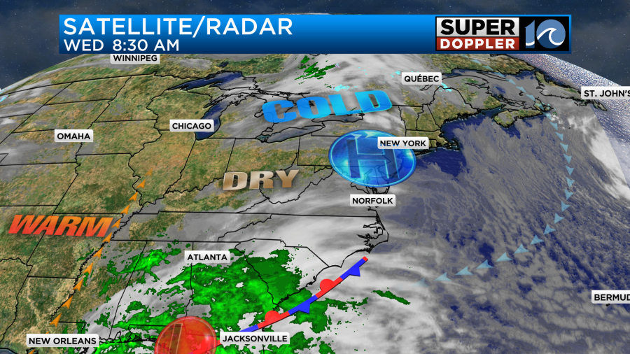
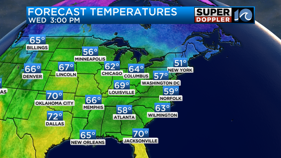
Moisture is trying to push up into our region, but it is only making headway in the mid-upper levels. Hence the clouds. We’ll have a mix of sun and clouds through the day. Winds will be light and out of the east. High temps should be able to reach to near 60 degrees this afternoon.
The low over the Gulf of Mexico is non-tropical. However, it is bringing some much needed rainfall to that area. The low will move east today, and it should weaken. It is forecast to cross Florida, and then re-form tomorrow. We’ll have high pressure build in a little more into our region. So we should have mostly sunny skies and beautiful weather.
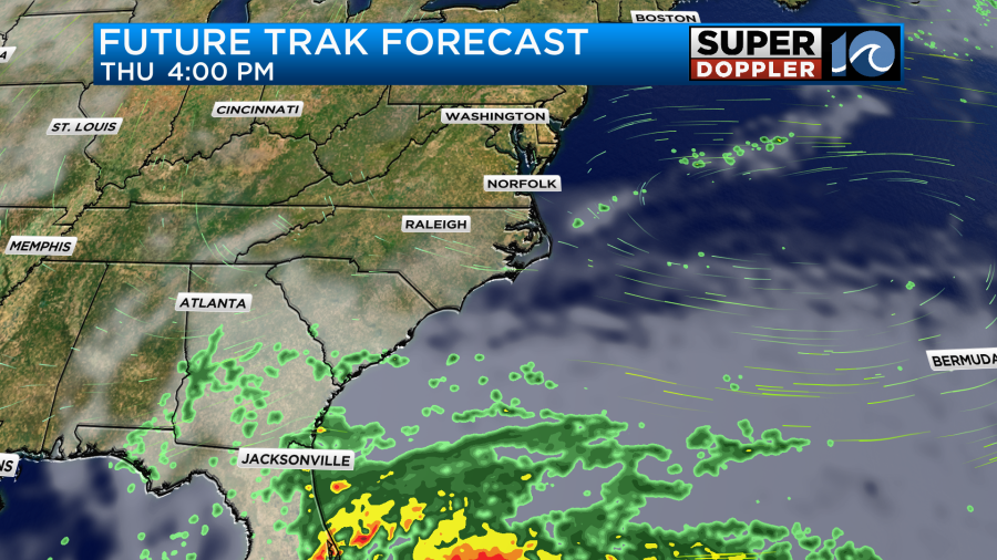
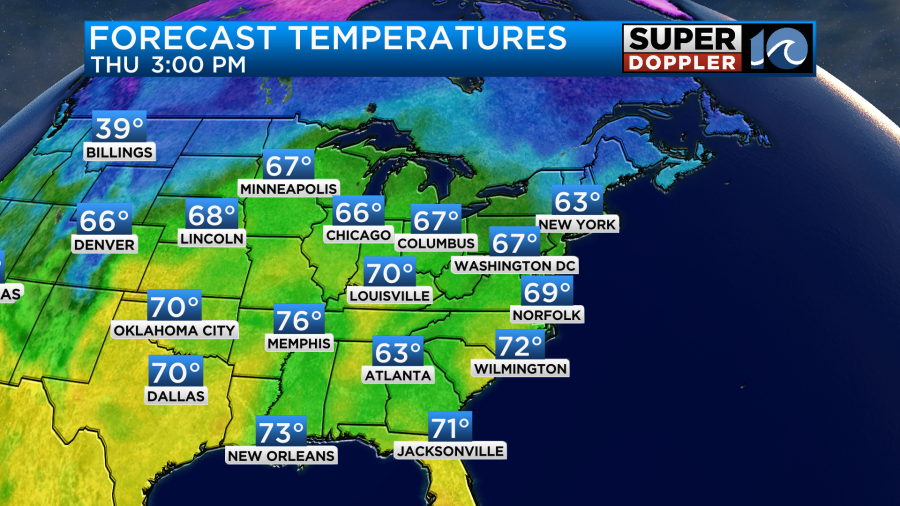
High temps will rise to the upper 60s.
It will still be dry and comfortable. Hopefully, you can get outside and enjoy the weather.
By Friday the offshore low will still be to our southeast, but it will be slowly marching north. We’ll have increasing clouds with at least a few scattered rain showers in the area. Some models have more rain than others. Here is our Future Trak model for late Friday.
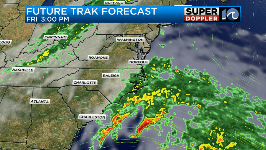
It has at least some rain here, but it does show the heavier band of rain just offshore.
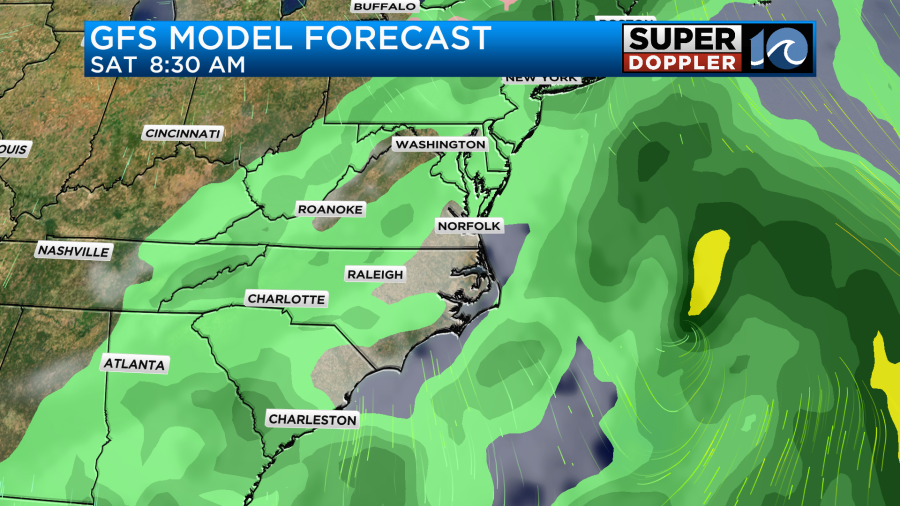
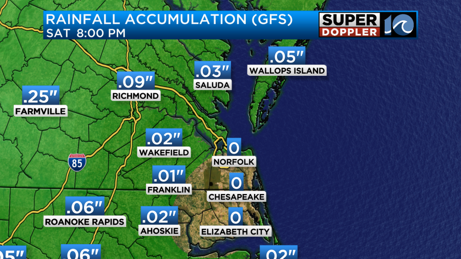
Meanwhile, here is the GFS model.

It does also have the bulk of the rain offshore with even less rain in Hampton Roads. Both do show more rain for the Outer Banks. The European model is now closer to the GFS.
The Friday forecast is for mostly cloudy skies and a few scattered rain showers between the late afternoon and evening. If the low slides a little more to the west, then the rain chances could quickly ramp up. High temps will be in the upper 60s to near 70. We’ll have more of a southerly wind.
By Saturday afternoon a cold front will move in from the west. This could also deliver us a few isolated to scattered showers. However, the GFS model basically has the rain evaporating as it moves east.
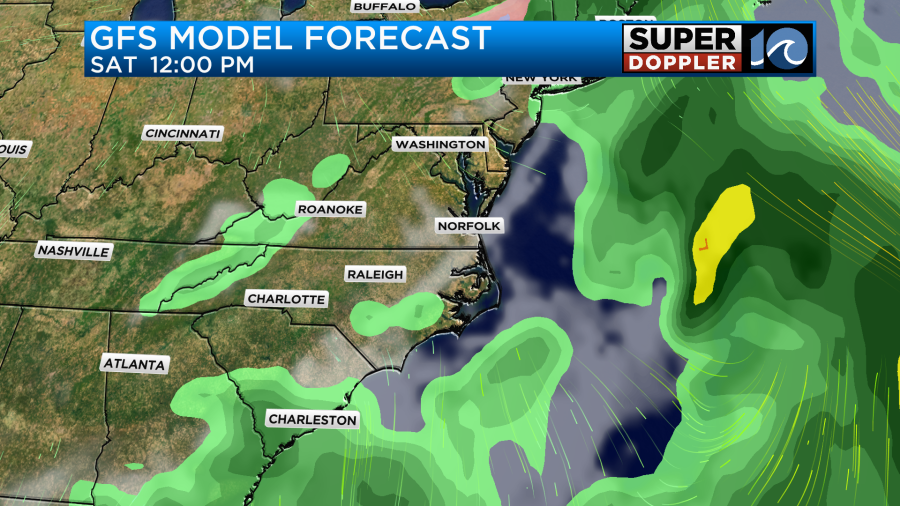
This time frame is still out of range of the NAM model (at the time of this writing), but the last frame is a bit more promising for rain for Saturday afternoon compared to the GFS. For now I have a slight chance for rain for that time. High temps will be more in the low-mid 60s. Either way we’ll dry out on Sunday. High temps will be in the upper 50s, and it will be breezy.
We’re still watching that tropical disturbance in the central Caribbean. It has a medium chance of becoming a tropical depression by the weekend.
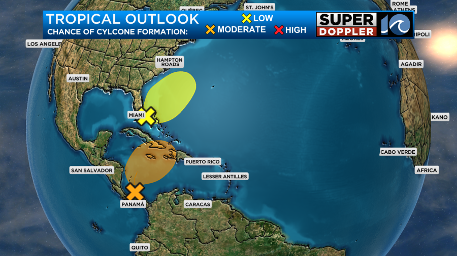
Either way it could bring some heavy rain to some of the Caribbean islands. The low that is over the Gulf of Mexico will probably cross Florida and fall apart. It is expected to re-form off the Florida coast. This is the same low that will be offshore from our region. It has a small shot at becoming tropical or subtropical, but we’ll see. It will be over the warm waters of the Gulf Stream for a bit. So there is a small potential. Regardless, it will stay offshore.
I’ve talked about the drought a lot lately. Here’s our latest number locally.

That 6.8 inch deficit is basically what we are running so far for the “meteorological” Fall season. They will get some rain from that cold front to our northwest. However, the GFS model is coming up with barely anything for our region.
I’ll have updates on this in tomorrow’s weather blog.
Meteorologist: Jeremy Wheeler