PORTSMOUTH, Va. (WAVY) – Lately there’s been some discussion about La Niña and the weather patterns over the U.S. This is actually a pretty complicated topic, more so when you are trying to predict snow for the season. (Place your bets!)
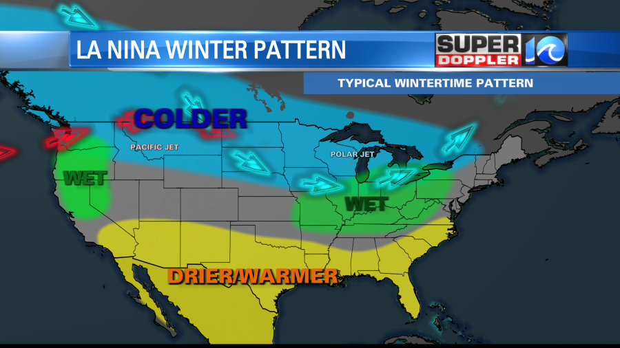
So let’s talk about that pattern and the long-range forecast. In the Pacific Ocean there has been a La Niña weather pattern that has affected our weather since last year. Everyone talks about El Niño, but they don’t often talk about a La Niña pattern. This is basically the opposite of El Niño, which is a warming pattern in the central Pacific Ocean. During some years stronger than normal trade winds blow over the ocean and create some upwelling (water that rises from lower depths). This pulls up cooler water over the central Pacific.

The cooler water impacts the weather overhead. This creates a long-term blocking high at the surface, and the jetstream tends to rise farther north. In-turn a teleconnection develops that impacts the jetstream over the United States. This pattern (generally) tends to create warmer and drier conditions over the southern and southeastern U.S. with wetter conditions over parts of the Midwest.
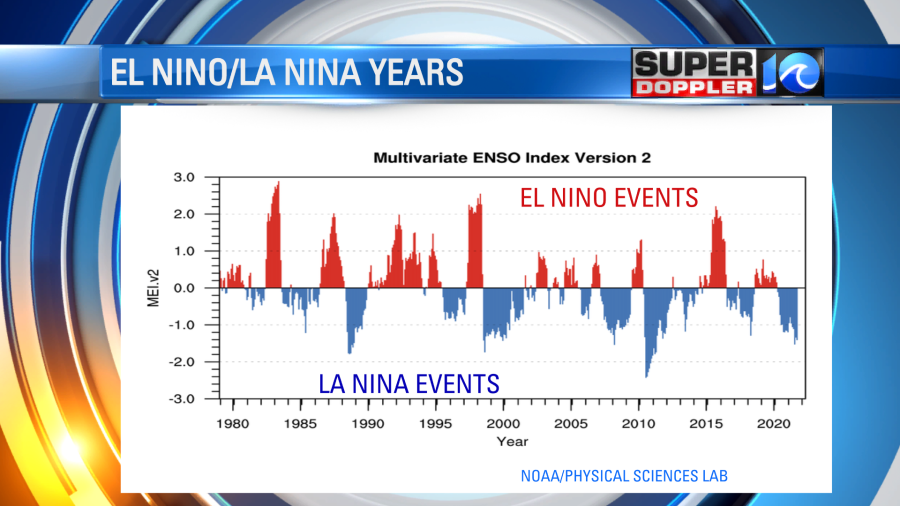
Since the 1980s there have been several big El Niño events as well as several large La Niña events recorded.
The problem is that it is more complicated than that. At least it is for our region. Cold air isn’t always locked up to the north. Sometimes it does dip down into our region. During some La Niña years this has created big snow events. The Winter of 2010/2011 is a good example.
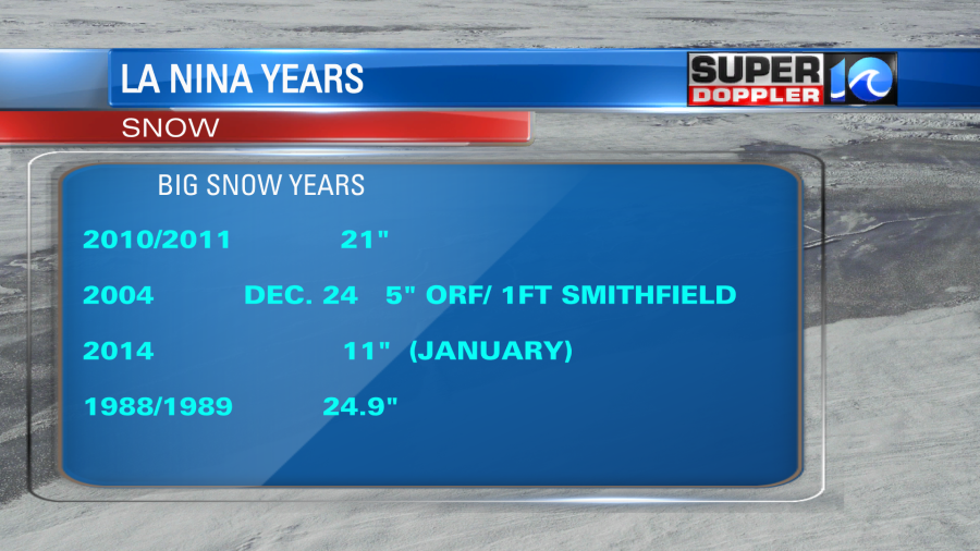
My first big snow event was in 2004. The models weren’t showing much around Christmas, but we ended up with over 5 inches in Norfolk and about a foot of snow in Smithfield, Virginia. That was a La Niña year. However, that doesn’t always mean that we get snow. There were a few La Niña years when we had very little snow. I had one viewer in the Winter of 2007/2008 ask why we were in a snow drought.
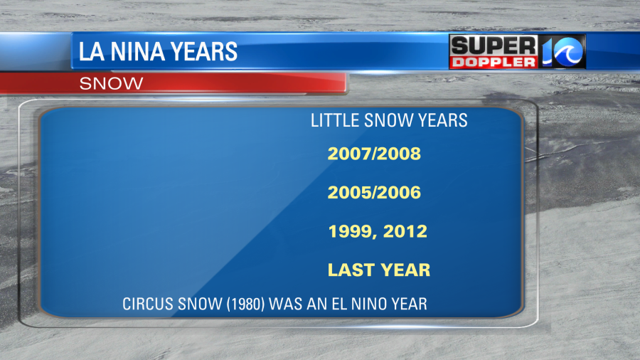
We had very little snow in 1999 and I don’t know if we had any recorded snow in 2012. If we did, it wasn’t much. So why is that? Well, it’s because you have to look at other pieces of the puzzle. Our weather also depends on:
- The North Atlantic Oscillation (NAO). A shorter-term pressure pattern over the Norther Atlantic Ocean.
- The Arctic Oscillation (AO) A pattern that determines the potential for cold air to drop southward.
- The overall temperatures for the year/season. 2012 was a record warm year over the U.S.
- Local water temps. (ocean, bay, and sounds).
- The mid-late Fall snow pack over the Rockies and Siberia.
So each year can be very different. Even if the La Niña pattern has the same strength as a previous year. I’d say this year is a bit similar to last year, and we didn’t get much snow last year. Also, it has generally been very mild and dry lately. So if I had to make a prediction for this upcoming Winter, I’d say that we’ll be looking at a less snowy 2021-2022 season. We’ll see though. Things can change. The Super Doppler 10 weather team will have a more specific forecast over the coming month.
Meteorologist: Jeremy Wheeler