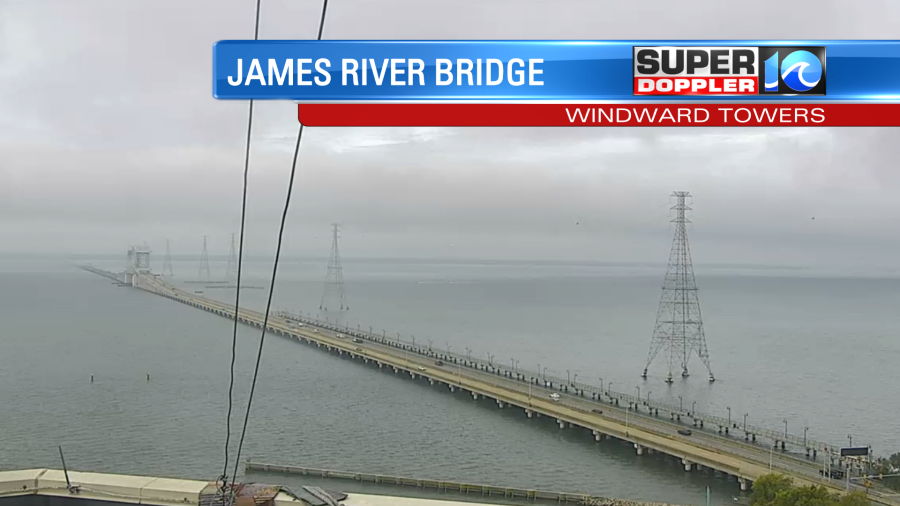
Today is going to be pretty steamy for early-to-mid September. We started off this morning with some thick clouds and deep moisture. You could even see it in the low clouds and haze.
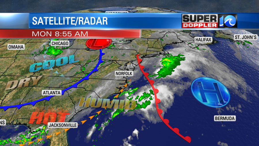
There is a warm front to our northeast with a cool front to our northwest.
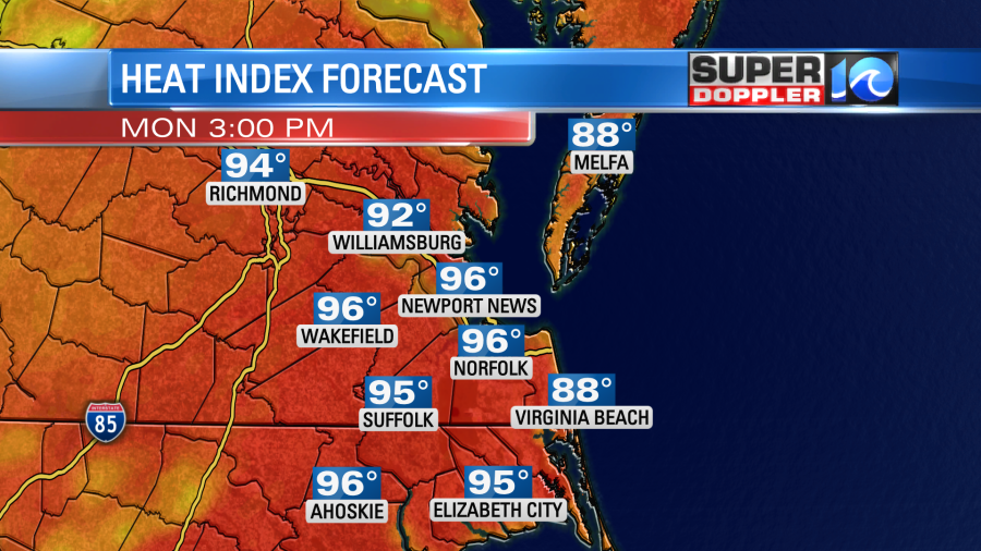
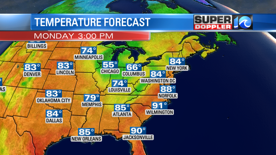
We’ll be in that hot/humid zone through the day. High temps are aiming for the upper 80s.
However, it will feel like the low-mid 90s with the heat index.

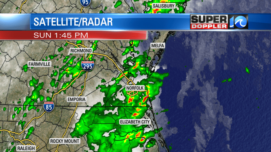
A few days ago the models made it look like today would be an almost-washout. However, they have backed off of the coverage since then. Having said that…We will have some scattered showers and storms later this afternoon.

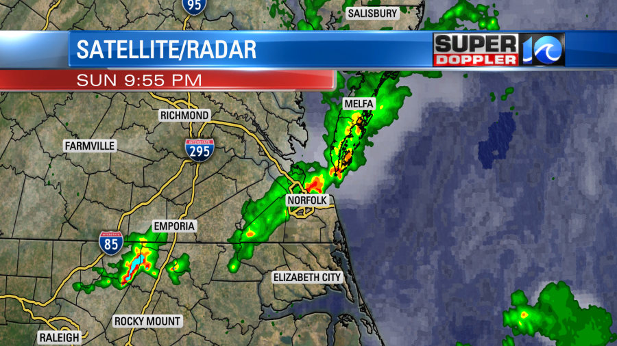
There could be a few heavy downpours between the late afternoon and early evening hours. A couple of strong storms could also happen this evening. That is more likely west and northwest of the metro. Tomorrow the cold front will drop to our south. Dry air will start dropping in, and we will start feeling a lot better by the afternoon.
The high temps will drop a little, but it won’t be what I’d call cool. We’ll be in the low-mid 80s. Winds will be light and out of the west/northwest. We’ll be partly cloudy with only some isolated showers. The weather will be very nice for the second half of the week. We’ll have fair skies and mild temps Wednesday through Friday. High temps will be in the upper 70s to low 80s.

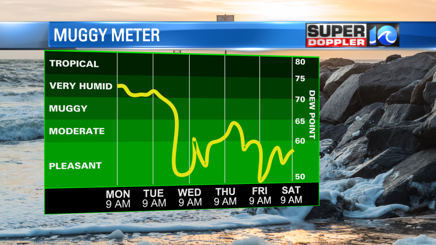
The lower humidity will feel really nice. No rain is expected. The next chance I have for a showers is only a 20% chance next Sunday.
We did have some pretty good rain showers yesterday and last night.
Some areas had more than an inch. Some only had a little under a tenth of an inch.
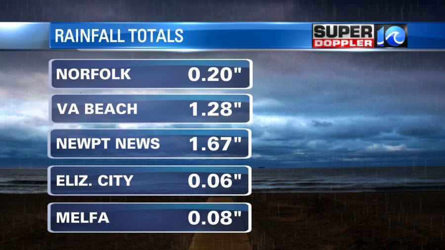
It’s interesting that the reading at Norfolk International Airport was only 0.20″. Norfolk Naval Base had 1.44″. However, the climate site is at Norfolk International. So that is what is going to go into the records. That’s just the way it goes with climate.
The tropics are quieter today, but not completely quiet. Both Danielle and Earl have fallen apart since last Friday. There are now only 2 tropical disturbances in the central and eastern Atlantic.

It appears that another big area of Saharan Air has branched off of Africa and has moved west. This could restrict the formation of the eastern disturbance, but the more western one may be able to get away from it and form. Either way both have a low chance of formation in the next 2-3 days.
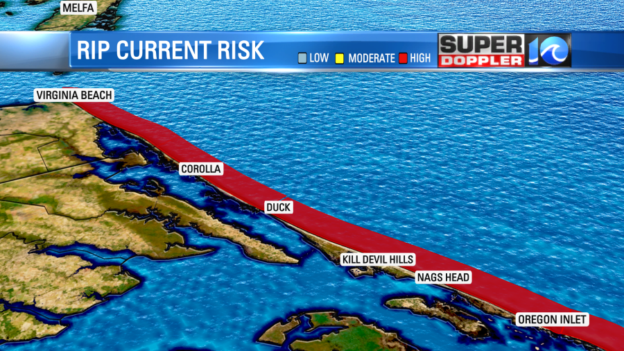
Having said that…There is still a high threat for rip currents at the local beaches due to the recent big tropical systems out in the Atlantic.
Meteorologist: Jeremy Wheeler