Hope we enjoyed all the weekend sunshine (even though it was chilly) because we’ve got some weather on the way this week. Two rounds of rain will work through the area. The first on Monday afternoon/evening and the second towards Thursday.
We even preheated the oven a bit this evening! As the clouds thickened up and hung low, a little moisture came with them and dropped in a few snowflakes! How about that! If I’m being honest, I did a double-take when checking the radar just like we all did when Brady threw that third interception. Check out the radar from around 9 p.m.!
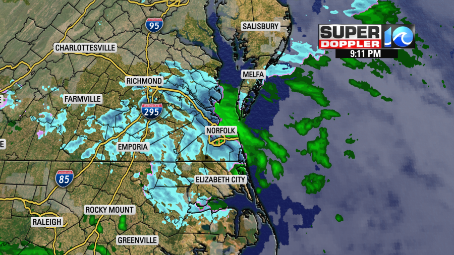
Many of you confirming either flurries, sleet, or graupel via the Twitter and Facebook. A few more snowflakes, sleet and/or graupel is likely through midnight or so. Nothing to accumulate on the ground or cause any issues, just a nice winter delight to finish the weekend.
Round 1
Temperatures tonight hold in the 30s as we’re blanketed with clouds. Moisture will increase through the night and as it does so temperatures will slowly come up to near 40° by dawn. The first half of Monday will be dry, so just expect clouds up until lunchtime or so. Rain won’t work into the area until after the noon hour. Scattered rain showers at first become widespread by late afternoon and evening.
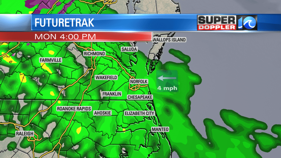
The southwest breeze will get high temperatures into the upper 40s, near 50° despite the clouds and rain. In fact, if the rain has a later start time temperatures may climb into the 50s. Overnight expect the rain to stick around, slowly breaking up by dawn on Tuesday. Look for some showers to linger for the first portions of Tuesday before clearing out with some sun. Since by this time we should be in the warmer section of this first system, so with the afternoon clearing Tuesday highs will get into the mid-50s.
Sunshine will take us through Wednesday with seasonable highs in the 40s. A nice day, really, and should hit the reset button before round two on Thursday.
Round 2
Clouds will increase by the end of the day Wednesday as we await our next system – one that should be a bit more organized. Since this is still in the extended forecast, there will be plenty of changes to the forecast, so keep that in mind. As of now, rain fills in by early Thursday morning with a solid breeze. Because the system moves in during the coldest portion of the day, it’ll easily pull down even colder air from the north. That means there’s a decent chance that by some point Thursday some snow could mix in.
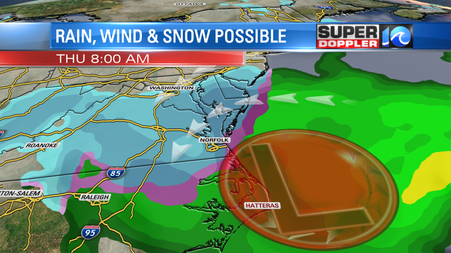
This should be a fast-moving system so don’t get your hopes up about any accumulations. We won’t even go down that road just yet! In fact, we’re right back to cold sunshine by Friday. As of now, stay locked in for updates as we fine-tune the forecast, and enjoy the few snowflakes that are actually falling from the sky as I type this on a Sunday night.
Stay stoked! – Meteorologist Steve Fundaro


