Over the last few days there has been some major flooding over the deep south. Some of this has come from the leftover moisture from “Potential Tropical Cyclone 4″…which never actually formed into a system. However, that deep moisture drifted across the Gulf Coast states, and it created numerous problems for many cities.

Some of the rivers down there are still rising today. So the problems will persist. The drought has improved over small parts of the Southwest and Deep South.

As of the latest update we still have some areas that are “Abnormally Dry”.

However, we did have some isolated showers yesterday that sat over the same locations for a time. A few of them were in the “abnormally dry” area.

We were actually on the edge of some of that thicker moisture yesterday. You can see it as a stream of white/grey clouds with a sharp northern edge.

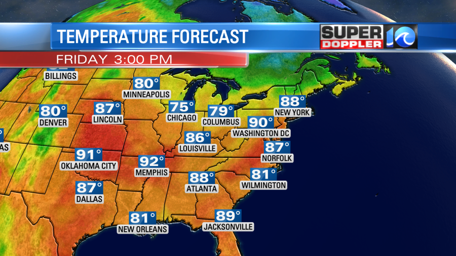
There is a stationary front to our south. There is a cool front to the northwest. We’ll be partly cloudy today with isolated showers or storms this afternoon. High temps will be in the upper 80s with a few 90s inland.

It will feel like the low 90s with the heat index. It will be rough if you are working outside in the sun, but it will be a nice day to head to the beach. The weather looks good for the ECSC. The waves today will run about 1-3 feet. There could be some occasional nice sets.

The waves will be closer to a steady 2 feet tomorrow. It will probably be about the same on Sunday.
We’ll be partly cloudy again tomorrow. However, there will be a little higher chance for some rain and storms during the afternoon. The cool front will be approaching form the northwest. The rain won’t be widespread, but there could be a few downpours.

High temps will still rise to the upper 80s to near 90 degrees. Winds will be variable at 5-10mph. We’ll only cool down a couple of degrees on Sunday. If we’re lucky then the humidity will dip slightly. We’ll be partly cloudy with some isolated pm showers or storms. High temps will be in the 80s. We’ll hit the 90s Tuesday and Wednesday of next week. However, the long-range models suggest that we’ll have a big cool down by the end of next week. Stay tuned for updates on that.
We are still keeping an eye on 2 tropical disturbances in the Caribbean and eastern Atlantic. Both are moving generally west, and both have a low chance of formation over the next few days.

Meteorologist: Jeremy Wheeler


