
Yesterday, the forecast for today had been drying out more-and-more. However, there were hints at an early wintry mix on some models and model runs. So I would say that it was a curveball forecast but one that we saw coming. (it was just hard to hit).
Anyway, even before I got in this morning the radar was showing a lot of precip, but the surface reports barely had any precip reaching the ground. I only had a few spotty showers on my early morning commute. By about 6am the radar had gotten more colorful, and some reports of mixed precip started coming in.
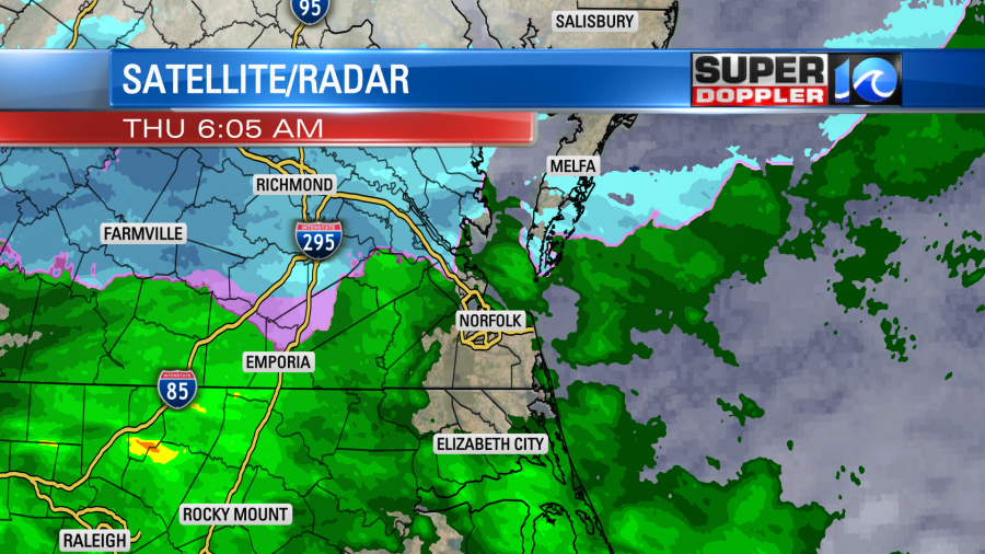
Most of the reports were sleet mixed with light rain. Between 6-8am there were also some reports of flurries between the Peninsula and Middle Peninsula. Either way there was some light precip briefly collecting on the roofs at Colonial Williamsburg.
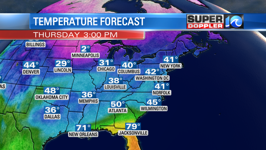
Surface temps were above freezing for most, but they were in the 30s. Today we have a weak area of low pressure moving along a stationary front to our south.

There is a lot of moisture pushing up/north over a colder/drier air mass. This process is happening over a very long stretch. Basically from Texas to Virginia. However, it is causing major problems with icing closer to Texas and Arkansas.
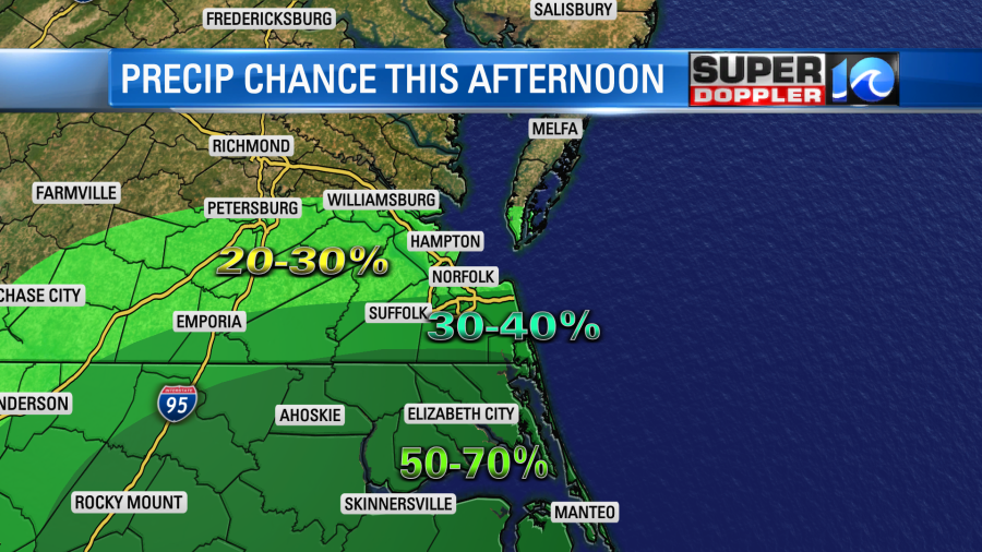
Our less-menacing wintry mix will turn into scattered rain showers by the mid-late morning. Then we’ll have scattered showers this afternoon.
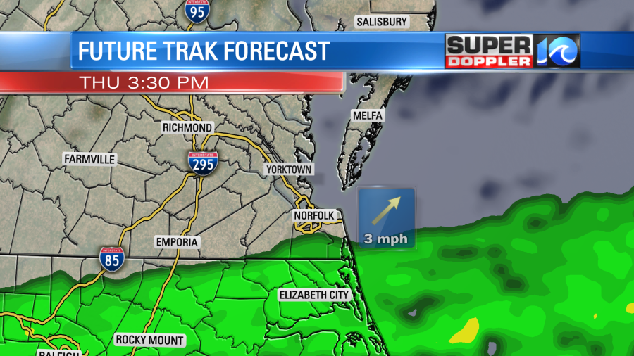
The best chance for rain will be over North Carolina with a few showers possible over the Southside. It should be very isolated or spotty from the Peninsula northward.
We’ll have lots of clouds through the day. Winds will be light and out of the northeast. High temps will only rise to the low 40s.
Tomorrow a stronger and faster cold front will swipe through the area. It will arrive early tomorrow morning. There will be lots of clouds at the time. The front might create a couple of sprinkles or flurries. Then we’ll get hit with some much colder and drier air. Temps will fall from the low 40s in the morning to the 30s in the afternoon.
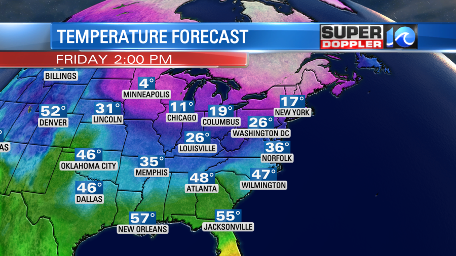
We’ll also have a wind out of the north at 10-15mph with gusts to 15mph. So wind chills will be in the teens and 20s.
We’ll have even colder air in the region on Saturday. Low temps will be in the 20s. High temps will be in the 30s. However, warmer temps will bounce back on Sunday. High temps will rise to the low 50s. We’ll even milder early next week with 50s and 60s returning. Wow!
Finally…The groundhog Punxsutawney Phil did see his shadow this morning. So it’s 6 more weeks of Winter for the Northeast. I’ll be at the Virginia Living Museum at 11:30am to see what our local prognosticator “Chesapeake Chuck” has to say.
Meteorologist: Jeremy Wheeler


