We have had a lot of cool pockets of air visit us during the month of June (and for some of May as well).
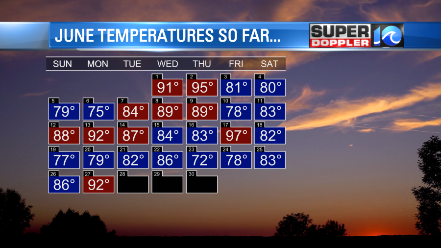
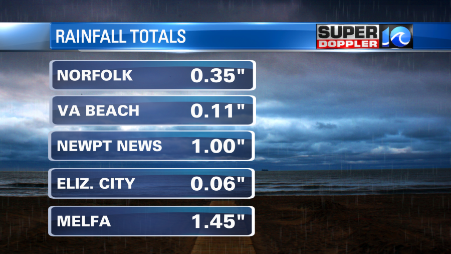
We are likely to finish out the month below average for temps and for precip. Another cold front moved into the area last night. This brought us some heavy rain showers to parts of the area.
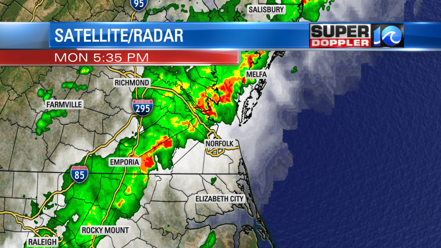
However, as the heavy showers dropped to the southeast a lot of them fell apart.
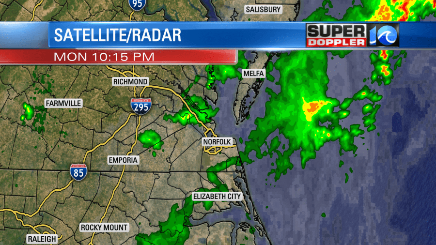
This is depressing as the folks that needed the rain the most got the least amount. While 1-2 inches fell from Newport News northward, parts of North Carolina only had about a tenth of an inch.
So at least we’ll have some pleasant weather in the region today. The cold front will keep dropping to our south. Cooler/drier air will sink in.
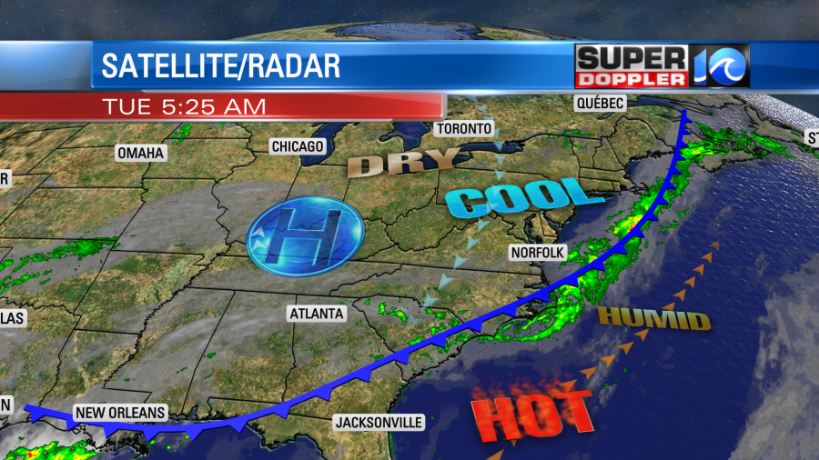
High pressure will build in as well. We’ll be partly sunny through the day. The wind will pick up out of the northeast. It will run at 10-15mph with gusts up to 20mph. So that will work against the sunshine to keep the temps down a bit. Highs will be in the upper 70s to low 80s. There will be a few mid 80s inland.
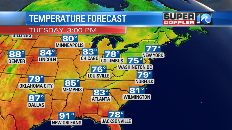
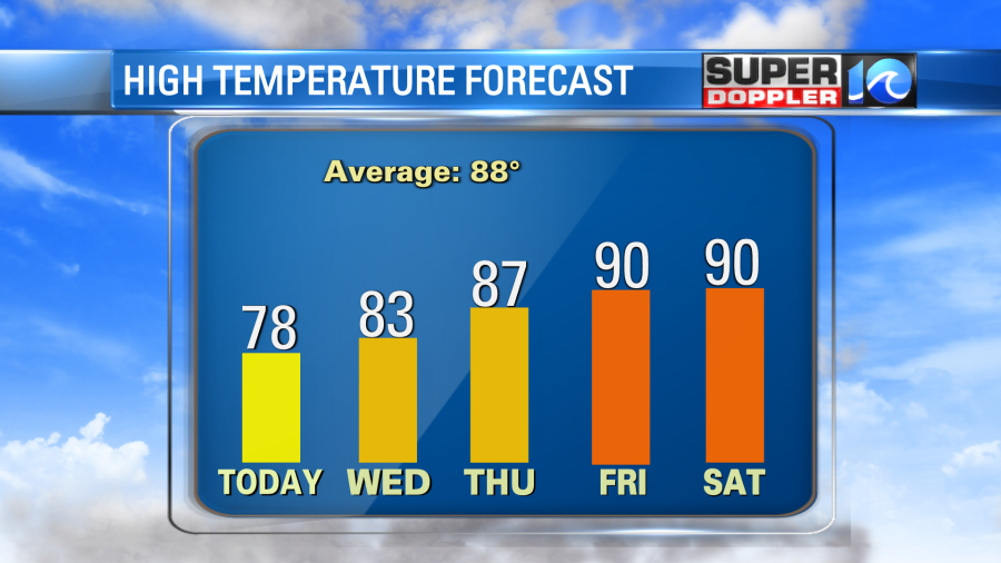
We’ll have some nice weather tomorrow. We’ll be partly cloudy again with dry air in place. The wind will be a little weaker and more out of the east. So we’ll heat up to the low-mid 80s with some upper 80s inland.
The temps and humidity will build as we go into the weekend. High temps will climb to near 90 by Friday.
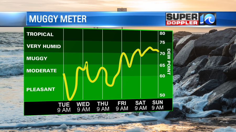
Our next best chance for rain will be on Sunday.
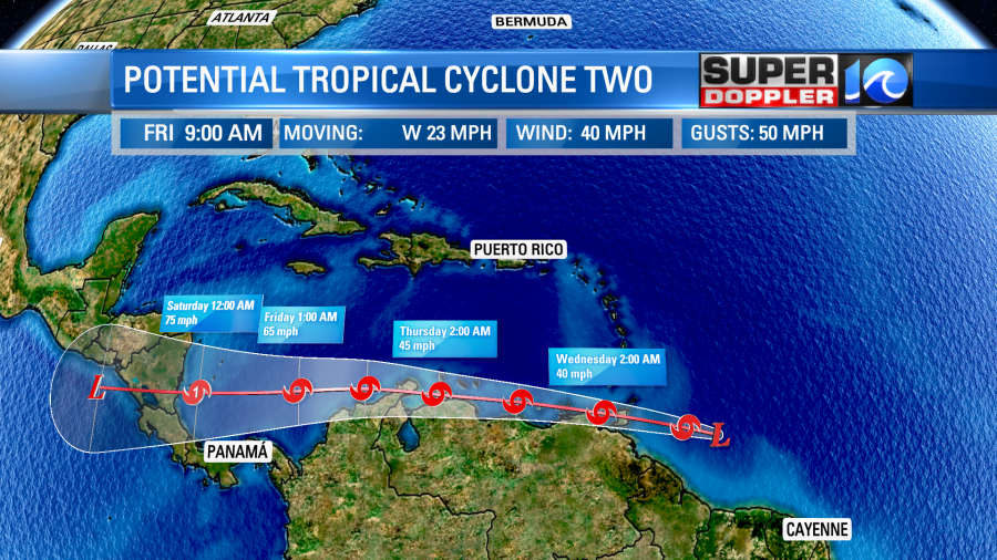
In the meantime there is a “Potential Tropical Cyclone” in the Atlantic. A cluster of showers and storms was strengthening northeast of Guyana, and it was rolling west.
This feature is still disorganized, but it does have some tropical storm forced winds. The tricky part of that forecast is that it will likely interact with a lot of South American coastline. So it could stay weak for a while. If it travels a little more northward, then it will likely strengthen sooner. The official forecast calls for it to possibly become a category 1 hurricane as it moves over the warm waters of the Bay of Campeche.
Whatever it does, we’ll have updates on it over the next few days.
Meteorologist: Jeremy Wheeler