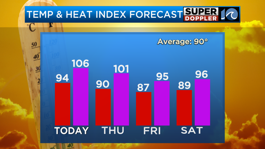
Yesterday was about as hot and humid as expected. High temps made it into the low-mid 90s.
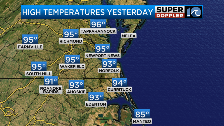
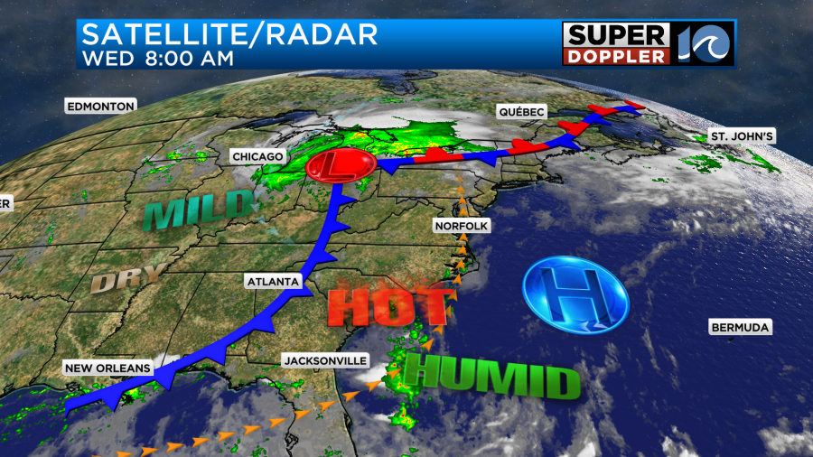
The heat index was over 105 for many. It was partly cloudy with only some isolated showers or storms. We’ll have very similar weather today. There is a stationary front to our north. It is attached to the remnants of Beryl which are roaming over the Great Lakes now. There is a cool front south of that feature that stretches to the southwest.
We’ll be partly cloudy today with only some isolated showers or storms possible. High temps will aim for the low-mid 90s again.
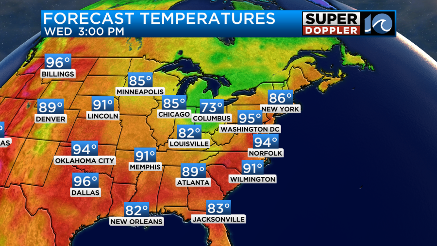
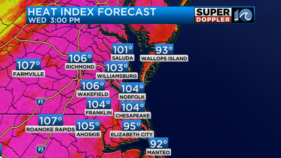
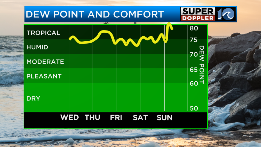
The heat index will be back to near 105 in many places.
One difference today is that there will be a nice breeze out of the south. That may really help in how it feels outside. Winds will run at 10-15mph with gusts up to 20mph.
Tomorrow the cool front will move into the area, but it will likely stall out just to our west. We’ll still be hot and humid, but not as bad as the last 2 days. Highs will be near 90 degrees. The heat index will still be near 100.
As the front stalls out it will create a bunch of scattered showers and storms. There may already be some in the region tomorrow morning.
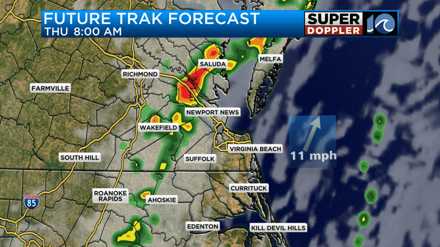
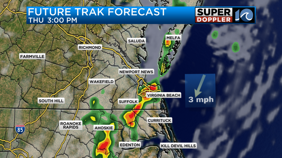
Winds will be out of the south at 5-15mph tomorrow. This will pull up more moisture out of the south. More scattered showers and storms will form and come up from the south as well later in the day.
This front will make for a bit of a tricky forecast Friday into the weekend. The front may drift back west a bit on Friday. At least in the morning. That may briefly decrease the rain chances for a time locally.
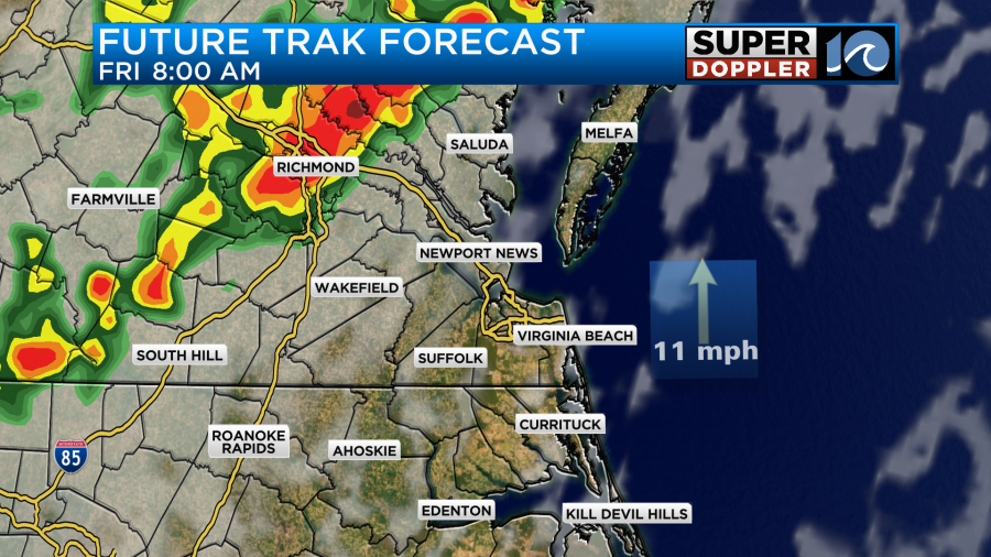
However, the front is forecast to wiggle back east later Friday. That could create some more scattered thunderstorms.
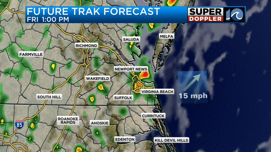
There could be some scattered heavy downpours once again.
High temps will be in the upper 80s, but it will still feel like the 90s due to the high humidity.
The forecast for Saturday may be a little less wet now. The GFS model is backing off of the coverage a little bit, but it does still have some rain.
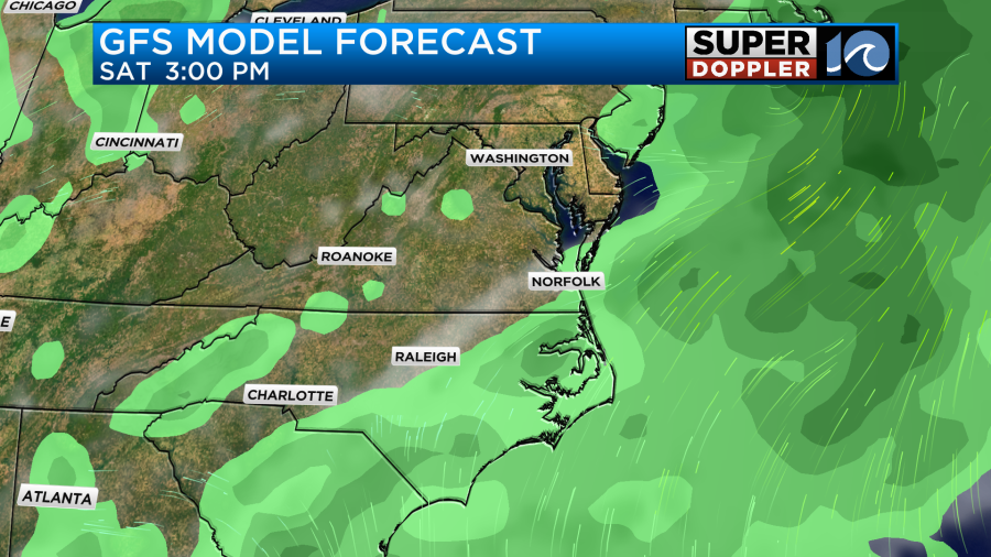
High temps will be in the upper 80s, but it will stay humid. A few showers may linger into Sunday, but I think overall we’ll have more sun and higher temps. They will likely return to the low-mid 90s.
We definitely still need rain in the region. Some of the models are showing about 1-3″ in the next 48 hours. However, there are still a couple of models like the NAM that are only showing about a half an inch or so.
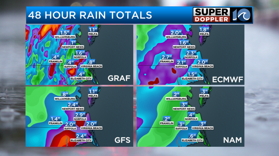
Some locations may get too much rain too soon. There may be some isolated flooding in the region. Stay tuned for updates on that.
Meteorologist: Jeremy Wheeler