Yesterday was really nice out. It was warm, but not too hot. It may have felt hot if you were in the full sun and out of the breeze for a while.

This is a good time of year. Humidity usually isn’t too bad. Pollen starts to decline. Mornings are still fairly cool and the afternoons are warm. However, this is also the time of year when temperatures flip-flop quite a bit. While our average high temps are in the 70s this time of year, usually we are bouncing from the 60s to the 80s to the 50s to the 80s again. We did a lot of this during this month so far, but there were some 70s.
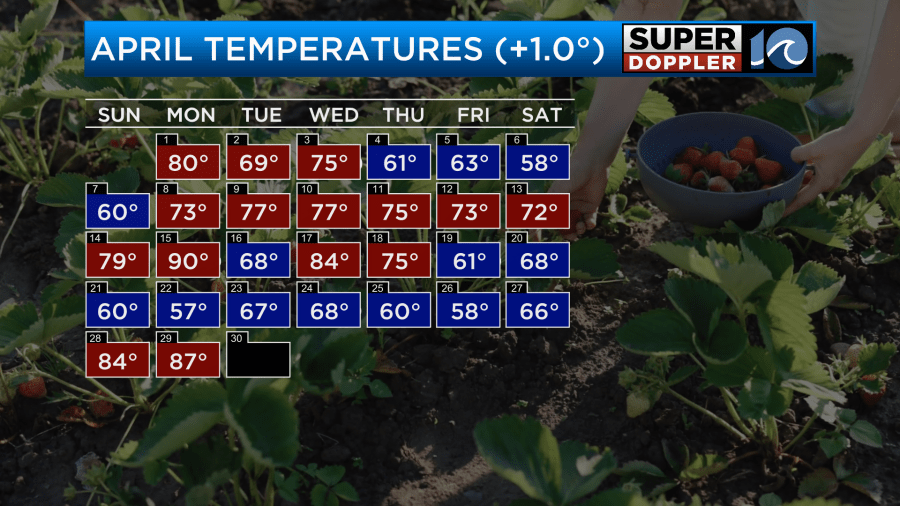
When it wraps up we will end up about a degree above average. However, look at the long cool and warm streaks.
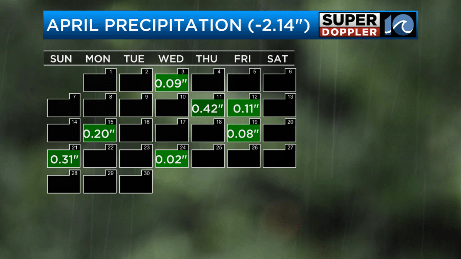
We definitely need some rain. That’s another thing that has become very feast or famine over the last 10-15 years. We just had the second wettest March on record. Now we are about 2 inches below average for the month of April for rainfall.
We won’t have any rain today. High pressure is to our south. There is a cool front to our west.
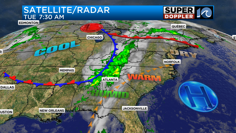
There will be some storms to our west. However, we are starting with lots of sunshine. We will have some scattered clouds come in from the west this afternoon. We will also have a southwest breeze. It will run at 10-15mph with gusts to 20mph. There will be a few gusts to 25mph.
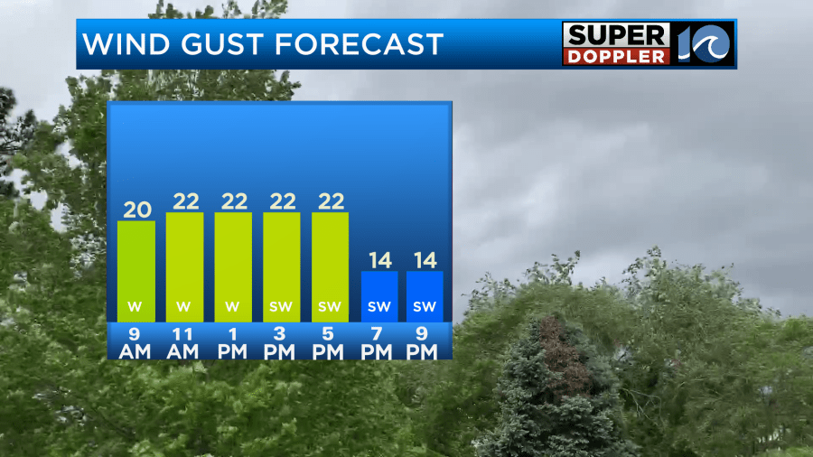
High temps will warm back up to the mid-upper 80s. This should be pretty close to yesterday’s numbers.
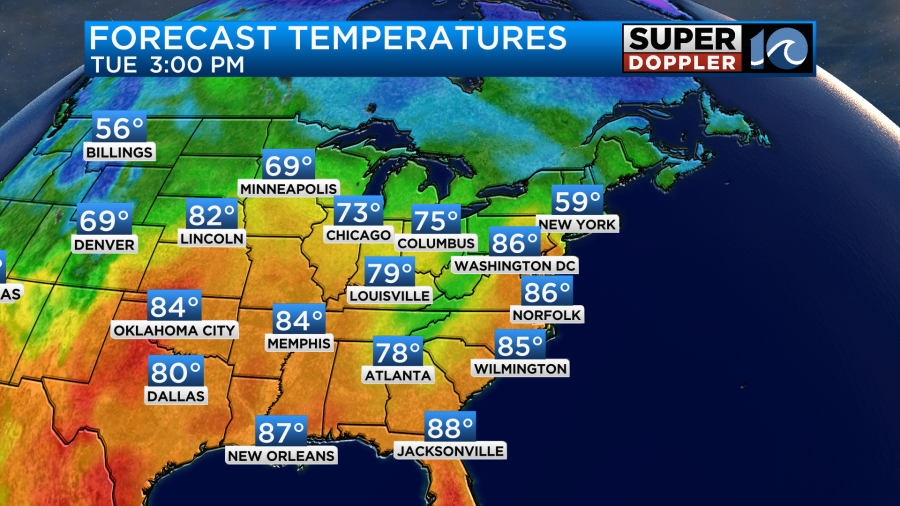
It may hit 90 in a spot or two, but that won’t be too common.
Tomorrow the cool front will move into the area. Winds will flip from southwesterly to northerly. They shouldn’t be too strong. We’ll be mostly cloudy through most of the day. We’ll have some spotty showers in the morning and midday. Then there will be a few scattered showers and isolated thunderstorms in the afternoon.

It does show a few thunderstorms into North Carolina. Keep in mind that not everyone is going to see the rain tomorrow. Our model is pretty lean overall. The GFS is now also pretty lean. It has most of the rain over North Carolina.
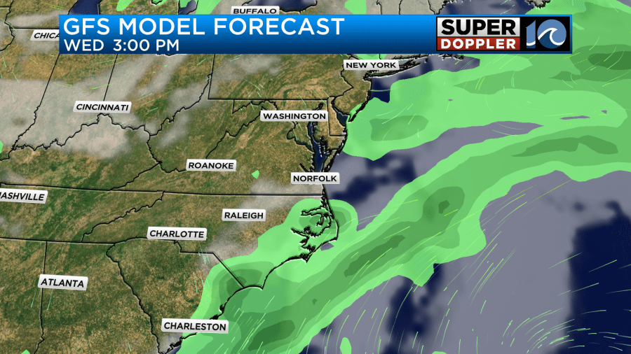
If the models are right then we are looking at pretty meager amounts of rainfall. A few spots may pick up a quarter to a half an inch if a couple of thunderstorms do pop.
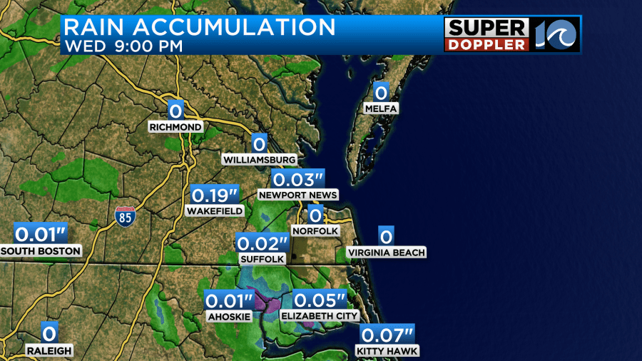
High temps will likely dip into the 70s. I’ve got upper 70s for now. Winds will turn out of the south by the evening.
That alludes to the big change for Thursday. Instead of the front dropping south and our area cools down. We will now likely warm up as the front lifts back north as a warm front. So now I have high temps near 80 degrees. That’s a big flip from yesterday.
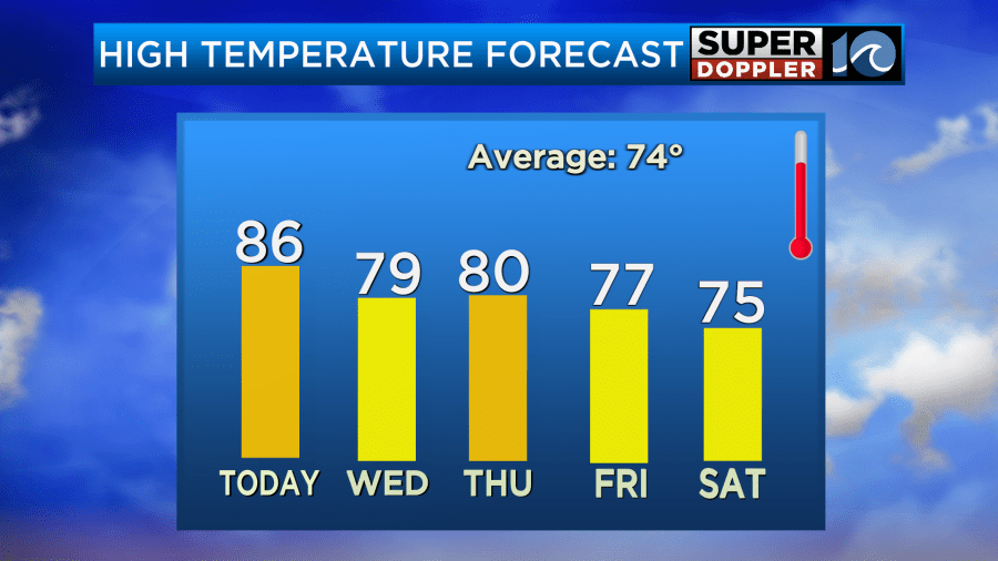
Another front might skirt the area on Friday and start cooling us back down to the 70s. We should be dry. Then a third front is forecast to move in over the weekend. That one will have some more punch to it. So high temps will be in the 70s over the weekend. We’ll also have an increasing chance for rain. We’ll have increasing clouds and scattered rain showers on Saturday.
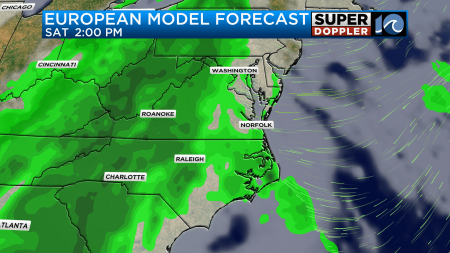
The coverage will probably increase even more by the evening. Then it looks like we’ll see a lot of rain on Sunday. Both the GFS and Euro models are very wet through the day. High temps will be in the 70s both days. I’ll go into more detail about the weekend’s weather in tomorrow’s weather blog.
Meteorologist: Jeremy Wheeler


