We have been keeping our eye on this system but it now officially has a name, Arthur. Although hurricane season doesn’t officially begin until June 1st, the tropics are heating up. The biggest impacts will be seen along the Outer Banks, and much of that region is under a Tropical Storm Warning.
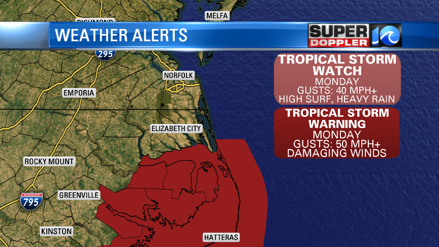
The models are in agreement over the next 24 hours but then start to stray after that. But it is expected to head east once it moves past the OBX. The latest track from the NHC has the eye of the storm passing by NC Monday afternoon.
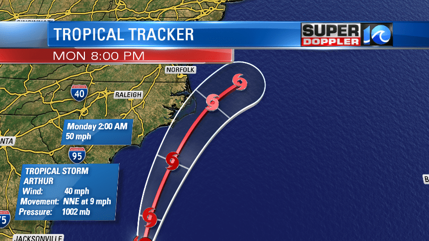
This spaghetti model plot shows how some models just go all over the place, and some of those can be thrown out but there still is some uncertainty of exactly how far east or west this system will track.
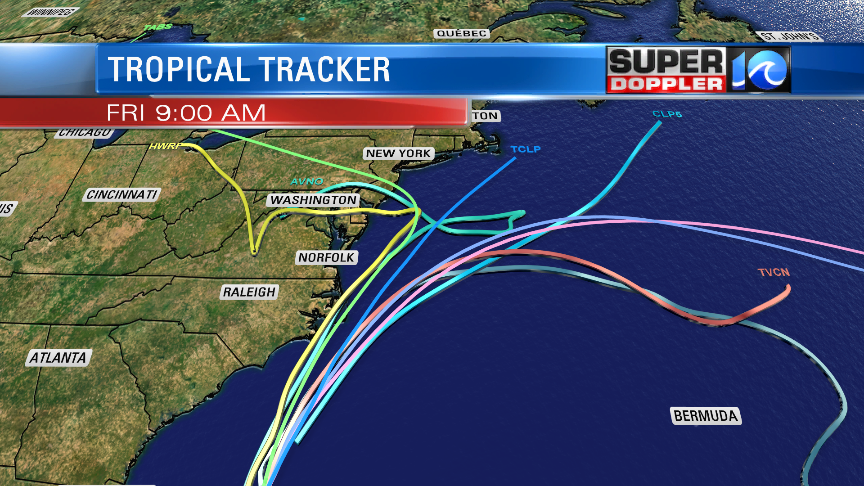
The main problems we’ll be watching for the Outer Banks is the potential for wind gusts 50 mph+ and ocean over wash. Wave heights could be over 10 feet so that will cause some problems along NC 12.
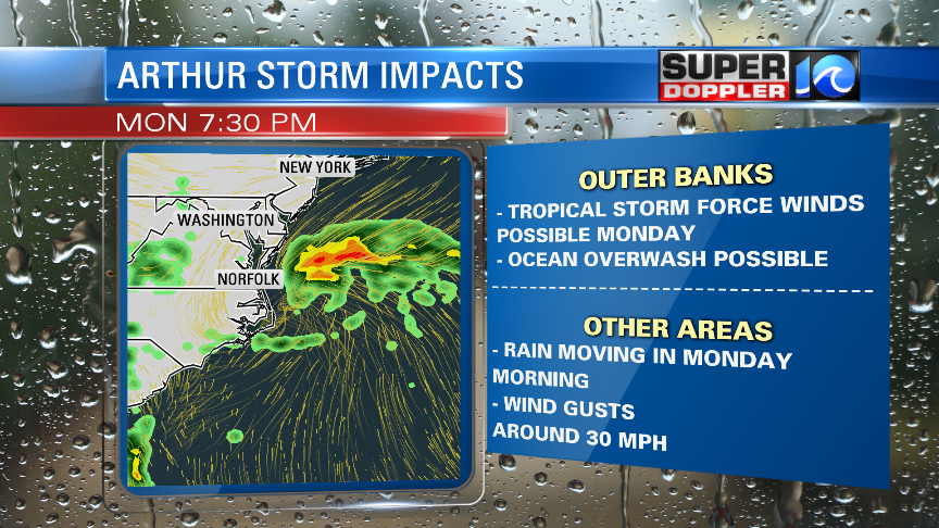
The rain will be the heaviest during the afternoon/ evening on Monday, especially in the OBX. Much of Hampton Roads will see some rain from this system but it won’t be a washout.
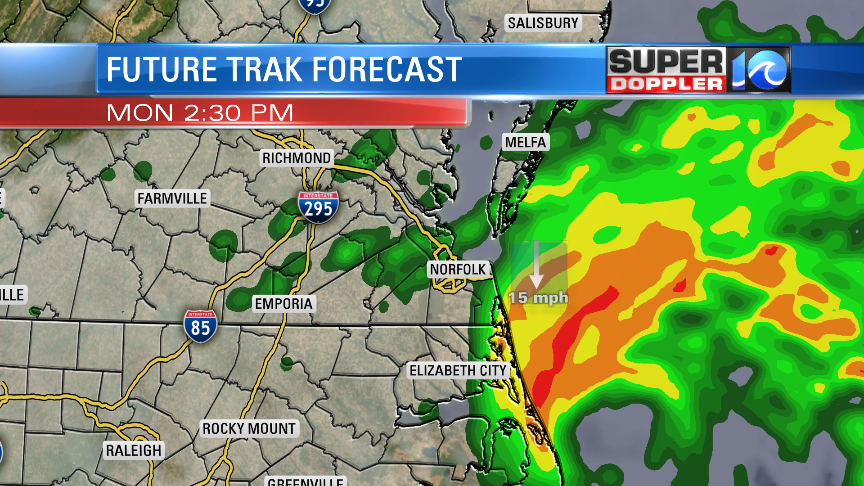
Rain totals therefore will be the highest along the OBX and then decreasing the farther north you are.
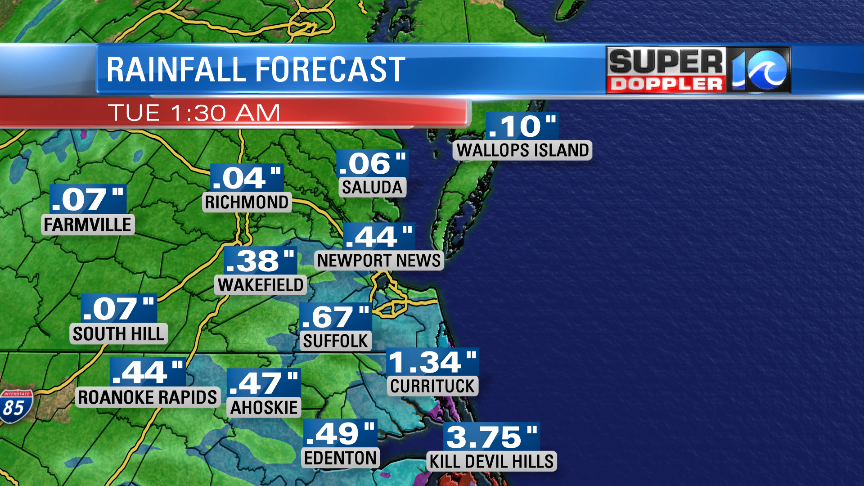
This can still change so you do want to stay updated! Unfortunately, the rest of the week won’t be great weather either. More rain will be moving in from the west through much of the week ahead.

Stay tuned for updates! -Meteorologist Casey Lehecka


