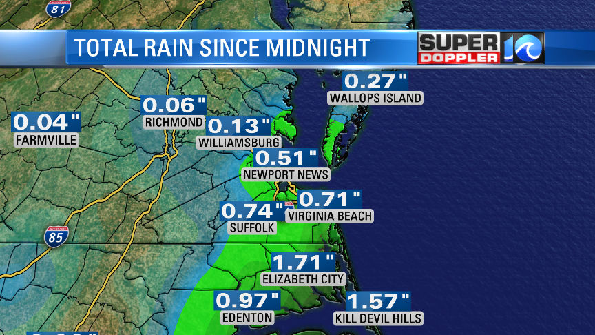
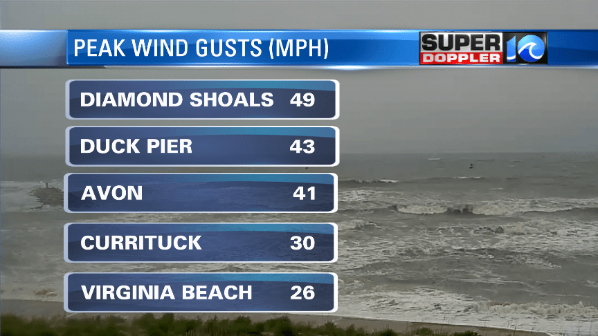
Arthur wasn’t a huge concern for the region, but it did give us a test run of what a tropical system will look like during a pandemic. Typically residents will flock to the stores to stock up on essentials, but with store shelves already pretty bare what does that mean for hurricane season? We’ll find out. Arthur didn’t produce any staggering numbers from this storm! But still some heavy rain and gusty winds. Here’s some of the totals we saw across the region:

As expected, less than an inch for much of Hampton Roads and lesser amounts the farther NW that you live.

Arthur came the closest to Hatteras Island which is where we saw higher rainfall totals. The center of the storm didn’t cross over land, but there still was some heavy downpours coming in from the outer bands.
The winds weren’t too impressive but nonetheless made for some unfavorable conditions for anyone who did have to be outside. The highest wind gusts were along the OBX, but we still saw some high wind gusts along parts of Hampton Roads.

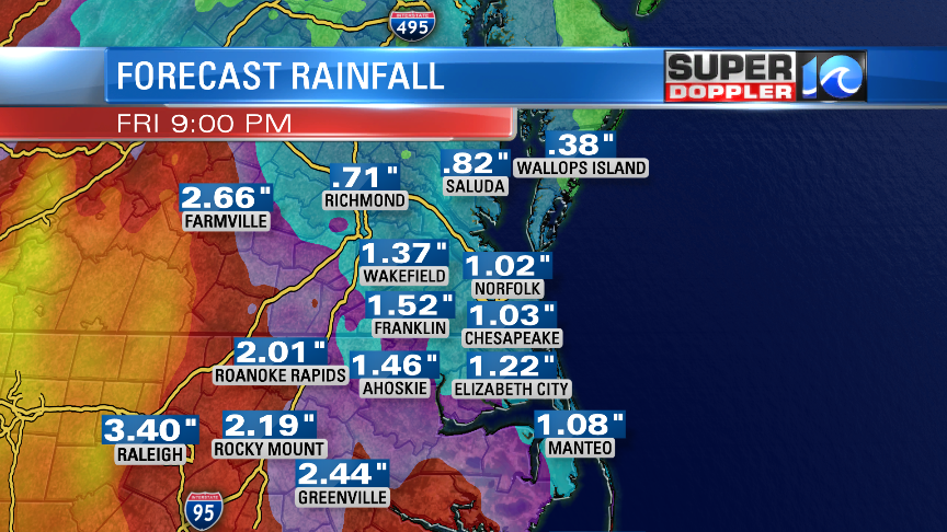
Unfortunately, this isn’t where the rain ends for the week ahead. Another system from the west will be moving in and giving us more rain, we’ll keep you updated on the timing and amounts of that. Here’s what the European Model has for rain totals through Friday. This won’t cause widespread flooding concerns but low lying areas might have some drainage problems.

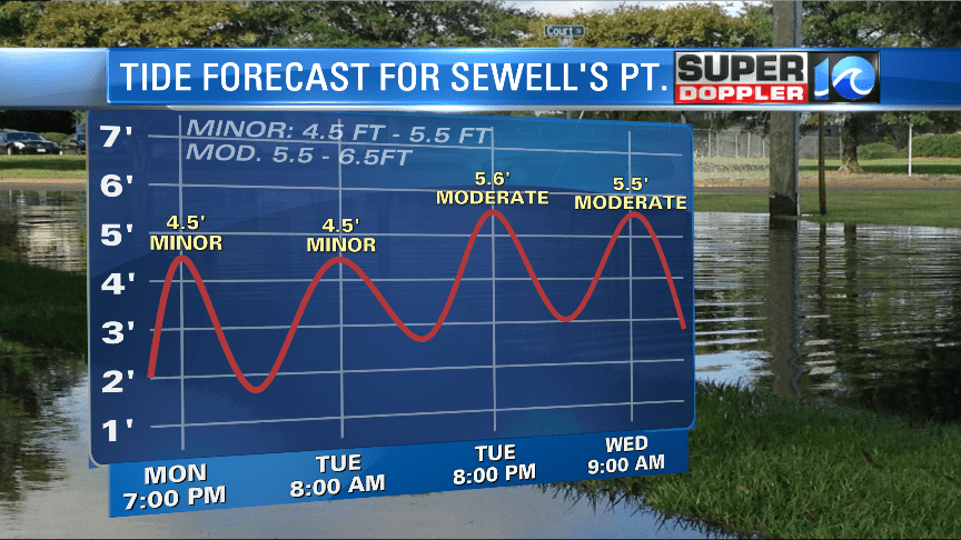
Lastly, the biggest problem we’ll be dealing with is the threat of tidal flooding the next few days. Tuesday night and Wednesday morning at high tide Sewell’s Point will reach around 5.5′ which is in the moderate level. Something to keep an eye on if you live in an area that deals with tidal flooding.

Stay dry! -Meteorologist Casey Lehecka


