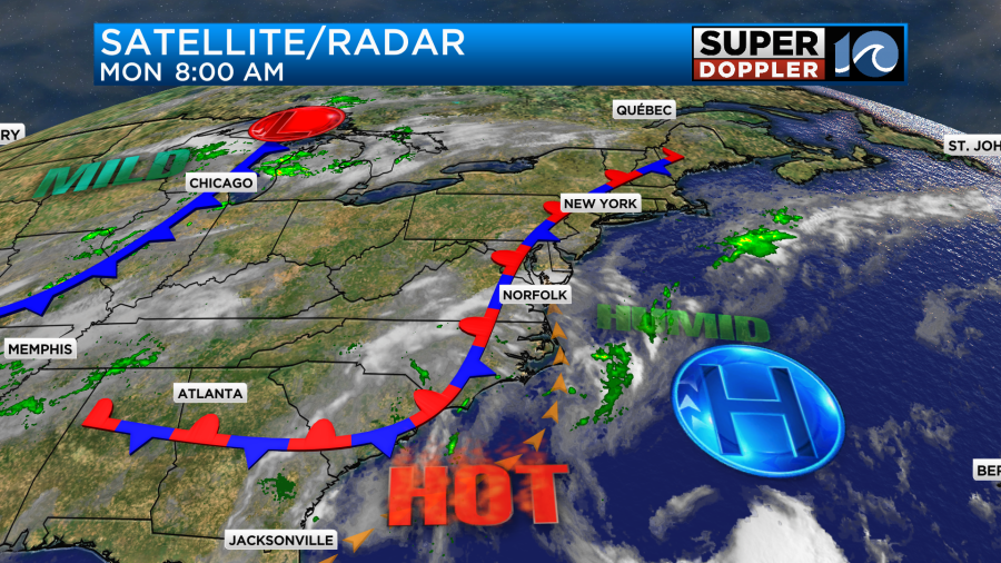
I would definitely say that the Dog Days of Summer have started early this year. I feel like we’ve been in them for at least a couple of weeks. This week we’ll have many days with a heat index around or over 100 degrees. Today we have high pressure offshore with a stationary front in our region.
We’ll have a mix of sun and clouds through the day with a decent stretch of partly cloudy skies for a while. There were a couple of spotty/light showers this morning, but they have fallen apart. As we get into the afternoon we’ll het things up to around 90 degrees or the low 90s.
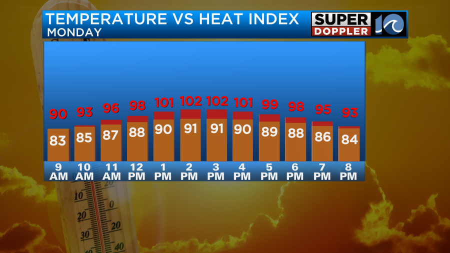
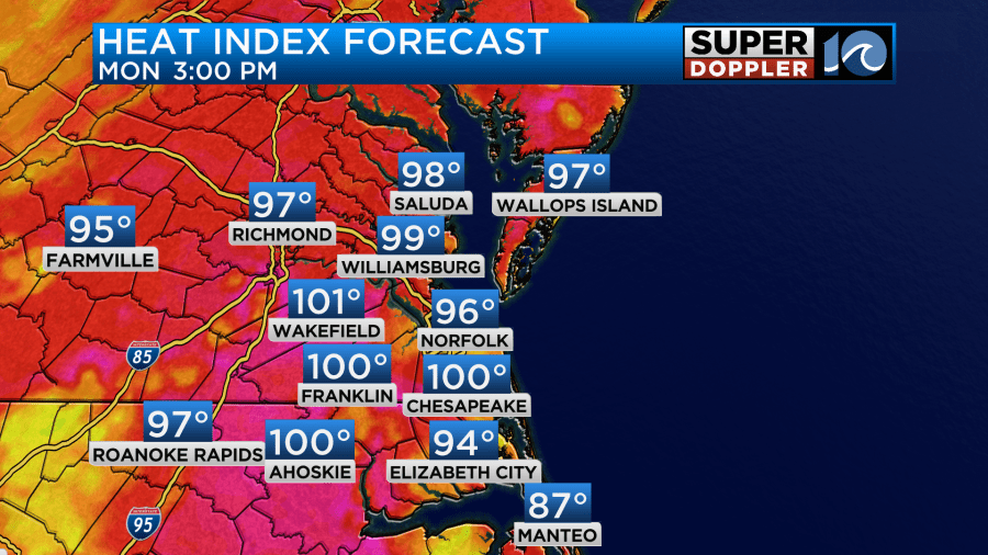
The heat index on the other hand will be around 100 degrees.
There will be some scattered thunderstorms forming later today. They won’t be widespread, but there should be some decent coverage. I’ve put the rain chances at 40%. Here is what Future Trak shows.
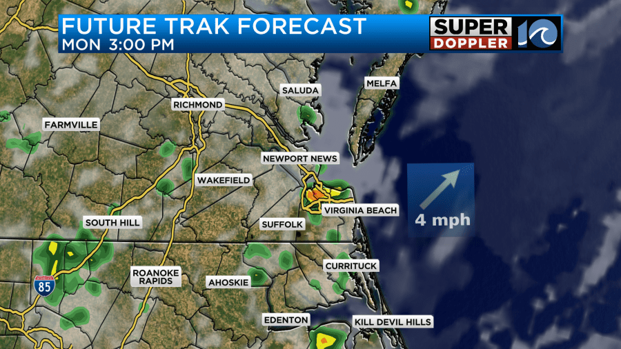
There may be some heavy rain in a few places. That would definitely cool things down but only locally.
Tomorrow the front will drift west a bit, and high pressure should edge in closer from the east. So we’ll be partly cloudy with only some isolated showers or storms. Since there should be less rain and clouds we are expecting the temps to go up. Highs are aiming for the low-mid 90s with a heat index over 100.
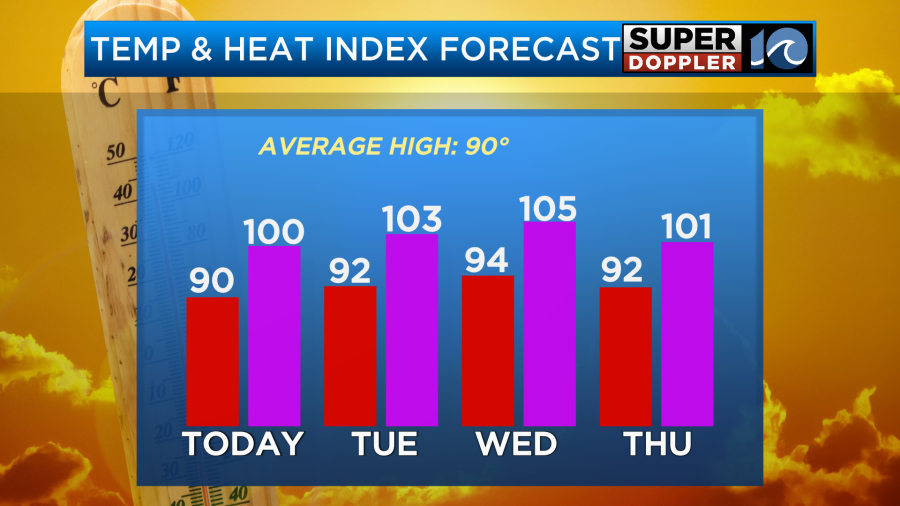
We’ll have similar weather on Wednesday with a little more heat in the forecast. By Thursday it looks like we’ll have more/deeper moisture in the region. This will be ahead of a cool front. So we’ll have more clouds and a better chance for thunderstorms. However, high temps will still be in the low 90s. We’ll be more in the upper 80s Friday and Saturday as the front stalls over the region. There could be quite a bit of rain on both of those days, but we’ll see. I’ll cover more about the weather towards the weekend in tomorrow’s weather blog.
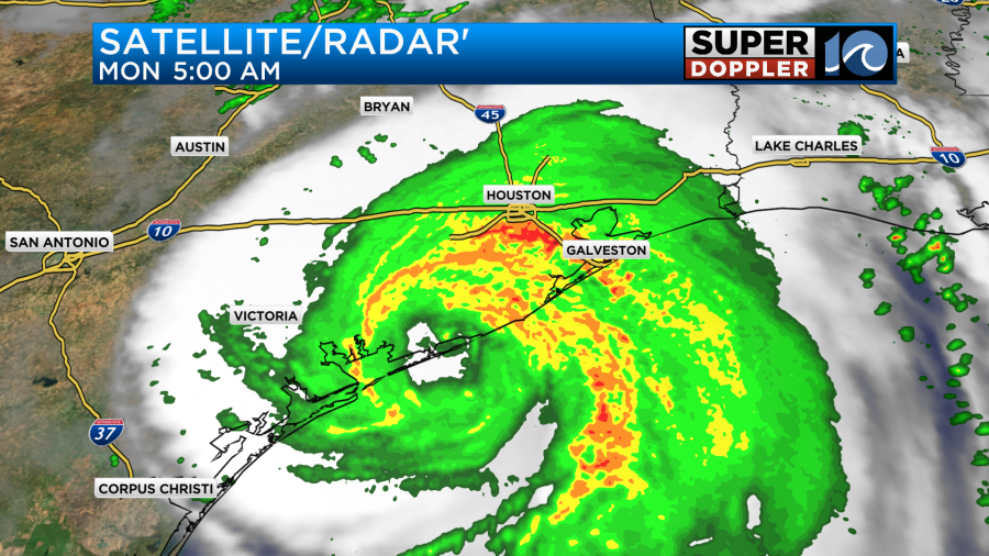
This morning hurricane Beryl made landfall as a category 1 hurricane near Matagorda, TX. At one point there were some wind gusts to over 90mph down there.
Now the hurricane is weakening and becoming a tropical storm as it rolls north over land. Beryl will be a large tropical storm today. It will cause a lot of rain over eastern Texas, western Louisiana, and parts of Arkansas. Isolated tornadoes will be possible along Beryl’s path.
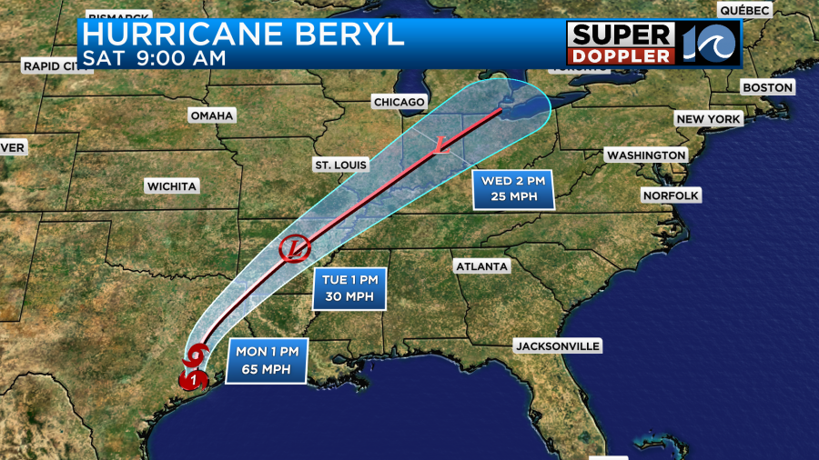
Tomorrow the storm will move northeast through Arkansas as a tropical depression. Then it will fall apart over the Midwest. While it will fall apart. Some of the moisture may indirectly move over our area late in the week. That could lead to that higher chance for rain, but we’ll see.
Meteorologist: Jeremy Wheeler