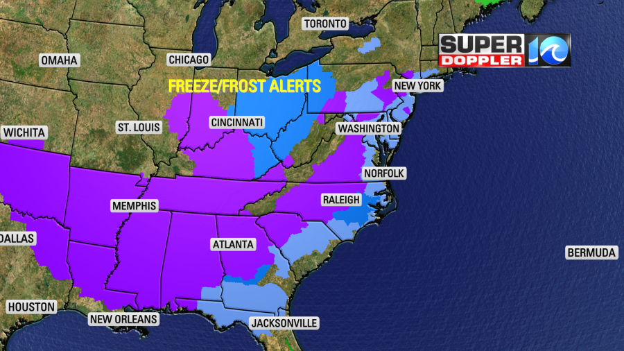
A large blast of unseasonably cold air has dropped down into the eastern United States. There were numerous frost and freeze alerts that are affecting millions of people.
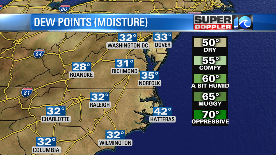
The temperatures in our region this morning were in the 30s with some 40s near the shore. There were a few inland locations near the freezing mark.
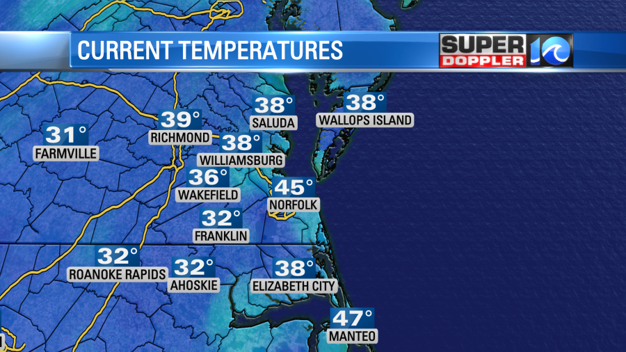
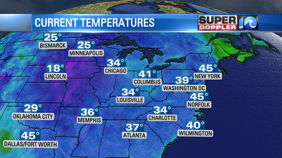
Temperatures were in the 30s all the way down to the Gulf Coast.
It’s a little ahead of schedule for us to get a frost. However, it’s very unusual to get 30s down to the Gulf Coast in October. Many record lows will likely fall to our west. The strong cold front has moved far offshore. Now high pressure is building into the region.
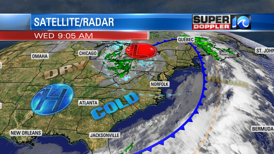
Meanwhile an area of low pressure is spinning over the Great Lakes. It is causing some snow showers to fall over parts of Pennsylvania and western New York state.
We’ll have lots of strong sunshine in our region. Winds will be out of the west at 5-15mph. Plus, it’s very dry outside. Dew points are in the 30s.
This will allow afternoon temps to heat up to near 60 degrees.
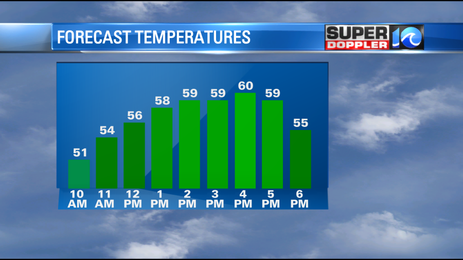
It will be pretty nice out once we warm up a little. It will be mild in the sun and chilly in the shade. Especially, if you catch the breeze.
By tonight we’ll have clear skies and light winds again. Temps will drop back down to the 30s. We’ll be in the upper 30s to near 40 in the metro with some 40s near the shore.
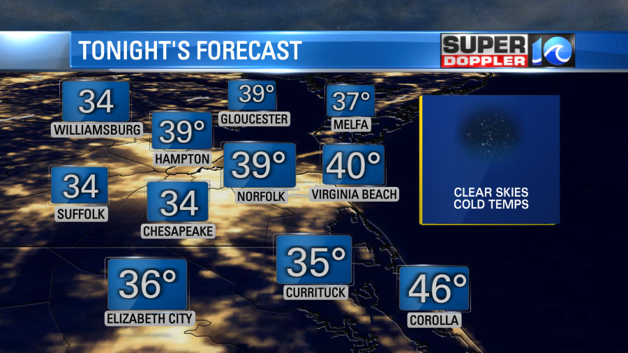
Inland/western temps will likely dip back down into the low-mid 30s. I don’t think the very light southwest wind will be able to prop up the temps. So we’ll probably have some more frost in those areas. Bring in the potted plants if you didn’t already. You many also want to cover up some of the newly planted plants with a tarp or blanket.
Tomorrow we’ll have another day with lots of sun and very dry air. However, tomorrow the wind will be light and out of the southwest. That should put our high temps up to the low-mid 60s.
We’ll keep heating up a bit more each day into Saturday. Highs will be near 70 by then. By Sunday there will be an offshore low developing. This will push some moisture back to the west as it moves northward. Rain chances are increasing for that day. However, the models vary in how much moisture moves inland. The GFS has some scattered showers. (mainly near the shore).
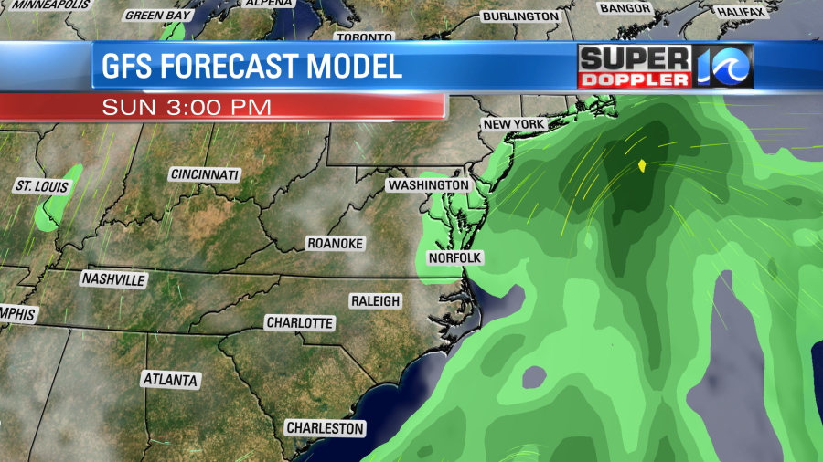
however, the European model has the precip reaching all the way to central Virginia and North Carolina. We’ll have updates on this over the next few days.
In world news…A recent post from the National Oceanic and Atmospheric Administration (NOAA) states that September tied for the 5th warmest on record for the planet. North America had its warmest on record. We were about 1.6 degrees above normal here. It will be interesting to see how October’s temperatures stack up with this recent shot of cold air.
Meteorologist: Jeremy Wheeler