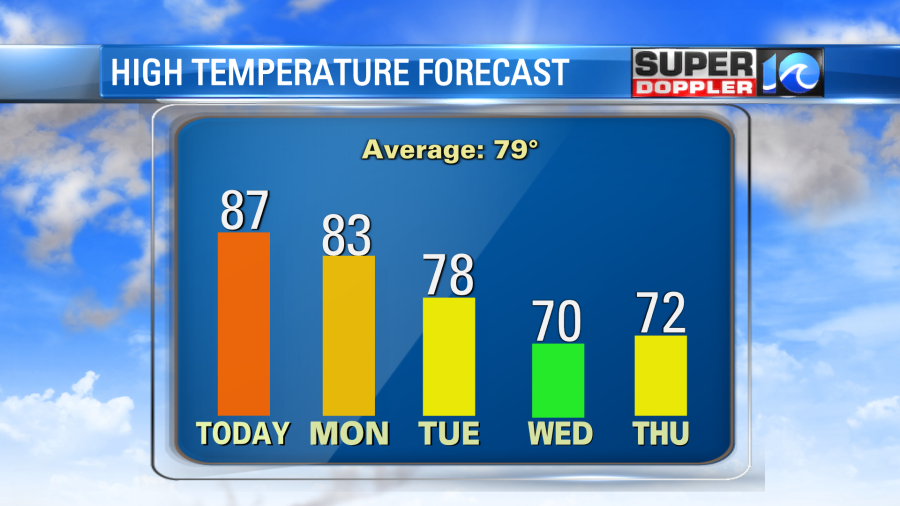
The weather over the last couple of days has been magical. (Slight exaggeration). Yesterday we had some mid-morning clearing. High temps were in the 70s in the afternoon, and it was dry! It felt so nice! Today Summer is going to make a brief return. A warm front is lifting to our north with high pressure offshore.
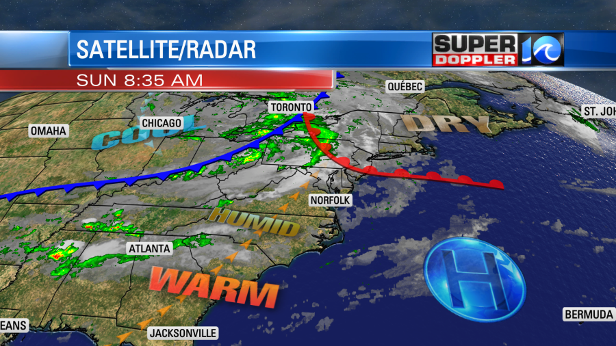
There is a cool front over the Midwest that will cool us down a little tomorrow. However, today we will have a strong southwest breeze. That will push our high temperatures up to the mid-upper 80s.
The humidity will also increase. Dew points will rise from the 40s to the 60s. The cool front will move into the region tonight. It might cause a few rain showers, but they will be scattered. Tomorrow the front will very slowly sink to the south. So we’ll be a little cooler (low 80s), but it still won’t feel like Fall. Luckily the humidity will drop sharply.
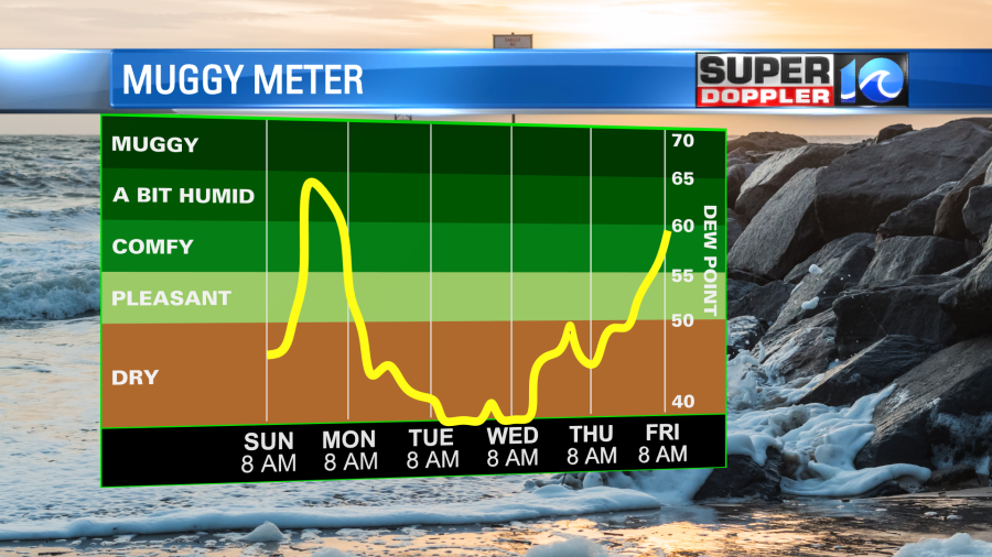
We’ll stay dry and cool from Monday night through Thursday. High temps will mainly be in the 70s. So yes….Fall will return.
The tropics have gotten a little calmer over the last 2 days. Fiona has fallen apart over the Canadian Maritimes. Hermine has become post-tropical in the eastern Atlantic. So now it’s down to 2 systems (Ian and Gaston).
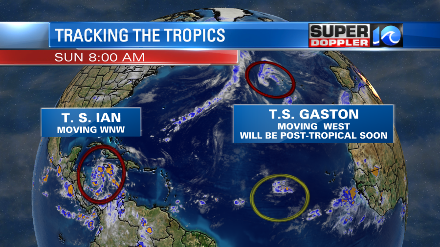
Tropical storm Gaston will be post tropical soon. It did bring some tropical storm forced winds to the Azores islands, but it is moving to the west away from that area today.
Meanwhile, Tropical Storm Ian is forecast to strengthen rapidly over the next 24-48 hours. It’s short-term forecast takes it over an area of high heat potential.
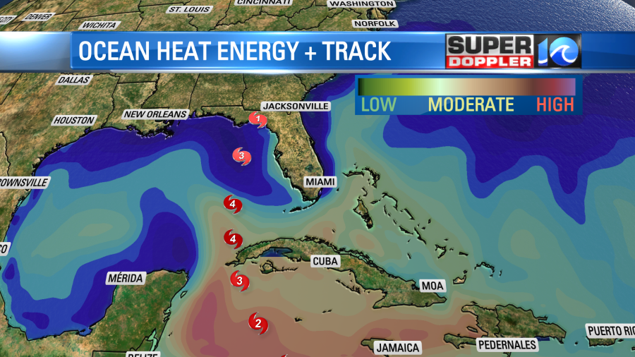
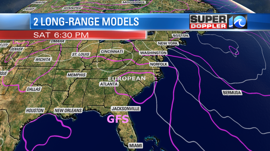
You will notice that the track takes it over western Cuba as a major hurricane. Then it remains a major hurricane as it turns north/northeast. Also, notice that the ocean heat energy (deep layer of warm water) is lower close to the coast of Florida. That may be one thing that could weaken the hurricane before landfall. The official forecast is for it to weaken later next week just before landfall.

In the short term there is plenty of warm ocean water, low wind shear, and lots of humid air. By the time it moves towards the Florida coast it will start to encounter a strong cold front and increasing wind shear. There should be some much drier air to the north of it as well. This is going to be the same cool/dry air mass that will bring us a return to Fall this week. The models are in good agreement in the 2-3 day forecast, but they are pretty split in the 3-5 day forecast.
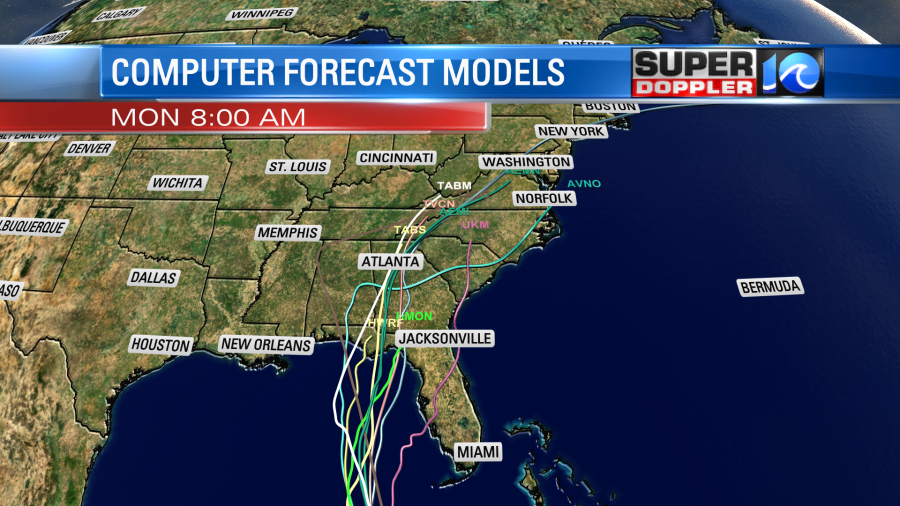
Some of the models (actually a good amount) do weaken the system as it moves north (over land). As of this morning both the GFS and Euro showed a rapidly strengthening and then a rapidly weakening system during the next 6-7 days.
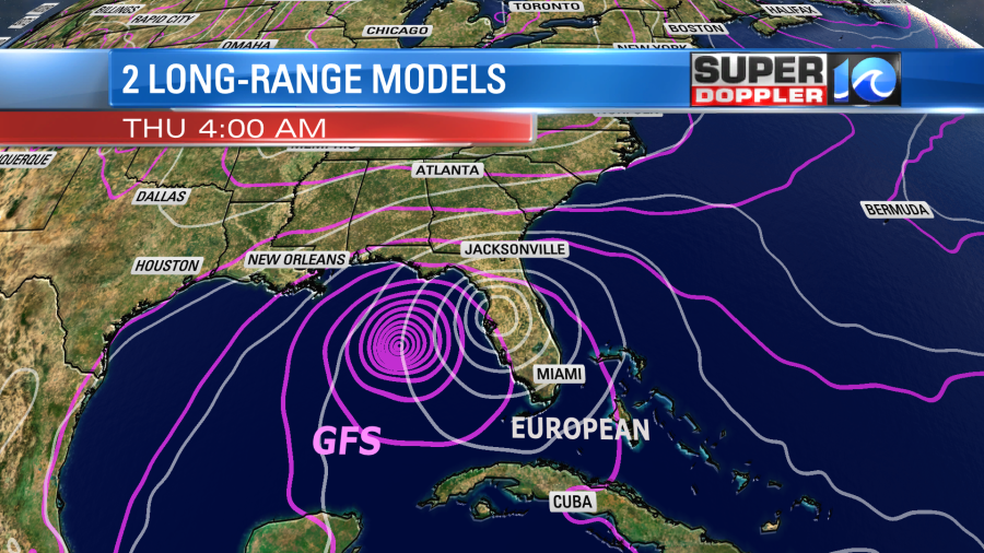
The moisture would probably keep moving north. Even if the system does fall apart. This could (potentially) be a great scenario for us. We could get a big soaking rain without the wind.
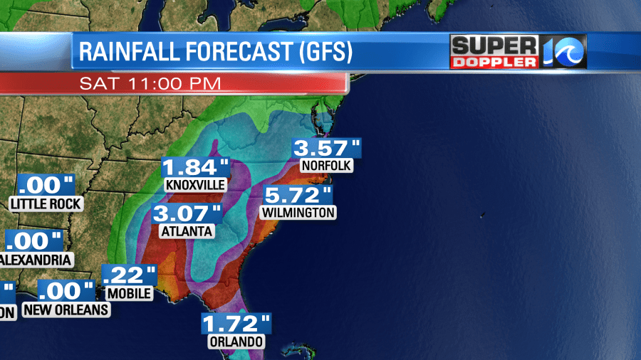
Remember we are in a moderate drought with a severe drought on the eastern shore.
I don’t want to paint too rosy of a picture just yet. There will still be some changes before then. The track still could change. The cool/dry air mass could stall out a little sooner which would allow Ian to remain stronger for longer. Or the cooler air could sink more to the south. That would favor more of a European track. It could possibly even head out to the Atlantic after Florida on a northeast track. For now that is not favored.
So stay tuned for updates to the forecast. We’ll have a lot of them before then.
One last thing… The waves and the rip current threats have gone down today at our local beaches today. The risk is moderate with waves running about 2-3 feet.
Meteorologist: Jeremy Wheeler