The weather is going to be looking pretty good over the next couple of days. Unfortunately, we are going to have some wetter and cooler weather over the weekend, and the timing just stinks.
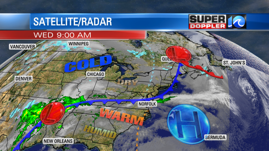
So let’s talk about the good weather first. Today is looking great! We have high pressure moving a bit offshore with a cool front dropping in from the north.
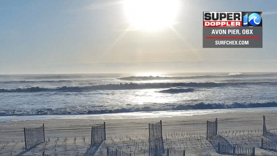
There were some high waves along the oceanfront, but the skies were beautiful overhead.
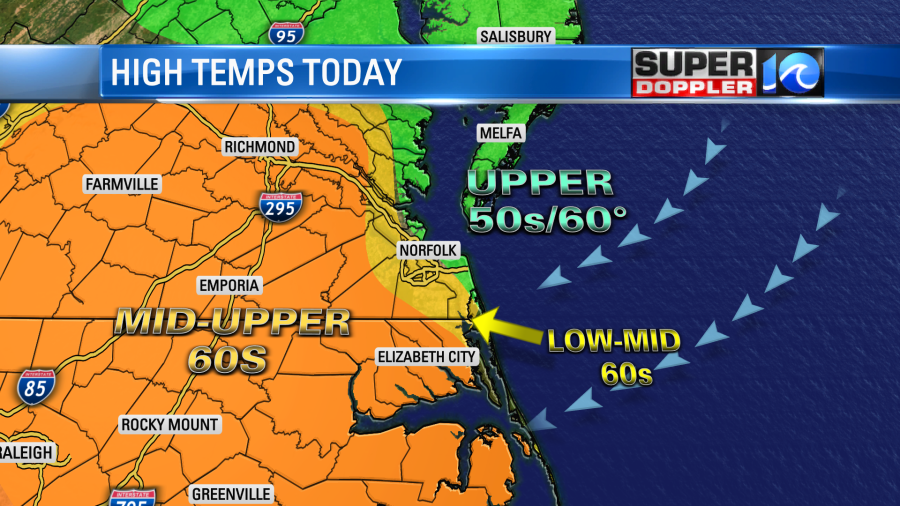
We’ll have partly cloudy skies today. The front will sink down to the Hampton Roads metro, and it will stall out this afternoon. The wind will change from southwest to northeast, but it shouldn’t be too strong. This will mix up the temps a bit. We’ll have high temps in the upper 50s to near 60 near the shore. We’ll be in the low-mid 60s over much of the metro with mid-upper 60s inland.
All of these temperatures will be well above average. We’ll be partly cloudy through the day. It should be pretty comfortable out there to go for a nice long walk. Again…A bit cool near the shore with the light breeze off of the water.
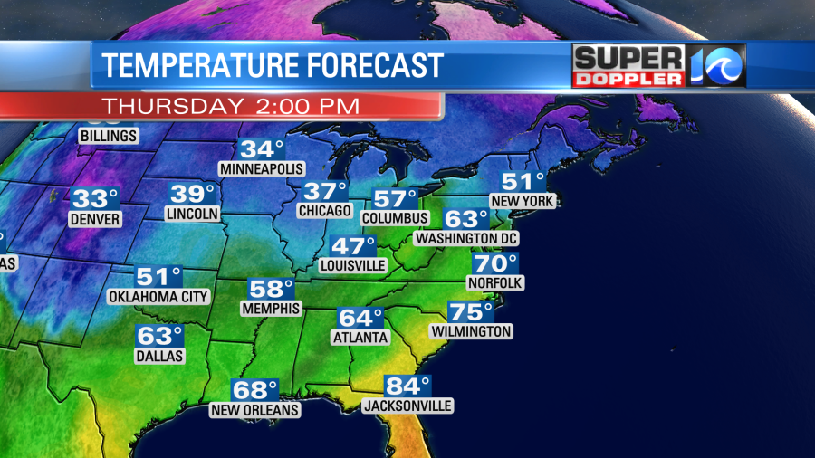
Tomorrow the high pressure system will still be offshore, and the front will lift back north as a warm front. This will let the winds increase out of the south/southwest. They could gust up to 20mph for a time. Skies will be a mix of sun and clouds. This combo will push the high temperatures up to near 70 degrees.
There may be some isolated showers, but I don’t think there will be too many of those.
On Friday a slow moving cold front will move in from the west. There will be a lot of moisture building ahead of it. This will bring us increasing clouds with an increasing chance for rain.
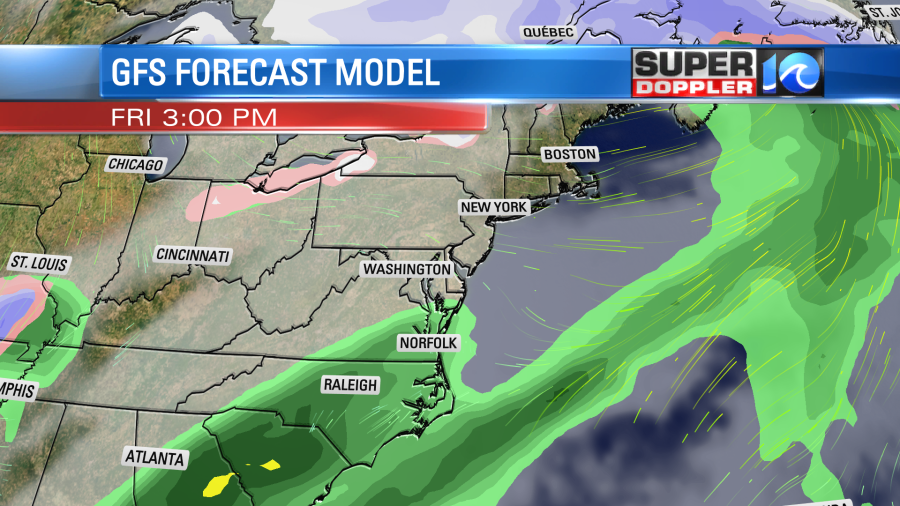
Temps should be able to reach the low 60s before the front slides through. Temps may fall a bit during the late afternoon.
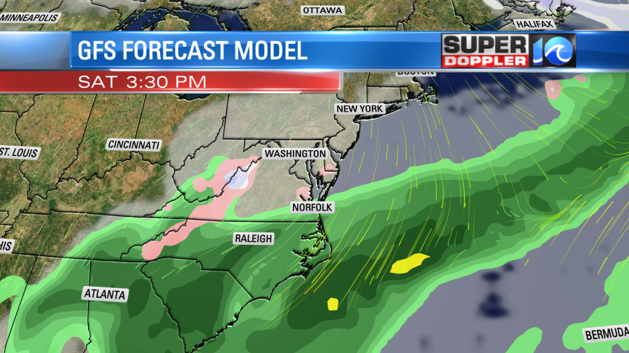
The forecast for the weekend keeps changing. It is actually pretty tricky. The cold front is expected to stall out just to our south. As this happens a strong upper level low will be moving in from the west. This will help to create a strengthening area of low pressure near the coast. the models are handling this setup differently. So the GFS model now has some scattered showers in southeast Virginia on Saturday with a widespread area of rain over eastern North Carolina.
The European model has the bulk of the rain over North Carolina with only some very spotty showers in Hampton Roads.
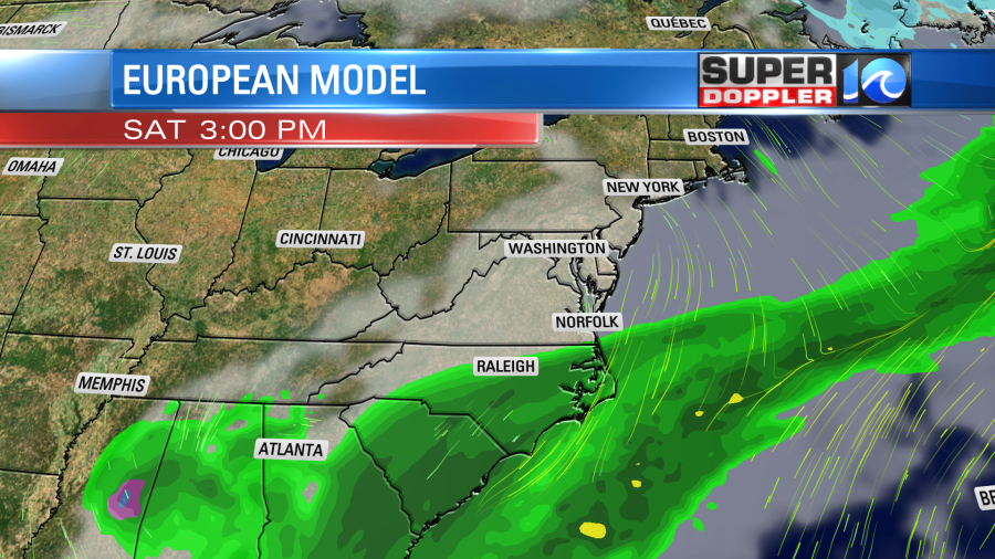
The theme is basically a higher chance for rain to the south with less of a chance to the north. But where does that rain-shield start and end? We’ll be able to get a better handle on that tomorrow when it is in range of the higher resolution models.
By Sunday the low is going to be sitting just offshore with the upper level low overhead. It looks like a lot of the moisture will swing back behind the front. So the models have REALLY wettened up the Sunday forecast, and that is not good.
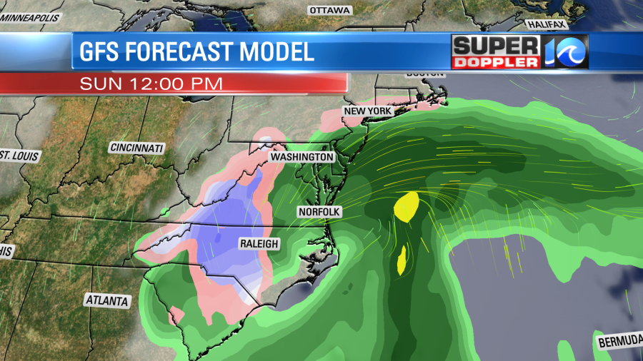
The last thing we need is a soaking rain during the big game! That will impact grilling out and driving to the home of friends and family. Plus…. there may be some minor tidal flooding this weekend developing. Finally, (salt in the wound) high temps both Saturday and Sunday will be near 50 degrees. That’s not terrible, but couldn’t we stretch out the warmer temps just a little?
I think basically the upper level low is pretty big and strong, and those types of systems tend do be slower than the long range models expect. So the rain keeps getting pushed back in time as it gets closer. Having said that the forecast could change some more before we actually get to the weekend. So stay tuned for updates.
Meteorologist: Jeremy Wheeler