This morning it was very chilly and breezy outside. Temperatures walking out the door were in the 30s and 40s. However, the wind chills were solidly in the 30s. The cold front that moved through the region has quickly moved to our east/southeast. High pressure is building in from the west.
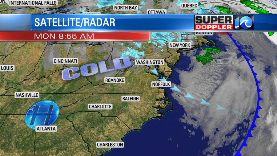
We will have a lot of sunshine today, but the northwest winds will gust up to 30mph through at least midday. Then the winds will taper off later this afternoon. Despite lots of sunshine, high temps will only be in the mid 50s. The average high is in the mid 60s.
Tomorrow the weather looks pretty good for Election Day. We’ll have lots of sunshine throughout the day. However, it will be pretty chilly in the morning. Temps will start off near 40 with 30s inland. Luckily the wind won’t be nearly as strong as today. So that will help a bit. Then by the afternoon we’ll have high temps near 60. We’ll cool back to the 50s during the evening.

We’ll be dry and a little milder on Wednesday. Then we’ll warm to the 70s with fair skies on Thursday and Friday.
Meanwhile hurricane Eta is strengthening over the western Caribbean Sea. It was a category 1 hurricane this morning, but is forecast to become a cat 2 soon. It is expected to make landfall over coastal Nicaragua in the next 24 hours.
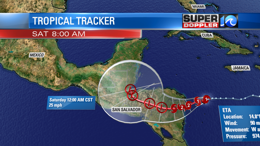
After that it should move inland/west and weaken. Then it is forecast to turn northward. However, some computer models have it moving more to the northeast and moving back over the water.
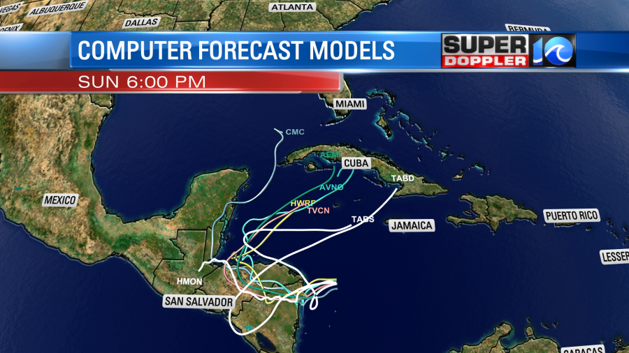
More models are trending that way. This scenario could bring it closer to Cuba by next weekend. It’s tough to say what will happen beyond that at this point. So stay tuned for updates.
Meteorologist: Jeremy Wheeler