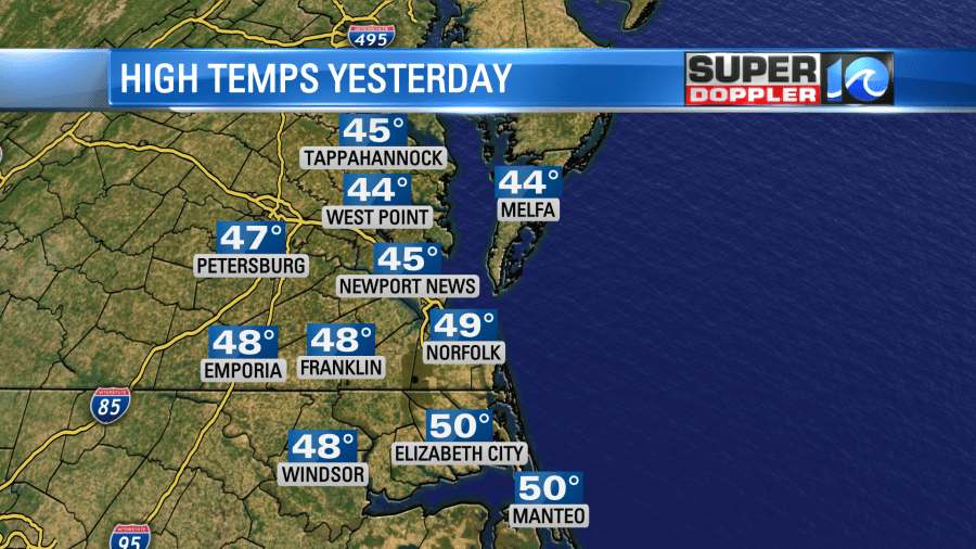
Yesterday the clouds strolled into the region, and they did not stroll back out. That wasn’t exactly forecast. However, the temps stayed chilly as expected. High temps were in the 40s with a few 50s to the south.
We did have high pressure near the region, but the clouds came from a weak upper level trough (dip in the jetstream). That dip should move out today, and high pressure should build in closer at the surface.
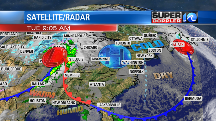
We did have some spots of clearing this morning, but we should see more of that through the day. Despite increasing sunshine it is going to stay chilly. High temps will only be in the mid-upper 40s this afternoon.
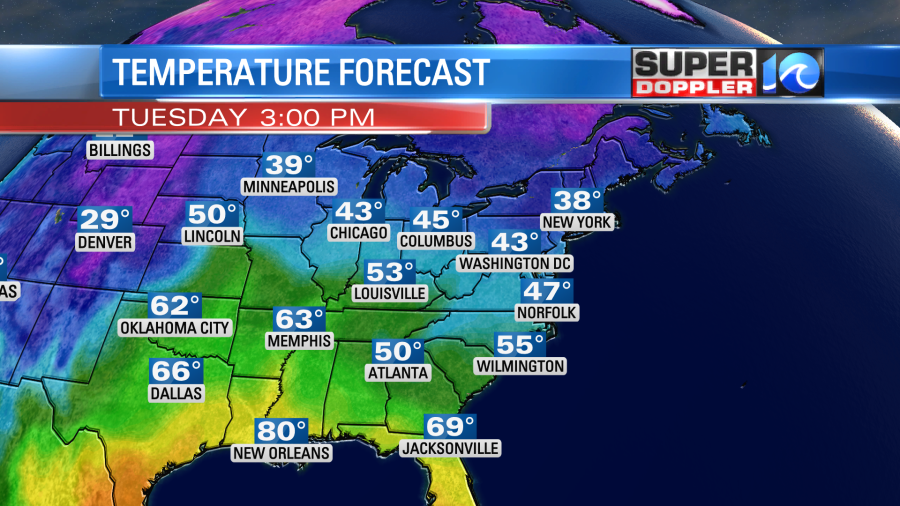
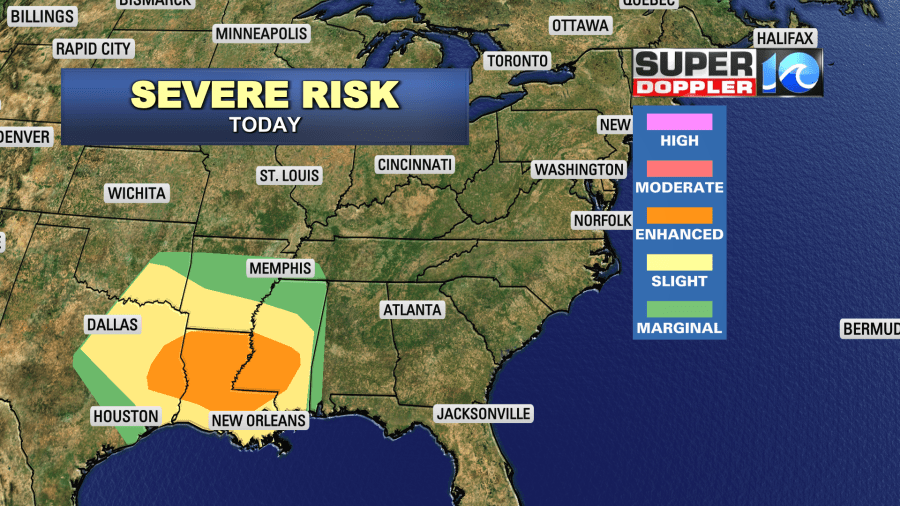
Local winds will be out of the north at 8-12mph. While we will be chilly and dry today, it will be warm and stormy over the deep south. They are expecting severe weather along some of the Gulf Coast States today up to Arkansas.
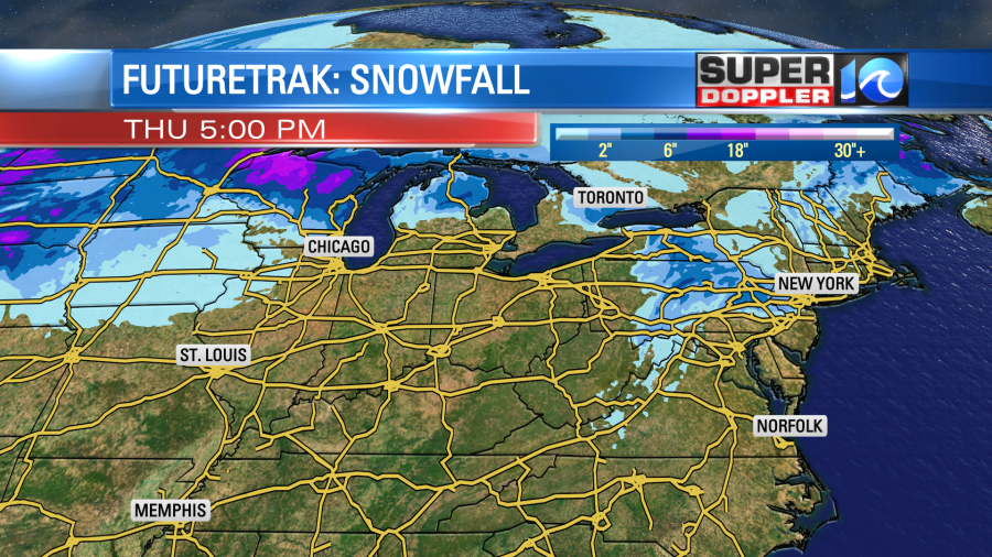
Meanwhile they will be tracking snow across the northern states with the same system. They will have a foot or two of snow between the northern Rockies and the upper Midwest over the next day or two.
Tomorrow that storm system moves east. We’ll still have high pressure in our area for most of the day though. So we’ll have increasing clouds with more high temps in the upper 40s to near 50.
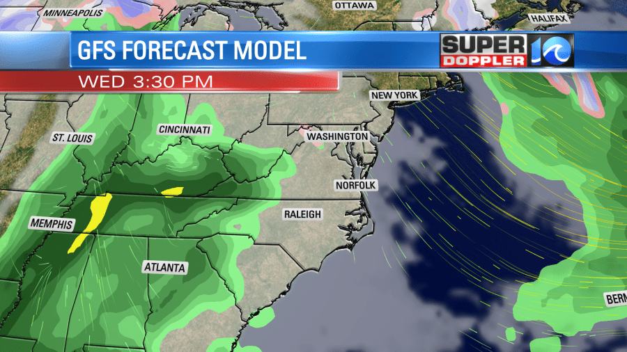
There will be some isolated showers during the evening, but the daytime should stay dry. As the system moves east it will lose a lot of its energy. The main surface low will actually run up through the Midwest, but another low will form near our region. This will move east, and it will act to bring us a lot of rain Wednesday night into Thursday. While we will develop a southerly wind on Thursday, we likely won’t be able to tap into the very warm and unstable air that will be running through the deep south. So I do expect a lot of rain on Thursday, but thunderstorms should be very limited and mainly to the south.
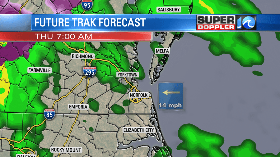
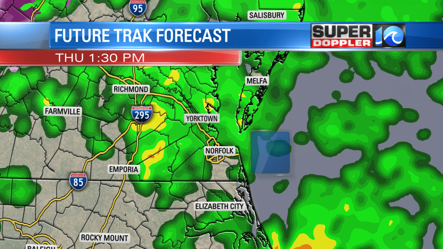
Having said that, the rain may be a bit heavy at times. Plus it should be widespread for a time. Despite the clouds and rain we should be able to warm up to the mid-upper 50s in the afternoon. It may hit 60 over parts of North Carolina. We’ll have an increasing south wind.
The rain should taper off Thursday night into early Friday morning. We could see an inch to an inch and a half before it ends. Then we’ll be dry and cool during the weekend. High temps will be in the low 50s or near 50. Lows will be in the 30s.
Some folks are talking about the long range weather forecast. They are asking about possible snow in the next couple of weeks. The long range models are definitely hinting at some colder shots of air. They are flirting with snow in our region at a couple of times. However, it’s WAY too early to talk about anything specific. The graphic that folks posted the other day with 18 inches of snow to our north was pretty irresponsible. The next update on the model showed almost all the snow gone during the same time period. Having said that I am going to be watching more closely for an increased snow potential (at least for the region) over the next 2 weeks. I think we will have a little better shot at a white Christmas this year compared to others. One thing to keep in mind is that the bay temperature and soil temperatures need to drop a bit more for the snow to stick. Let alone the overnight low temperatures. Keep checking back for updates.
Meteorologist: Jeremy Wheeler


