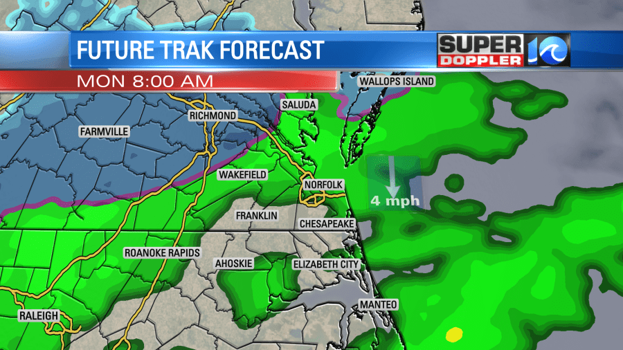
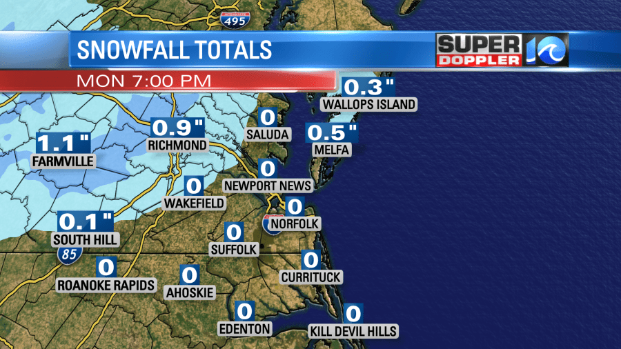
Some of us might see the first snowfall of the season Monday as a storm system coming in from the south bumps into some frigid air.

As of Sunday night, this storm is still to our south, but will be bringing clouds overnight, and then rain for most of our area before sunrise Monday.
For the Hampton Roads cities, this storm is likely only going to bring rainfall. We don’t have enough cold air in place to get snow this time around.

As you see for the Eastern Shore, there might be some snow in the morning. This snowfall could easily last until noon. In the early afternoon, the storm will start to move to the south.

For the Eastern Shore, we might get some snow accumulation on grassy surfaces, but other than that, little to no accumulation is expected. Road travel should not be impacted. During the day the cold wind from the north will be getting stronger. In the morning the wind will be in the 5-10 mph range. In the afternoon wind speeds will be close to 15 mph.

We probably will see rain last all day for the Hampton Roads cities and into NE North Carolina. As the rain comes to an end, we will see dry/cold air move in. Lows will be below freezing for many Monday night. The dry air should clear out most of the water on the roads; so ice is unlikely to form. The rest of the week ahead is looking cold at first, then warmer with highs climbing to the 60s by the end of the week.
Meteorologist Jeff Edmondson


