I am not going to sugar coat it. Over the next few days we are going to have some pretty nasty weather. It is going to be cold and wet for the bulk of the next four days. You’ve been warned.
Today, we have a cold front sinking to the south. There is a stationary front just to our south. Plus, there is a weak area of low pressure moving along each front.

With this and the ample moisture combined today is going to be a chilly and damp day. We started off with lots of fog in the region.
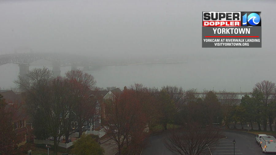
Temps were sitting at the dew point (near 50) from the time that I got in until the time that I wrote this blog. When you cool temps to the dew point, then dew and/or fog forms. The problem is that we won’t warm up much through midday. Maybe just a couple of degrees. So fog many linger until around noon. Clouds will also persist through the day. At the same time rain showers will increase. We’ll have scattered rain showers by midday, and we’ll have even more this afternoon.

Rain showers will all be light and scattered. This will be as the cold front enters the area. Winds will turn to out of the northeast behind the boundary. Then temps will fall this afternoon to the upper 40s.
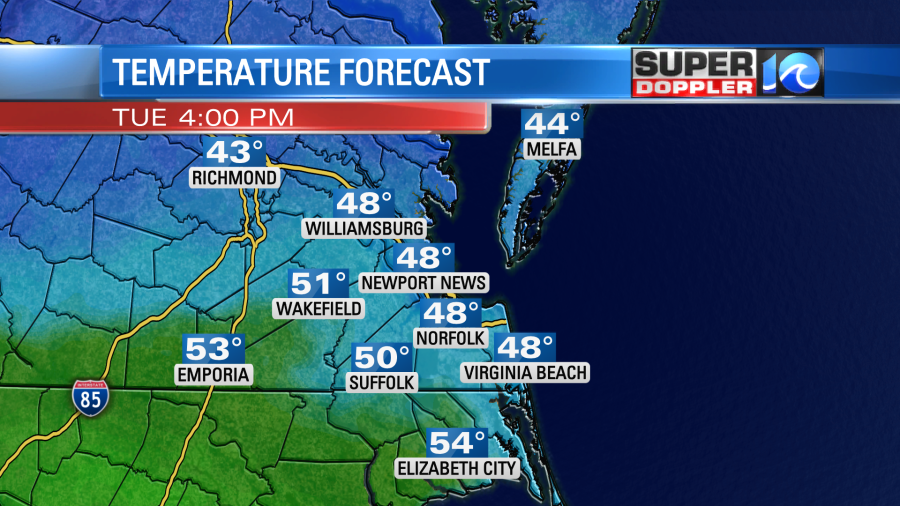
Temps will drop to the mid 40s this evening. Clouds will hang tough, but the rain chance should drop a bit for the evening commute (30%). However, during the overnight moisture will push up over the cold front as it sinks down to northeast North Carolina. This pattern will allow for rain to become widespread between about 1 a.m. and 5 a.m.
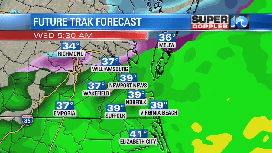
Temps will be in the 30s at that time, but they should be in the upper 30s for most. That means that a cold rain will be falling tomorrow morning. There may be a few sleet pellets as well. Mayyyybe a couple of wet flakes too. That’s for the metro area. We’ll see. North of the metro there will likely be a wintry mix of rain, sleet, and some snow. This should melt as temps will be above freezing. However, it’s possible that a few decks and grassy spots could see a light coating between Gloucester County, the Northern Neck, and the Eastern Shore. Again, the bulk of this should be a melting mix except for a few spots.
The rain should all move out by midday as drier air moves in (temporarily).
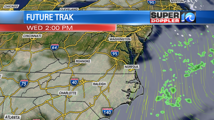
It will be a cold day throughout. High temps will only be in the low 40s in the afternoon with some upper 30s north of the metro.

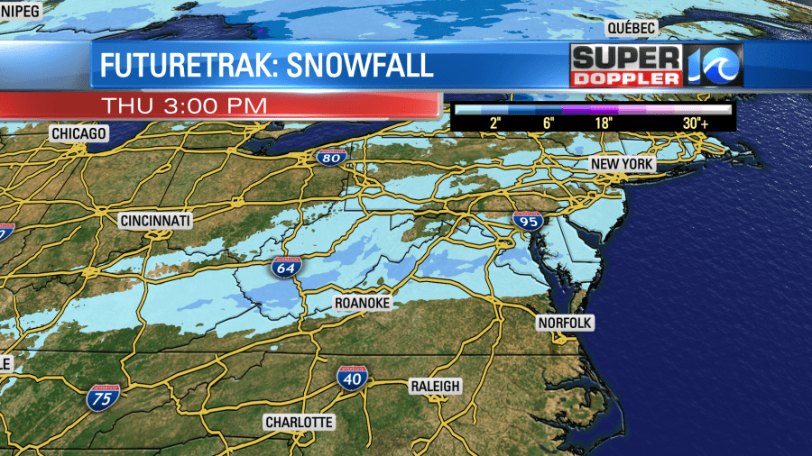
We’ll be mostly cloudy for a while, but there may be some clearing during the afternoon. We’ll be fairly dry Thursday morning, but then a lot more rain moves in later in the day.

This will be ahead of a stronger and faster moving cold front. High temps will be in the 40s. That front will finally sweep through on Friday morning. We’ll have some more scattered rain showers early, but I think they will move out by the afternoon. High temps will be in the 40s again. However… temps will drop to the 20s Saturday morning. We’ll only top off in the mid-upper 30s Saturday afternoon. At least it will be dry, but this will be some of the coldest air we’ll have had in a couple of months.
It stinks that we’ll be this cold without snow. However, there will be some snow accumulating just to our north.
I’ll be at the Virginia Living Museum on Thursday to see what our resident groundhog “Chesapeake Chuck” has to say about the rest of the Winter.
Meteorologist: Jeremy Wheeler