While we won’t have any really bad weather over the next few days, it is definitely going to stay cool, cloudy, breezy, and damp. (I’m not complaining, but some might). The remnants of Ophelia are dropping south/southeast today, and a cold front is also dropping to the south.
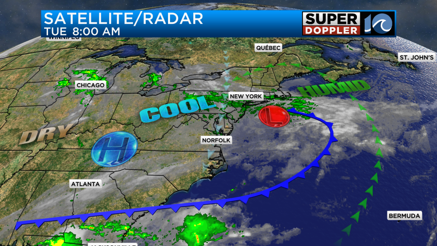
We started off the day with lots of clouds over the region. There were some breaks to the south.
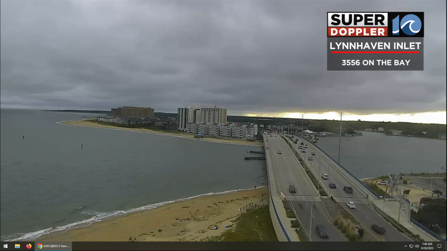
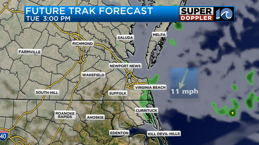
We’ll hold onto a lot of clouds through the day. There will also be some scattered showers coming from the north/northeast.
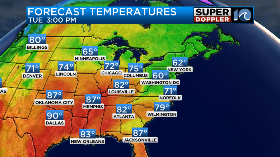
Take the warm rain jacket with you. The temps will be a bit cool. Highs will only be in the low 70s with some mid 70s inland and south.
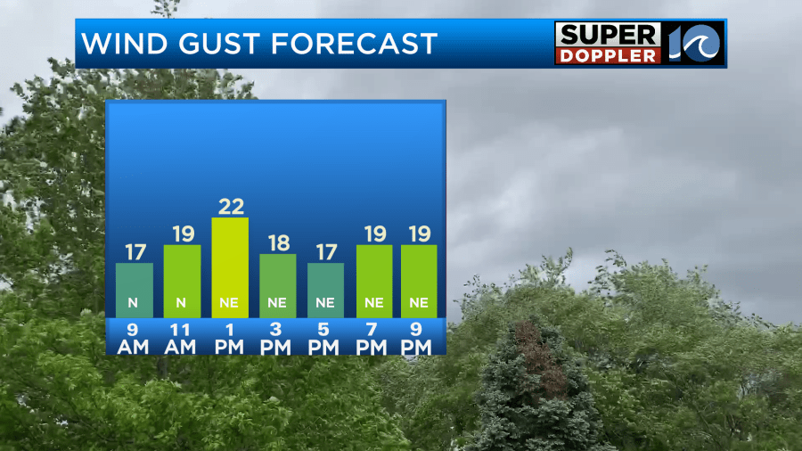
The thing is … the breeze will also be picking up out of the north/northeast, and gusts will be to 20 mph.
Also, if you get wet due to the drizzle or scattered showers, then you could get chilled pretty quickly.
Tomorrow the low will be offshore to our northeast. We’ll continue with the cool northeast breeze out of the northeast. There will be lots of clouds again with some scattered showers and drizzle at times. High temps will only be near 70 degrees.
This pattern will continue through Friday. Then we should be warmer and drier by the weekend.
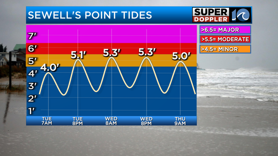
We will have some minor tidal flooding in the region over the next few days as well. It could be up to moderate levels in a few places.
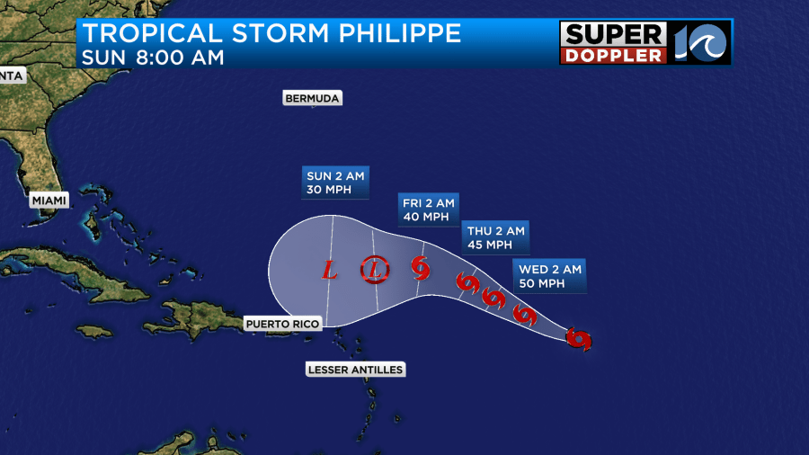
Meanwhile tropical storm Philippe is struggling a bit. The center of the system has moved away from the main cluster of thunderstorms.
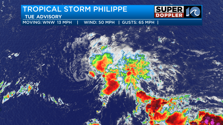
This means that wind shear and drier air are working on the system, and pushing the storms away from the center of the storm.
Due to the wind shear, the forecast keeps Philippe weak over the next few days as it moves to the west. The National Hurricane Center even has the system falling apart in a few days.
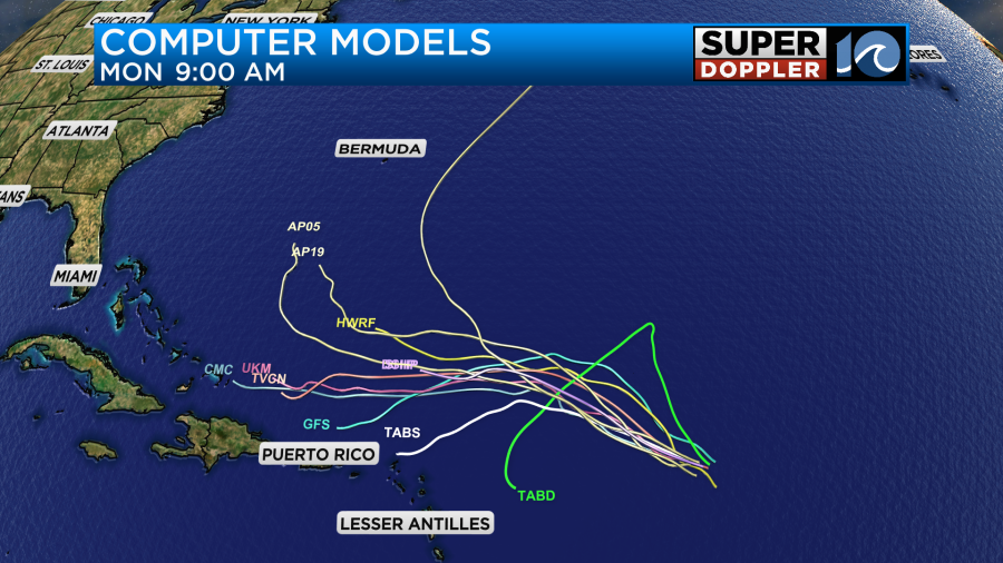
You will notice that the track is more westerly today. Many of the models have really changed their tune. The GFS model has had a wild swing to the west.
So it is a bit reassuring that the official track has Philippe eventually falling apart. However, it is a bit unnerving that the system could keep heading west towards the Bahamas. Even a weak system could restrengthen or reform down the road. So we’ll keep a close eye on it.
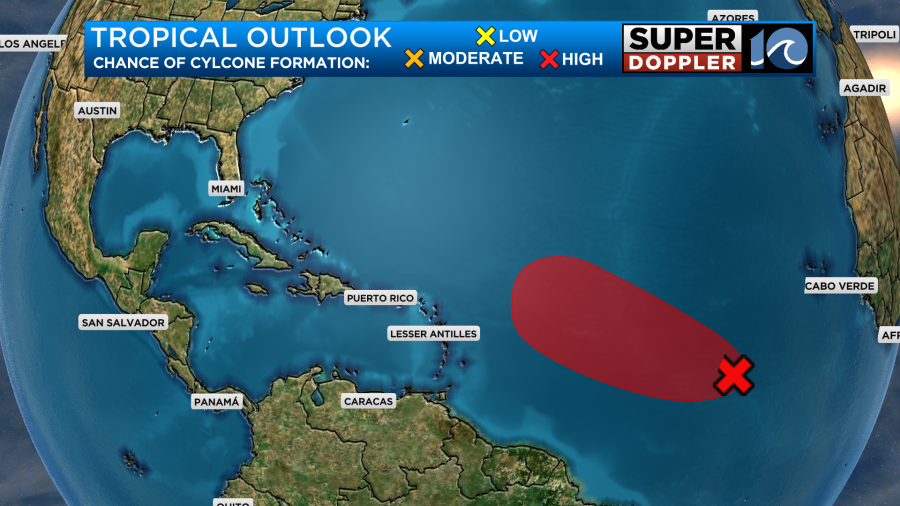
We are still monitoring the tropical disturbance in the eastern Atlantic. It has a high chance of formation over the next few days.
The one in the Gulf of Mexico is no longer on the NHC forecast map.
Meteorologist: Jeremy Wheeler