Yesterday afternoon and evening we had a big area of rain and storms form over the region. There were some strong to severe storms in the area during that time.
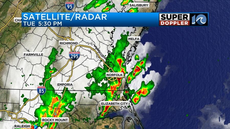
There were several reports of wind damage over the region as well, but there were no reports of tornadoes.
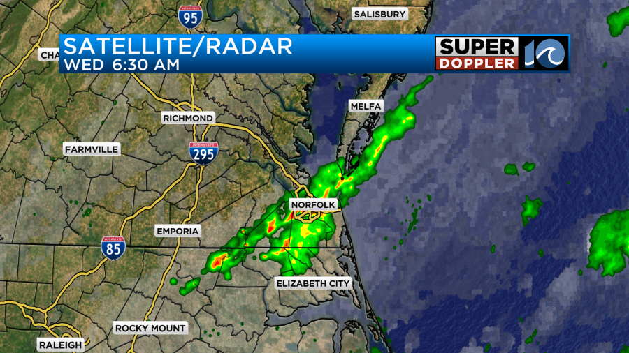
The rain ended before midnight, and then things were quiet for a while. However….This morning we had a nice curveball in the forecast. At first a little rain had formed in the pre-dawn hours as the cool front moved into the region. Then it flared up into a large cluster of showers and heavy downpours. This was NOT forecast on any model that I looked at even up until this morning. So that was fun.
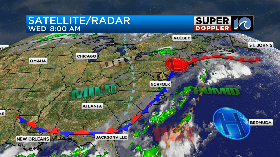
After licking my wounds from that awesome forecast, I looked to the future. Today the front will slide a little more to the east, but it will stall out near the coast.
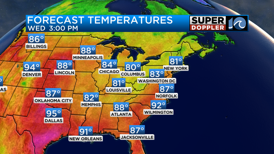
The good news is that we will be cooler than yesterday. Yesterday we hit the mid-upper 90s. Today we will run more in the upper 80s with a few 90s inland/south.
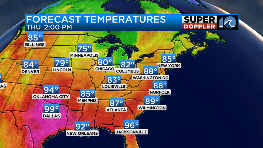
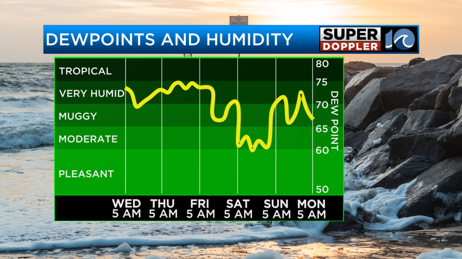
We’ll have a mix of sun and clouds today. After the batch of showers move out this morning we’ll have quiet weather for a while. Then a few more showers will form this afternoon with a couple of thunderstorms possible. The humidity will drop from yesterday, but not too much. Dew points will still be near 70. Tomorrow, the front is actually forecast to move west now. As this happens we’ll have mostly cloudy skies, and there will be some scattered rain showers with a few thunderstorms. High temps will be in the upper 80s to near 90 degrees.
The front will move even more west on Friday, but it will weaken. This means that it will be hot and humid with a few pop-up showers and storms. High temps will rise to the low 90s, but the heat index will be in the upper 90s. A strong cool front will then swipe-in and knock out the other front by Friday evening. That front will have some much drier air. So by the time the weekend gets here the dew points will drop to the 60s.
Hit temps will be in the 80s both days. While it will be nice, the heat does look to return (briefly) on Monday.
The tropics aren’t too busy, but there are two tropical disturbances that now have a medium chance of formation. They are both in the eastern Atlantic, and they are moving generally west.
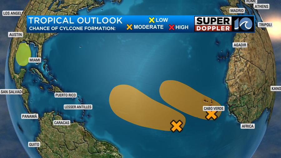
There is also a new area over the Gulf of Mexico that has a low chance of formation over the next few days. We’ll watch all of these features to track their progress.
Meteorologist: Jeremy Wheeler