
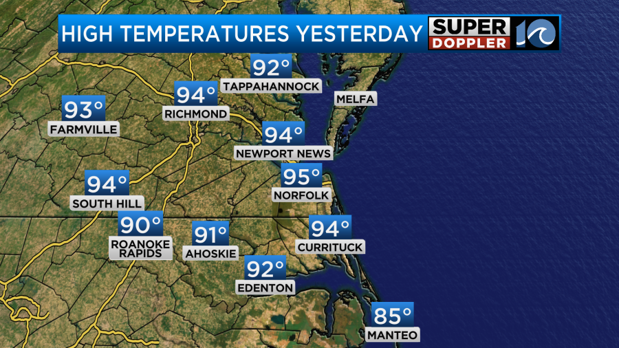
As expected we had one more hot day yesterday with highs temps in the 90s.
Also as expected a cluster of showers and storms formed in the afternoon and cooled down some areas.
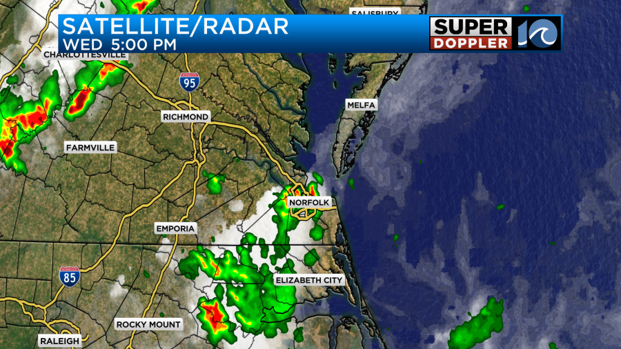
We had some more heavy rain over parts of North Carolina early this morning well before sunrise.
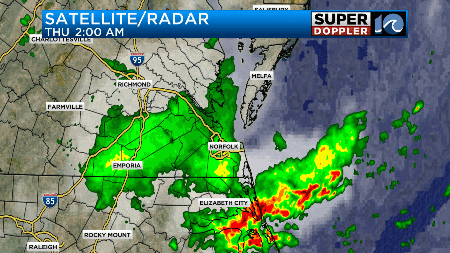
This was from a group of thunderstorms that formed to our west and moved east. The heavy rain really added up in the rain gauges to the south. It doesn’t show up too much in this 24 hour rainfall totals graphic.
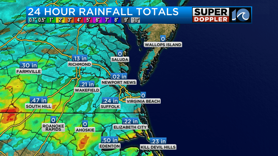
So take a look at the radar estimated rainfall.
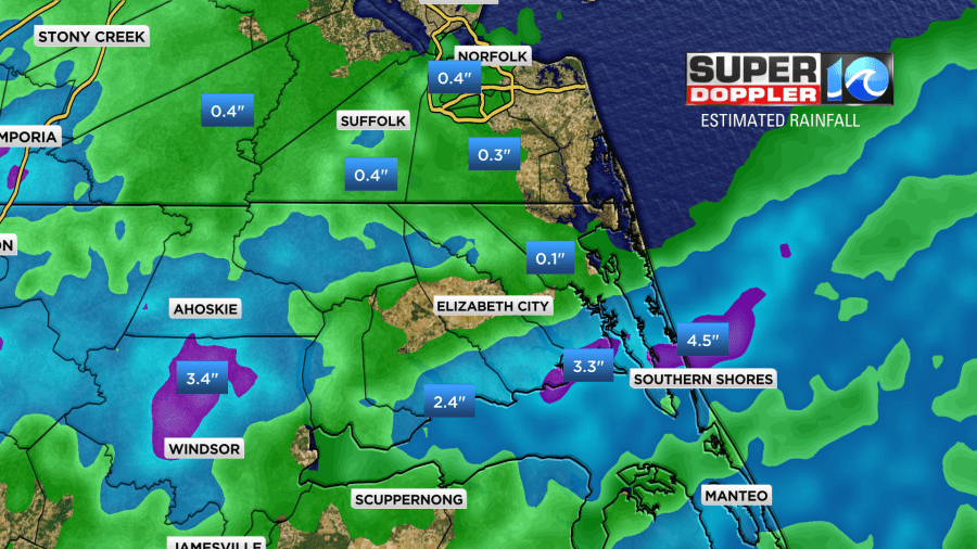
You can see that about 2-3″ of rain fell in some locations between Bertie county and the northern Outer Banks.
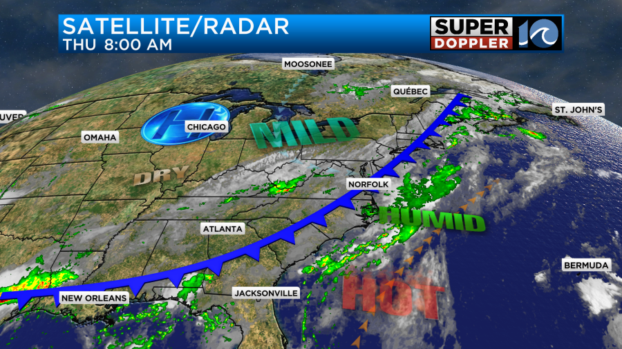
This was all ahead of a cool front. That front has made it into the region this morning, but now it is really slowing down.
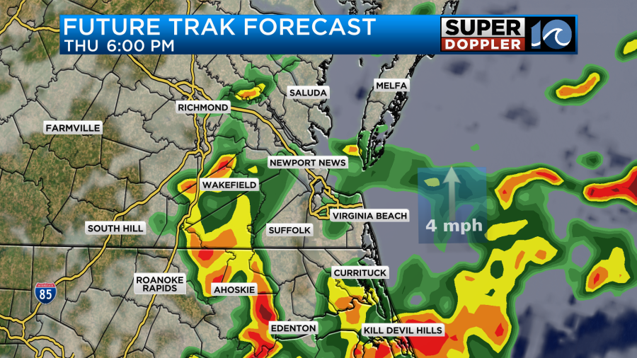
We’ll have lots of clouds today. More scattered showers and storms are forecast to fire up later this afternoon. Some of these could contain heavy downpours.
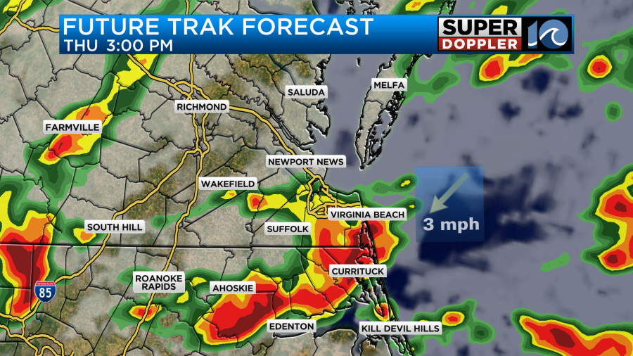
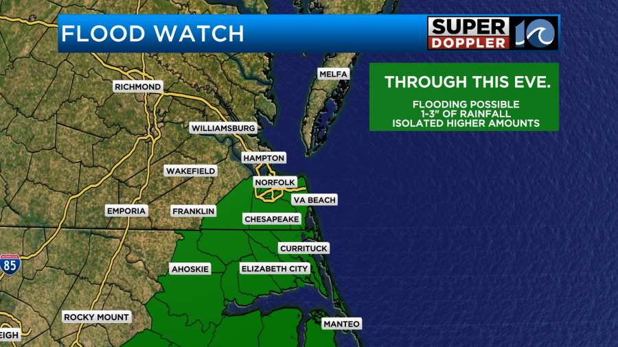
Our model focuses on the Southside and North Carolina, but a few heavy showers could work north of those areas for a time. It is interesting that this is where the Flood Watch has been posted by the National Weather Service.
There may be a few strong storms this afternoon. Especially if a few downbursts occur. Then there may be some gusty winds for a time. The scattered storms should decrease during the evening, but some heavy rain could continue during the first part of the evening commute.
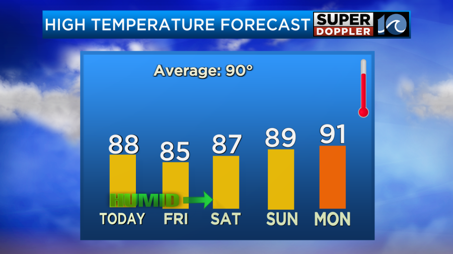
The great news is that the heat has finally broken. High temps today will be in the upper 80s in our region.
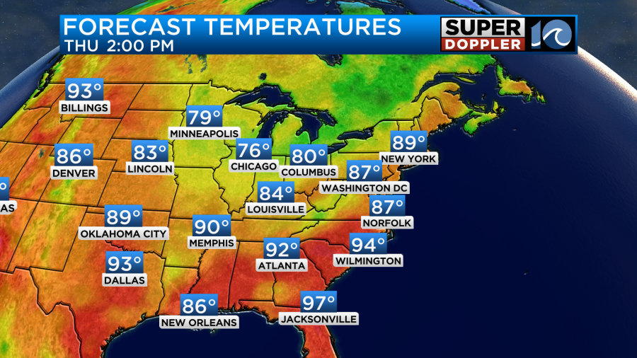
However, we are not alone. As you can see there was a sizable cool down over most of the eastern half of the country. It is still very hot out west. Local winds today will be variable at 8-12mph.
Tomorrow the front should sink to our south a bit. This should allow for some slight drying. I’m optimistic that the sun will pop out some more. We should only have a few spotty showers in southeast Virginia, but there will be some scattered showers and storms over northeast North Carolina.
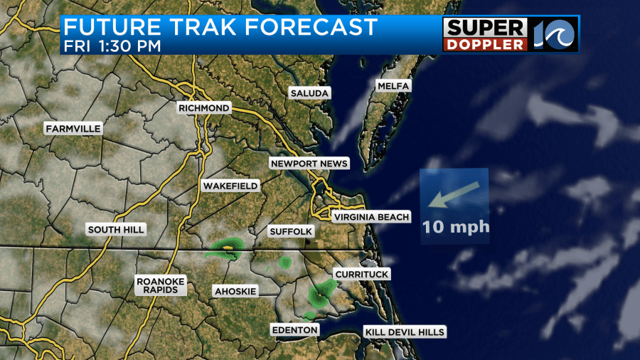
This is assuming that the front will land about where the models predict that it will stall out. High temps will be in the mid 80s. Fingers crossed that it will be a mostly nice day.
In the next 48 hours we could see highly varying amounts of rain. Some models only predict about a quarter to a half an inch while others call for 1-3″ solid.
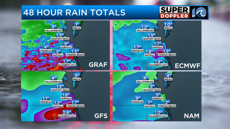
I think it will be a big range of 0.5″ to 2.5″ with some locations getting 3″ or more. The bulk of this should fall in the next 24 hours (from the time of this writing).
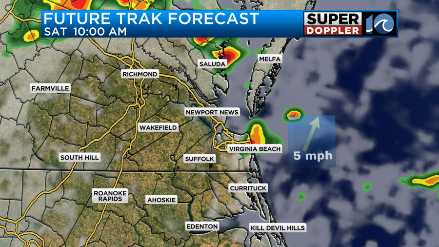
By Saturday the front should lift north slightly as a warm front. It may even stall out again. This would bring a lot of rain to the region. The models are handling the coverage differently along the front. Our Future Trak model isn’t showing a whole lot during the day.
The hi-res NAM also isn’t showing too much. However, the regular NAM and GFS models are showing quite a bit of rain.
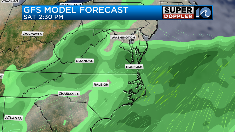
I’m splitting the difference for now with some scattered showers and storms expected but no wash outs. High temps will be in the 80s.
The front will probably stay stalled over the area on Sunday. So we’ll have more clouds, more scattered showers and storms, and more highs in the 80s.
At least it will stay cooler for a while. The tropics are still calm too. Hopefully, that continues for a while as well.
Meteorologist: Jeremy Wheeler


