
Last night many of us woke up to the sound of thunder. The rolling thunder (thunder that lingers for a while and travels) lasted for about 20 seconds. That’s the longest thunder that I’ve heard in a while. Anyway, that happened during the middle of the night.
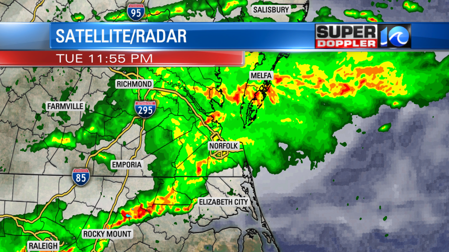
There were some heavy downpours over the region, but that was actually a good thing for some. I’ve mentioned recently that the Eastern Shore is still in a moderate drought.
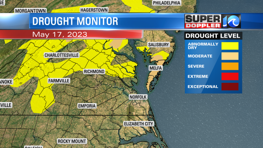
Well…last night Melfa had about an inch and a half of rainfall.

We had about a half inch to an inch over the rest of the area. My weather watcher, Barry in Gloucester, had about 2 inches.
The rain had pretty much wrapped up by 7:30am. This rain came from a couple of systems. Firstly, there was a fast moving (though weak) area of low pressure that zipped through fast from west to east. There was also a cold front moving in from the north. Now that cold front is sinking to our south.

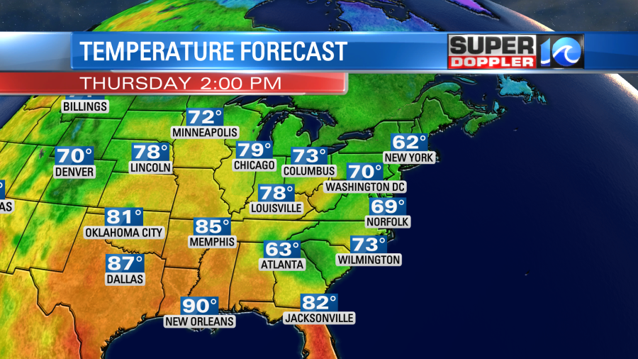
The wind will pick up out of the north as the low gets farther out to sea. We will have some gusts to 25mph out of the north/northeast. This will keep the temps down today. High temps will only be in the low 70s with a few mid 70s to the south.
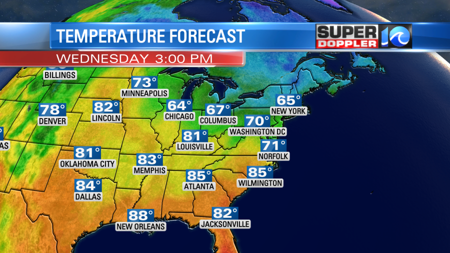
Tomorrow we’ll have lots of sun as high pressure sinks closer to our area. Winds will be steady out of the east/northeast. This will keep the temps down well below average.
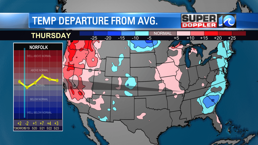
The jetstream is rising far north in western North America. It is dipping in the east.
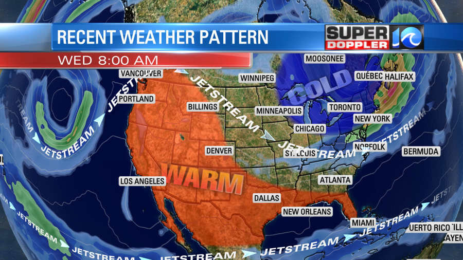
So there has been some very warm temperatures reaching all the way up to western Canada. Hopefully, in the next 2 weeks it will flatten out more and allow more warmth to flow into the eastern U.S. on a consistent basis.
Meteorologist: Jeremy Wheeler


