Since Sunday some drier air has pushed into the region, but some more unseasonably dry air is going to be sinking into the region over the next 48 hours. I think folks will be loving it. let’s talk about it.
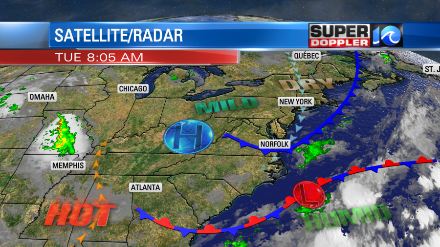
Today we have a cool front that is sinking to our south but very slowly.
Dew points are in the 60s mostly, but they will drop to the 50s by this afternoon.
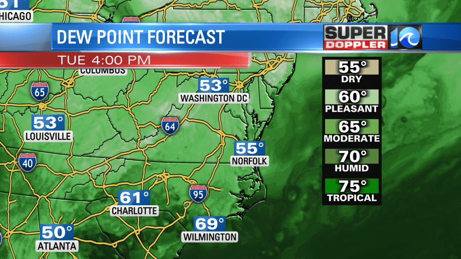
The humidity will stay down tonight and tomorrow. This will make it feel very comfortable, and maybe even a bit like early Fall.

Having said that… Since the front is sinking southward we might have enough moisture for an isolated shower today in southeast Virginia. There is a little higher chance in northeast North Carolina.

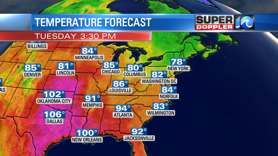
That is up through about 3pm. From 4pm onward the dry air will win, and we’ll have clearing skies. We’ll have a steady northeast wind through the day at 8-12mph. High temps will be below average again. They will run in the low-mid 80s.
Tonight we’ll be mostly clear with dry air and light northeast winds. This will allow temps to drop quite a bit. Low temps will be in the low-mid 60s with some 50s inland. It will feel wonderful for early August.
Tomorrow the front will sink to our south and fall apart. High pressure will build in from the west. So we’ll have lots of sun with a few clouds, and the air will be very dry. It will be awesome outside. High temps will only rise to the low 80s with some mid 80s inland.
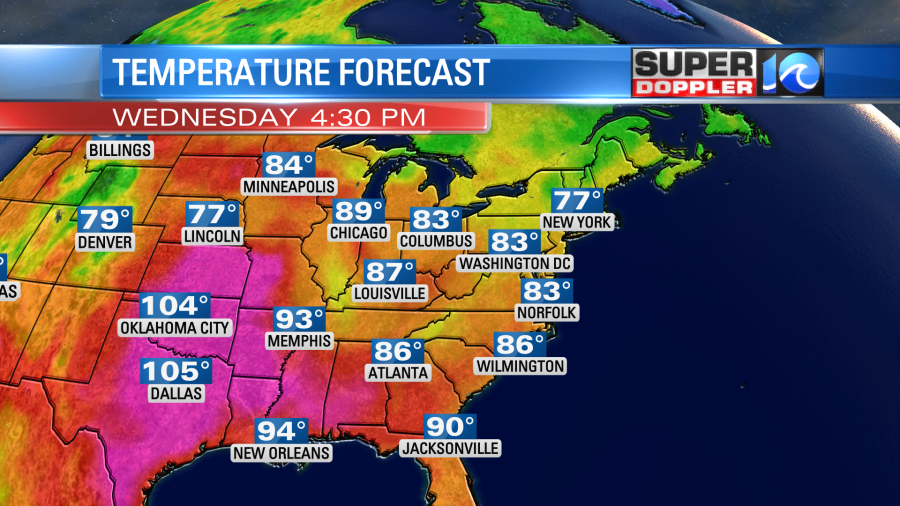
This is about 7-10 degrees below average. We are not alone. It will be nice and cool in the northeast states for a few days. We’ll stay in the low-mid 80s on Thursday. There will be some isolated showers possible, but the chance looks lower than yesterday’s forecast. However, we will probably have some scattered showers and storms on Friday as the moisture increases and we heat up a bit more. Even then though highs will still be in the 80s. The weekend doesn’t look as hot nor as wet as previous forecasts. For now I have highs in the 80s with some isolated showers. I’ll have an update on that in tomorrow’s weather blog.
There hasn’t been much of an update in the tropics. There is one weak disturbance in the north Atlantic that is moving quickly to the northeast. It is over cooler water now. So it has an almost zero chance of formation.

The other feature in the middle of the Atlantic is running out of time to form. As of this morning it only has a medium chance of formation. That is down from yesterday.
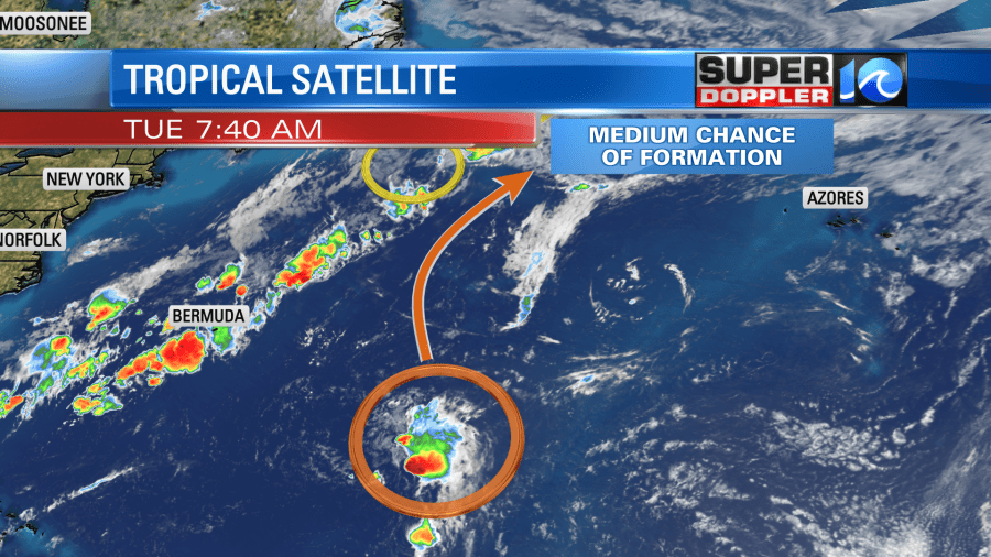
We’ll see if the latter one does anything, but even if it does it will stay out to sea.
The weather should be fine for the rocket launch this evening at Wallops Island. Hopefully, there are no delays.
Meteorologist: Jeremy Wheeler


