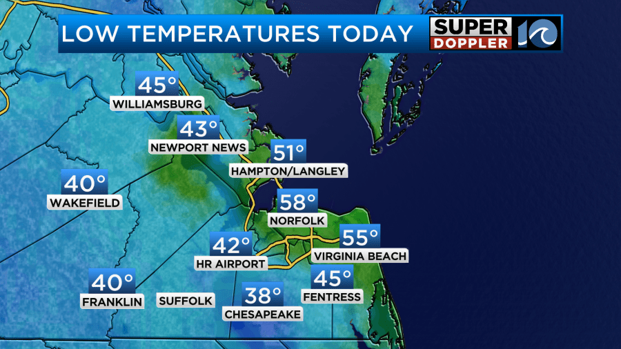
This morning was dry and chilly in spots. Morning lows were mainly in the 40s and 50s, but there were 2 spots (Chesapeake, and Melfa) which dropped down into the upper 30s for a short time.
We are looking at some nice Fall weather today. High pressure is building into the region. There is a cold front far to our southeast. Milton is post-tropical, and it is roaming out to sea.
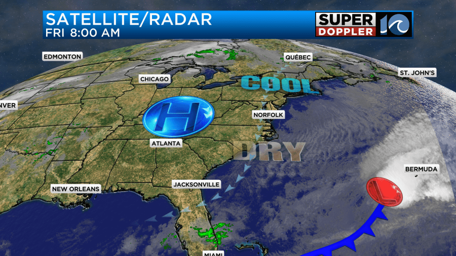
We’ll have lots of strong sunshine today with a light breeze out of the north. It’s super dry outside. Dew points are in the 40s with a couple of 30s. Because of the dry air and strong sunshine temps will be able to rise to the upper 60s this afternoon.
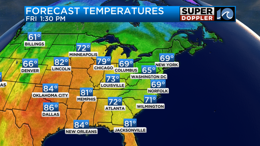
There will even be a couple of 70s inland and south. That’s a big daily rise in temps for some areas like Chesapeake. We’ll cool it down quickly this evening. Temps will be in the 60s for kickoff at the football games, but it will be in the upper 50s to low 60s by halftime.
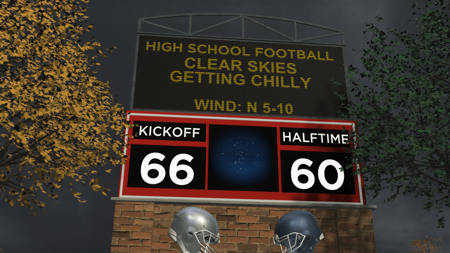
Tomorrow we’ll start off in the 40s and 50s. There may be one or two 30s inland. However, we’ll have more of a westerly wind through the day. That will let our high temps bounce up to the mid 70s.
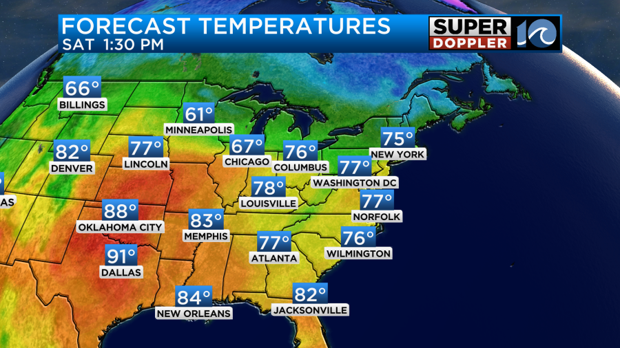
If you notice the heat out to the west building. Well then you’ll also notice that the heat slides east over the weekend. Yep… High temps will reach up to near 80 here on Sunday.
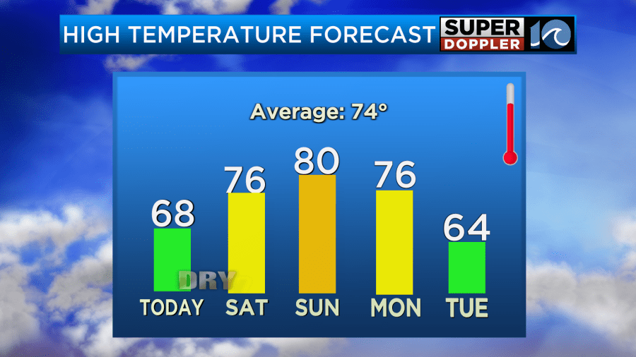
The good news is that it will be very dry outside. So it should still be very comfortable even with the milder temps.
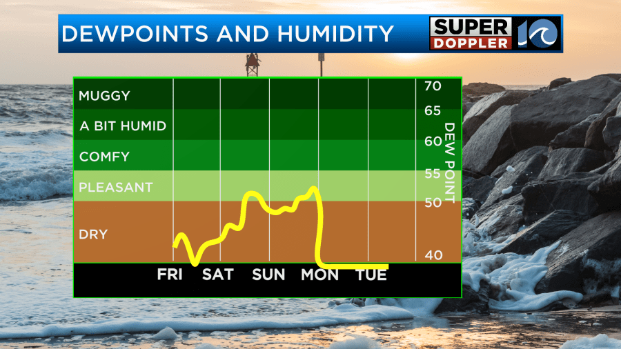
You’ll notice that temps will drop big-time next Tuesday. Highs will be down to the low-mid 60s for a couple of days next week. Morning lows will be down in the 40s and probably even in the 30s inland. There’s a low chance that a few far inland spots may get a frost next week. Stay tuned for updates on that over the weekend.
Meanwhile, the tropics are still busy. Milton did major damage to parts of Florida. There was a high storm surge near Sarasota, flooding from heavy rain from St. Petersburg to Daytona Beach, and numerous tornadoes. However, Milton is no longer a tropical system. It is post-tropical.
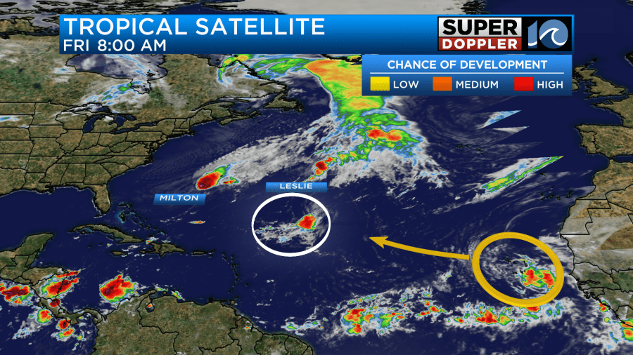
It will keep heading east, and it should have little impact on Bermuda. Tropical storm Leslie has finally started to lose its energy. It will move north then northeast and gradually become post-tropical.
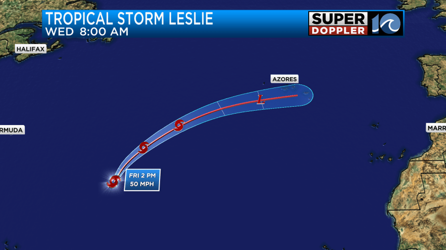
The disturbance in the eastern Atlantic has a medium chance of formation. We’ll keep an eye on it. All of this activity is keeping the oceanfront churned up. We’ll have a high threat for rip currents for at least the next 2 days. Waves will run about 3-4 ft in Virginia Beach with 3-5 ft waves over the Outer Banks. The surf may clean up by tomorrow. It may be some really good surf for a time.
Meteorologist: Jeremy Wheeler


