
We are going to be in a pretty warm pattern for the next 3 days. Then we will be in a much cooler pattern for the weekend. (I’m just the messenger).
Today we have an area of high pressure offshore with a weak area of low pressure to our south.
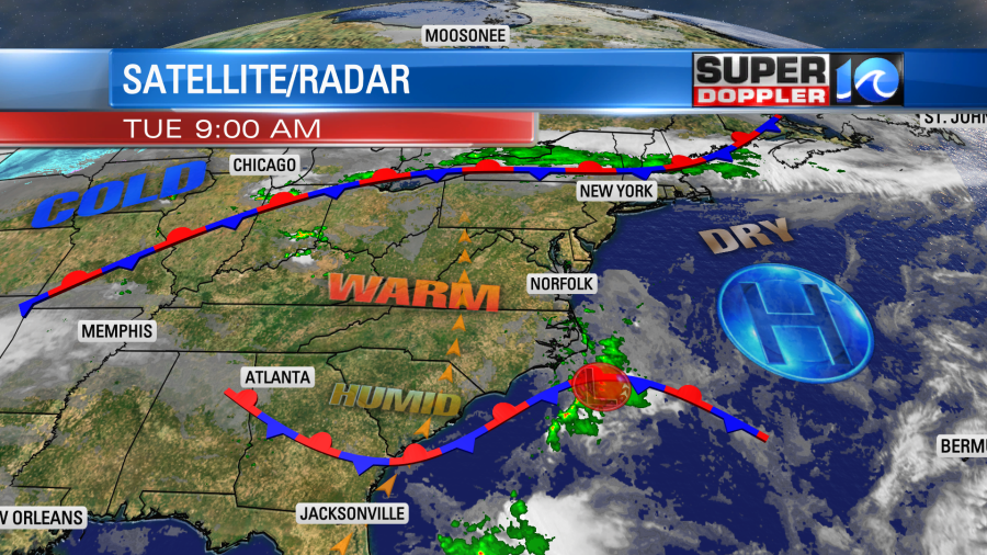
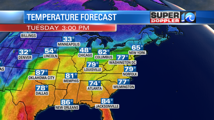
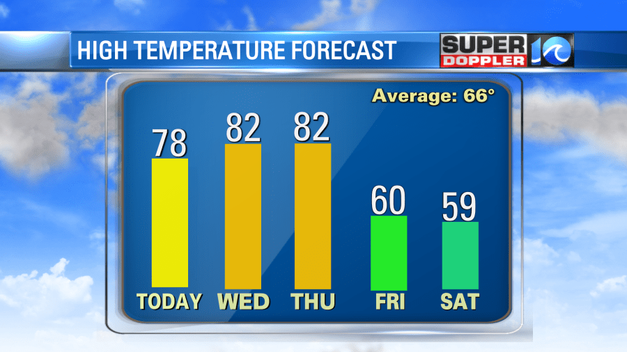
This produced some spotty showers this morning. They were mainly over northeast North Carolina. This low will move out to sea today. Any spotty showers in the region should move out too, but a stray shower or two could linger into the afternoon. We’ll have a mix of sun and clouds through the day with a light south wind. High temps will rise to the upper 70s.
During the next 3 days we’ll hold on to this pattern of high pressure offshore and light to moderate winds out of the south.
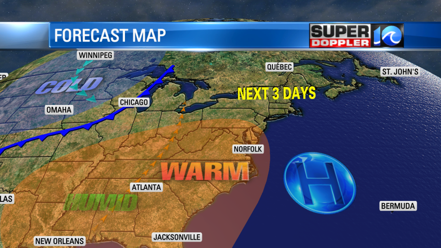
That means that tomorrow we’ll have high temps in the low 80s.
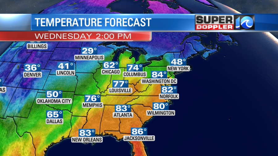
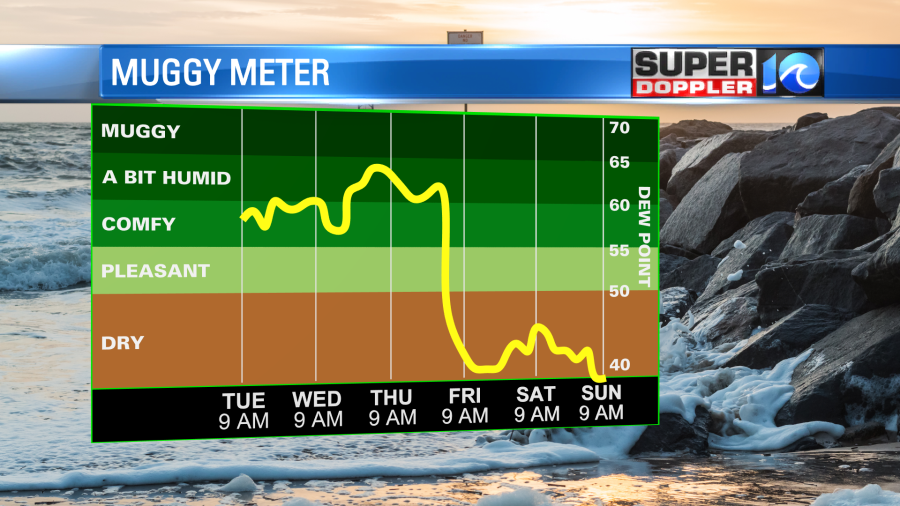
We’ll be partly cloudy on Wednesday. It should be nice, but the heat and humidity will probably have a lot of people running their A.C. units. We’ll be very warm and humid on Thursday. High temps will be in the low 80s again. Dew points will rise above 60.
However, there will be increasing clouds with some late-day showers and storms. The bulk of them may hold off until the evening, but either way we’ll have some rain late.
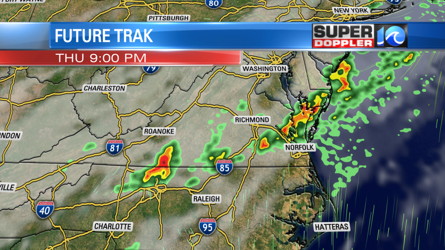
This will be ahead of a strong cold front that will swipe through the area Thursday night. After that we’ll enter that cooler period. The setup will be a large area of high pressure locked in over the Atlantic….but the NORTH Atlantic. This will give us a long stretch of winds coming in off of the water. We call that fetch.

This setup happens a couple times a year, but when it lasts for a long time it can really give you a cool/wet pattern. One time (I think in 2005) this pattern gave us high temps only in the 50s in May for a few days.
Having said that, high temps will only be near 60 on Friday, and we’ll be in the upper 50s probably on Saturday.
The models disagree on how far north the high will sit between Friday and Sunday. The GFS is a little more north. So it allows some scattered showers and drizzle to come in off of the ocean between Friday and Saturday.
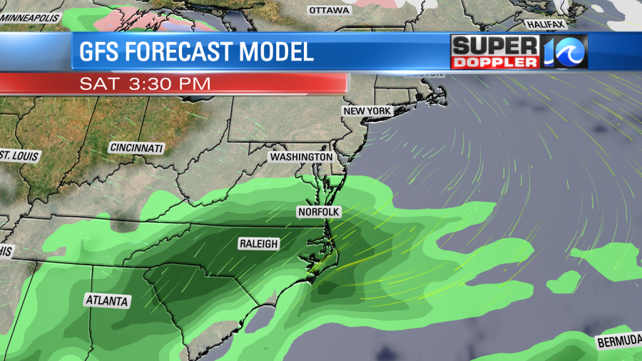
Meanwhile the European model has the high a bit more south. So it keeps the rain to our south as well through that time.
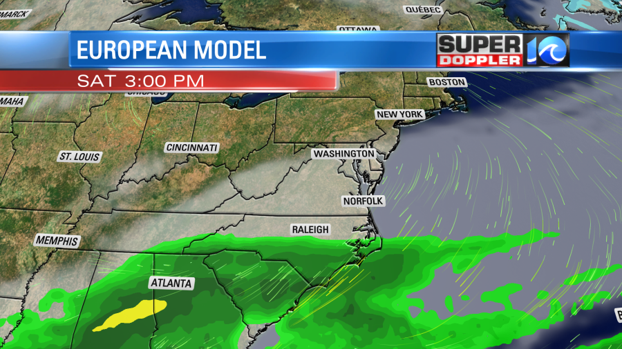
Hopefully, the models will come into better agreement on that over the next couple of days. It will be Eastern weekend after all. For now both models look drier for Easter, but I’ll go into more detail on that in tomorrow’s weather blog.
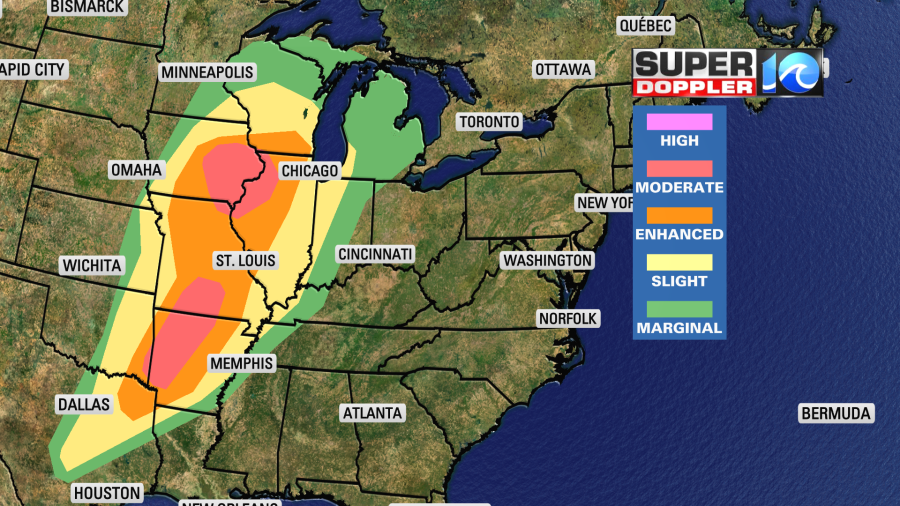
In national news… There will be another chance for severe storms and tornadoes across the central U.S. today. This is while many areas are cleaning up from recent storms.
Also, a big report just came out about hurricane Ian from the National Hurricane Center. After closer review it appears that it was able to reach category 5 status for a brief time over the water. It was the most expensive hurricane in Florida’s history, and it killed 156 people. The other sad part is that due to the dramatic change in track before hitting west Florida many people were not prepared very well. That isn’t implying fault. The angle that Ian cam from the Gulf made for a very tricky forecast for all meteorologists. Here is the report: Hurricane Ian Report.
Meteorologist: Jeremy Wheeler


