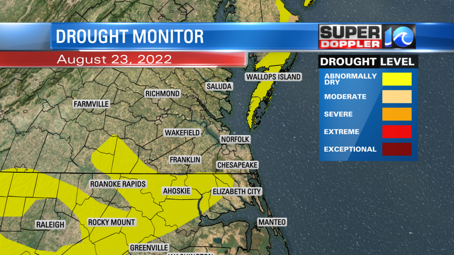
Recently we had gotten caught up on rainfall in our region. The U.S. Drought monitor has shown improvement recently as we have had some decent rain.
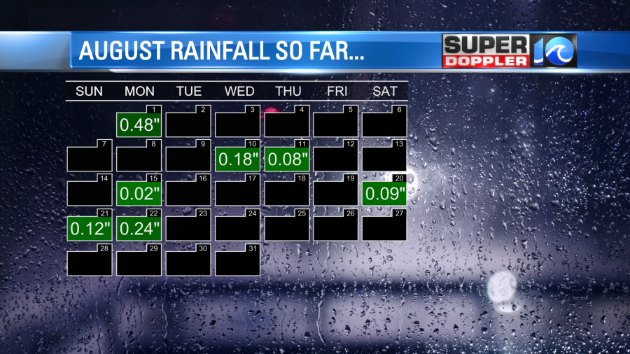
However, not all of the rain has made it into the rain gauge at Norfolk International. So we are actually down 3.29″ for the month of August compared to average.
I would say that some other cities nearby are almost caught up to their average.
The drought is still going in the western and central U.S., but ironically there has been some bad flooding over parts of the Southwest and Deep South. The rain yesterday was both incredible and devastating near Dallas Texas.

One part of Dallas county picked up about 15 inches of rain in a 24 hour period. This is more than many hurricanes put down during their lifetime (although they do cover a much larger area). Yes, these downpours will help the droughts out there. However, when you get that much rain in a short period of time it tends to runoff. So it doesn’t soak into the ground very well. Plus, of course, it causes a lot of damage and sometimes deaths.
They have a few ingredients down in Texas for this flooding. They have had a stalling front, lots of deep/rich moisture, and a small piece of the jetstream down there lately.
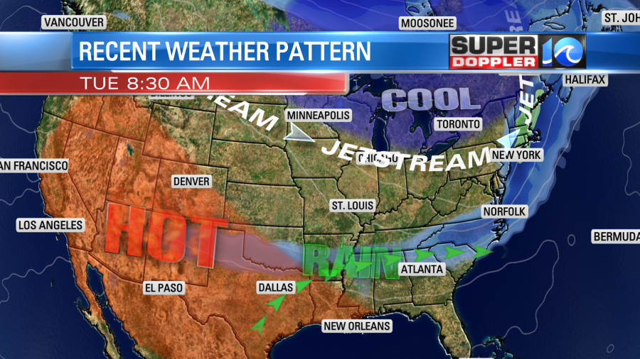
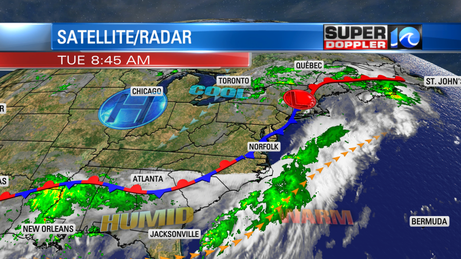
We are in-between the pieces of the jetstream right now. So we don’t have hardly any upper level winds. However, we do have a lot of moisture, and we do have a stalling out front just to our north.
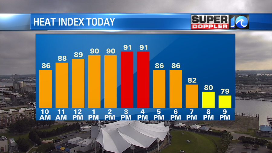
The layer of deeper moisture is just to our south. So we will be hot and humid today. The high temps will be in the upper 80s. The heat index will be in the low 90s.
We’ll be partly cloudy with some isolated showers or storms. We’ll have similar weather tomorrow, but the front will slip a little more to the south. We’ll be a couple of degrees cooler, and a TAD drier. High temps will be in the mid-upper 80s. We’ll basically have similar weather over the next few days into and through the weekend.
Going back to floods and droughts… There has been a worsening drought and historic heat wave in China recently. Both are breaking long-standing records. Hydro-power is taking a hit. As many as 66 rivers across 34 counties in southwestern China have dried up due to the scorching heat. Here are two articles with more information on the heat wave and the drought: China heatwave. China Drought.
Finally, here’s the tropical update. The weak tropical disturbance in the central Atlantic has weakened, and it has a low chance of formation over the next few days. There is another disturbance east of there with a similar track to the west. It also has a low chance of formation.
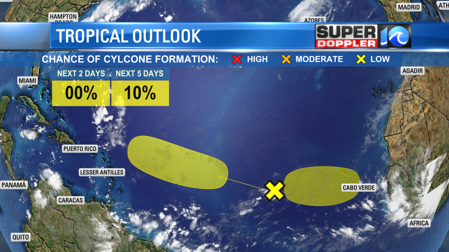
If either of them pick up then maybe then will bring some higher waves to our area by the end of the weekend for the ECSC. It’s pretty quiet for the next couple of days.

Meteorologist: Jeremy Wheeler