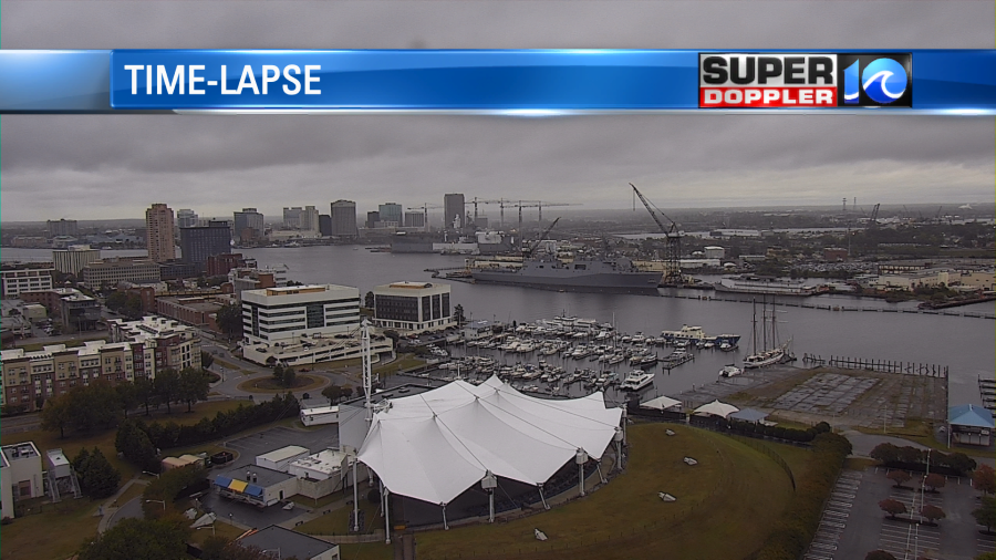
The rainy weather lately has really helped out our lawns. It has cleaned out the air. It has washed the dust off of the buildings and vehicles. But I think many folks are ready for a little sunshine.
To tally it up let’s take a look at the rainfall for September. It feels like it’s been so long ago that were in the middle of a big drought. Remember, the rainfall was nil for the bulk of September.
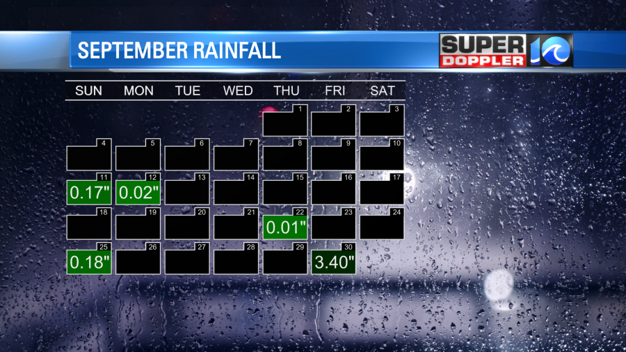
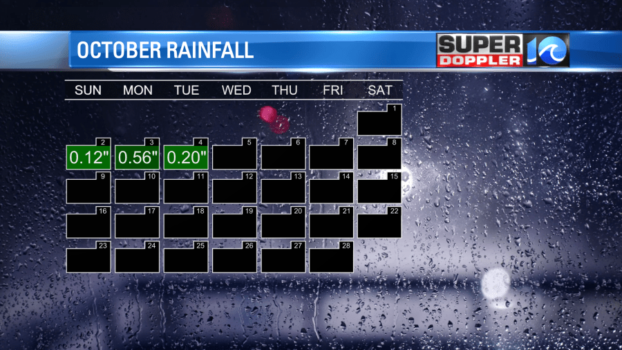
Then we had the remnants of Ian bringing us the heavy rain on the last day of the month. After that another low formed and brought us the recent showers into early October.
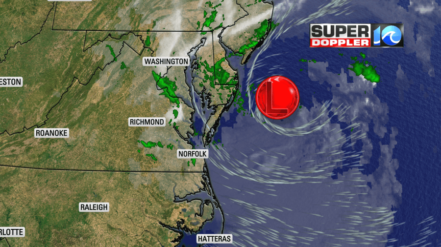
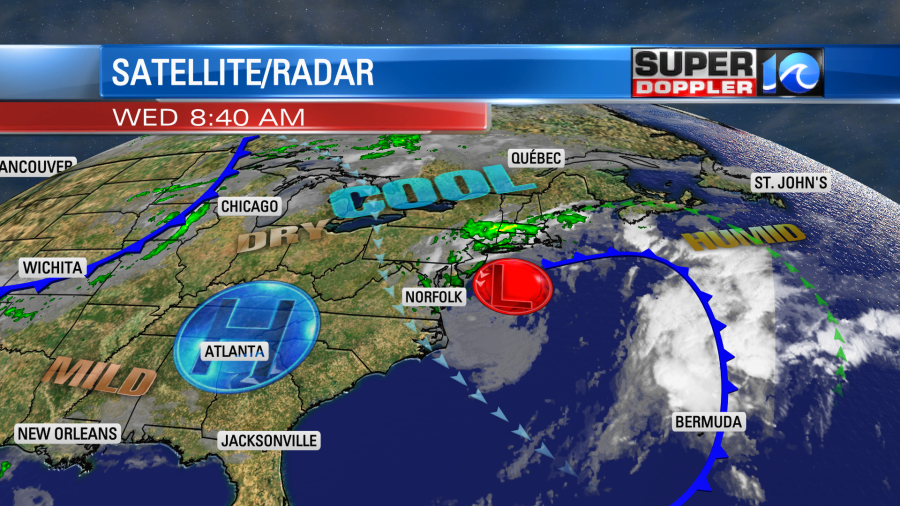
This morning the low is still fairly close to the area, but it is still weak. It actually drifted a little west since yesterday. Strong high pressure is to the west.
This morning we had cloudy skies with a few more showers and some drizzle.
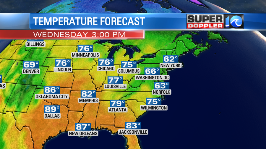
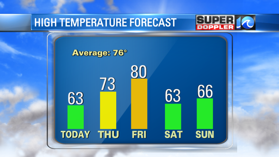
There was a northwest breeze at 10-15mph, but it was not nearly as strong as the last couple of days. As we go through the day the offshore low should drift slowly to the east. High pressure should gradually build east as well. This should push the light and scattered precip offshore. Clouds will take longer to move out, but I’m hopeful that we’ll see a little bit of sunshine later in the afternoon into the evening. With less wind and a little sun high temps should be able to reach the low-mid 60s.
While we may see a little sun today. I’d say that tomorrow is much more of a guarantee. The low should be gone, and high pressure will build in. We’ll have partly cloudy skies with high temps in the low-mid 70s. It should be very nice! Going into Friday we’ll be even warmer with high temps near 80 degrees. This will be ahead of a strong cold front. That front won’t pass through the area until Friday night. It is expected to pass through mostly dry. Then we’ll be cool and dry over the weekend. High temps will be in the 60s. Low temps will be in the 40s and 50s.
Meanwhile there is a little activity in the tropics. We have a fairly new tropical depression (number 12) that formed yesterday in the eastern Atlantic.
It is weak, it is moving to the northwest, and it should only be a nuisance to a few mariners before it falls apart.
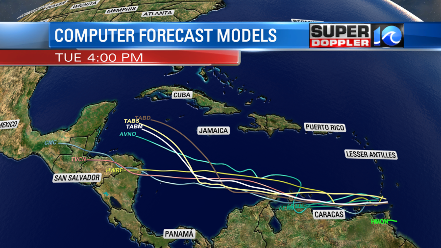
There is also a tropical disturbance near the southern parts of the Lesser Antilles and the ABC islands. This is moving generally to the west.
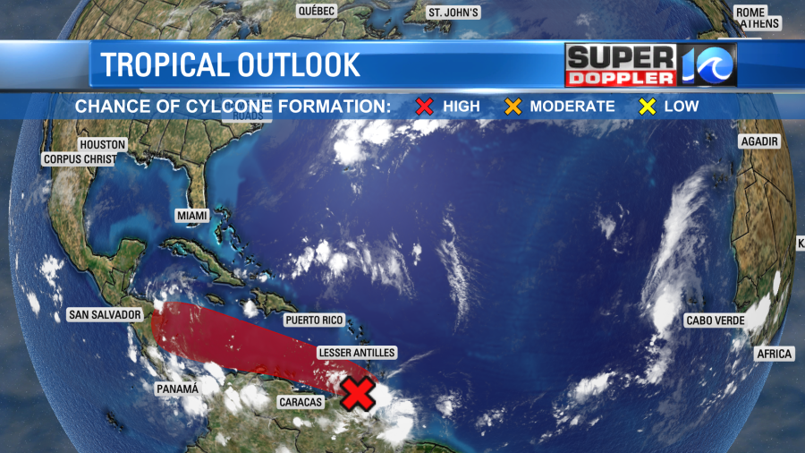
It has a high chance of formation over the next few days, but it should stay south of the U.S. It could impact central America early next week.
We’ll keep an eye on it.
Meteorologist: Jeremy Wheeler