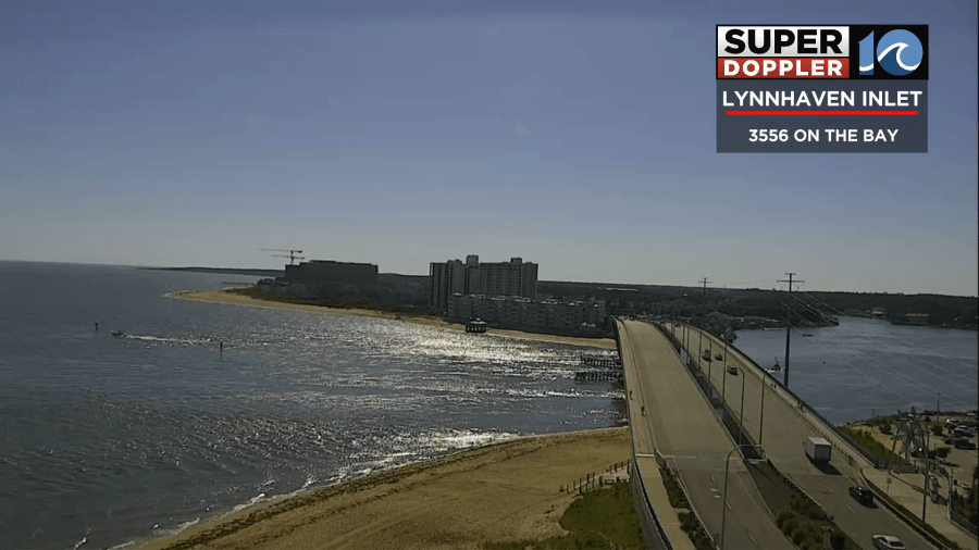
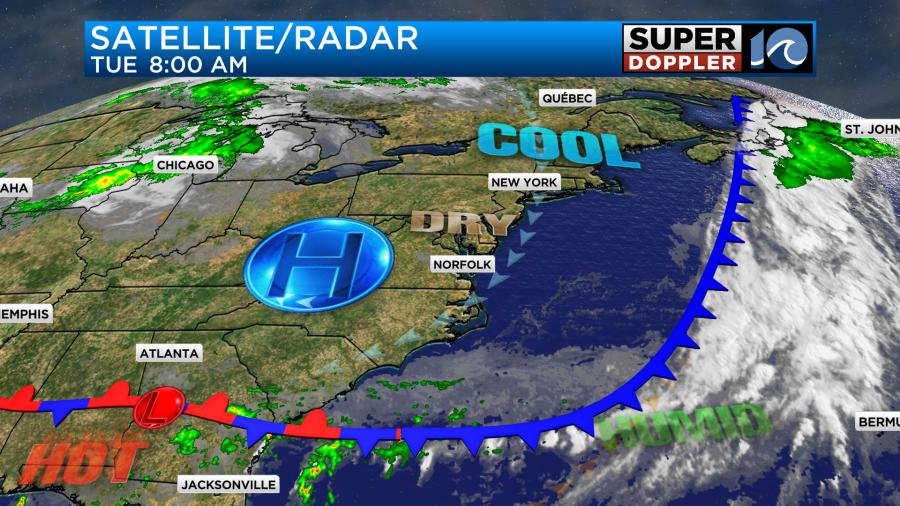
Locally, we are looking at some great weather today! A cool front has dropped to our south with high pressure building in from the northwest.
We had a gorgeous morning with lots of sunshine and comfortable temps.
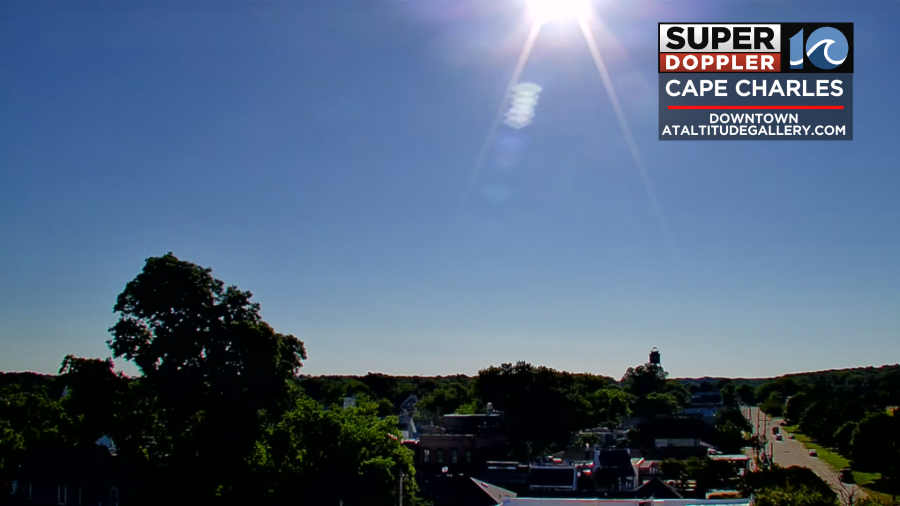
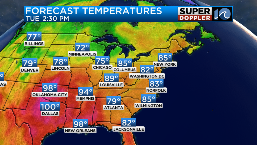
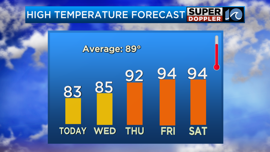
We are going to have a lot of sunshine today from start to finish. We’ll have a nice northeast breeze pulling down some seasonably mild and dry weather. High temps will run in the low-mid 80s.
The dew points have dropped to the 50s. So that will make it feel great! There’s no rain in the forecast. One problem that folks will encounter today is that there is a moderate threat for rip currents at the local beaches in Virginia with a high threat across the outer banks.

Be sure to check in with the lifeguards if you are heading to the OBX beaches today.
Tomorrow we’ll have some more pretty good weather overall. There will be more clouds, and we’ll be a little warmer. High temps will rise to the mid-upper 80s. We’ll have a light east wind. Hopefully, the rip current threat will go down. There may be a stray shower or two, but I’m keeping the chance for rain at 10%.
By the 4th of July (Thursday) we’ll start to heat up a little more. High temps will rise to the low 90s.
The humidity will also be going up. Dew points will get back to the 70s.
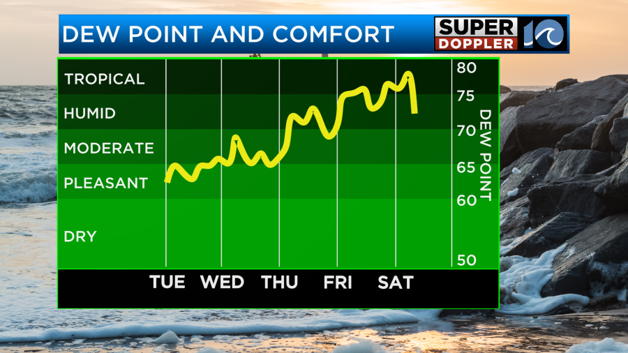
This will put the heat indices up into the upper 90s during the afternoon. We’ll be partly sunny during the day. The rain should stay away, but a couple of isolated showers or storms could form near the region in the evening. Maybe closer to Williamsburg or Gloucester.
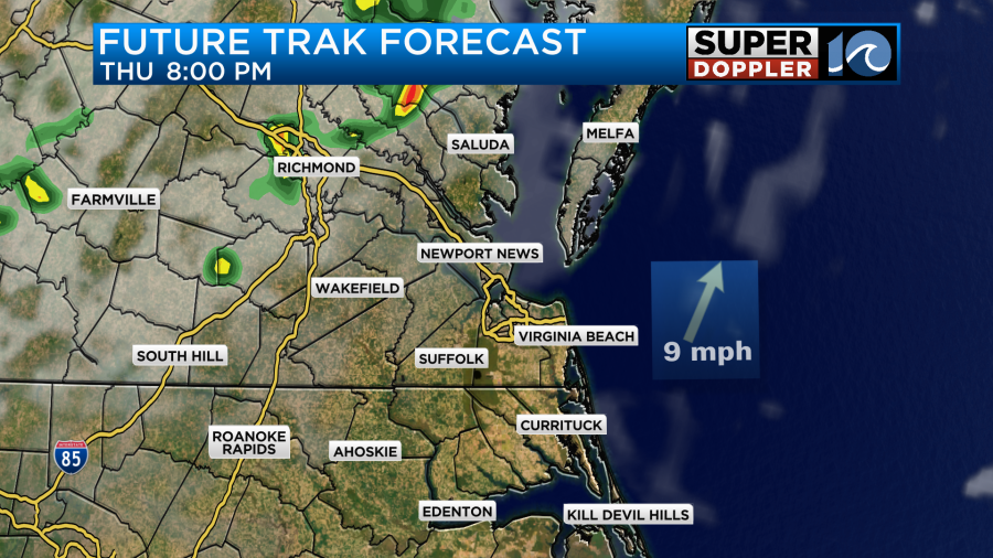
So check back for updates to that part of the forecast.
On Friday and Saturday we’ll have high temps in the mid 90s with the heat index near 100. We’ll be partly cloudy with a few PM showers and storms. There may be a little higher chance for rain on Sunday. Stay tuned.
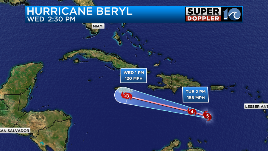
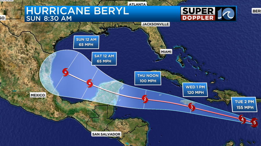
Ok so last but not least. Hurricane Beryl is a monster hurricane! The hurricane-forced winds are fairly compact. However, last night Beryl became the earliest category 5 storm on record. This morning it remained a category 5 with a very distinct eye on the satellite.
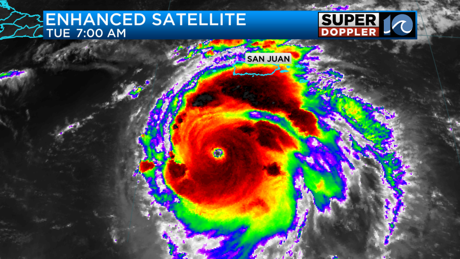
The storm was located a few hundred miles to the south/southwest of Puerto Rico. It was moving quickly to the northwest at over 20mph. The system already brought damaging winds and surge to the southern Lesser Antilles. There is some wind shear that is starting to work on the system. That should weaken it at least a little. However, the forecast for Jamaica is looking much worse than yesterday. Now the hurricane is expected to pass just south of Jamaica, or it could even make landfall over the island.
The hurricane-forced winds are forecast to pass over at least the southern part of the island.
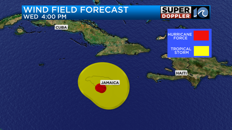
The forecast track models have started to cluster around the southern edge of the island.
There is one model (TAB-Deep) ((green line)) that has it going north of Jamaica. That model uses the prediction if it is a stronger storm. Which it is right now. Either way the island could see a high storm surge, strong damaging winds, and heavy rain.
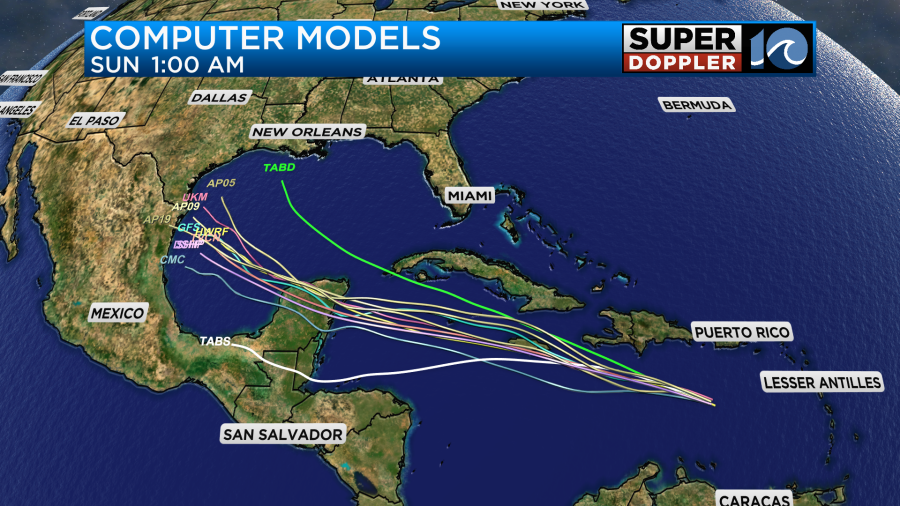
After Jamaica the system will move to the west/northwest. It may weaken depending on what happens with Jamaica, but it could stay strong for a while. It is expected to run into the Yucatan Peninsula, but there’s a low chance that it could pass north of that landmass. Afterwards it will turn a little more to the north, and it would then aim for northeastern Mexico or southern Texas.
There’s a decent amount of uncertainty in the 3-5 day forecast. We’ll have updates on this system over the next few days.
Meteorologist: Jeremy Wheeler