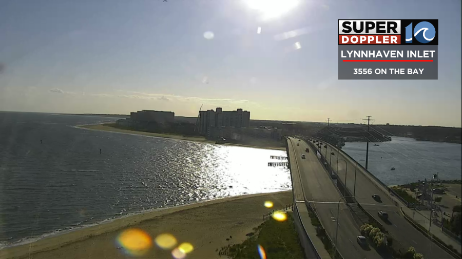
Today’s weather is looking great! We started off with some awesome shots on our tower cams!
Temps were in the 60s with some 70s near the shore. There were a couple of 50s inland. The 70s were from the northeast wind coming in off of the water. Current water temps are in the upper 70s. However, that will work in reverse this afternoon. The breeze will stay up out of the northeast, and that will help to keep the temps down. It will run at 5-15mph with some gusts to 20mph near the shore. A cool front has dropped to our south, and the cooler/drier air is rushing in.

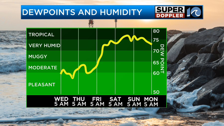
Dew points have dropped to the upper 50s to near 60. They will stay steady through the day. High temps will run in the low 80s with some mid 80s inland.
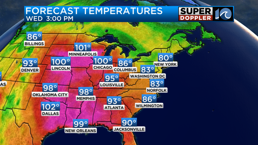
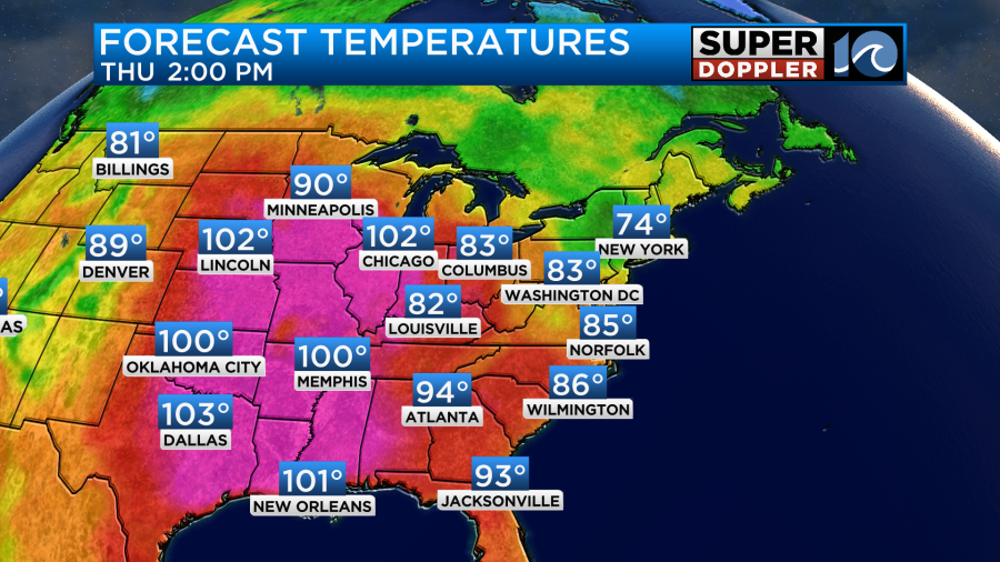
Meanwhile there will be records breaking all across the central U.S. as temperatures aim for around 100 all the way up into Illinois and Minnesota. That is rare even for late August.
High pressure is building into our area. So we’ll have plenty of sunshine all day long. One issue is that we have a high threat for rip currents at the local beaches.

If the waves can clean up a bit, then it might be some good surf briefly for the ECSC surf competition. We’ll see. It might be be better tomorrow as the winds lighten up and turn out of the south/southwest. That same wind will heat us up a bit on Thursday. We’ll run up into the mid-upper 80s.
The humidity will rise a bit tomorrow, but it still won’t be too bad. At least not until Friday.
We’ll be partly cloudy tomorrow with an isolated shower north.
A warm front will sweep through the area on Friday. As the humidity and temperatures increase it will become pretty rough for those working outdoors. High temps will aim for the mid 90s. The heat index will rise to near or just over 100. We’ll have partly cloudy skies with some isolated showers or storms.
A cool front will enter the area on Saturday, but it will stall out for a bit. We’ll have a mix of sun and clouds with some scattered showers and a few storms. The chance for rain does not look too big. High temps will drop to the upper 80s, but the humidity will stay high. It will be warm and humid on Sunday with highs in the 80s. There will be a few showers.
The shell game of the tropics has changed once again. Gert is no longer a system. Harold is falling apart over Northern Mexico, and Franklin is moving over the island of Hispaniola.
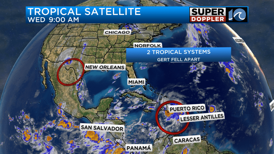
Harold is pretty much just a rain maker near the Texas-Mexico border, but even the rain is becoming pretty scattered.
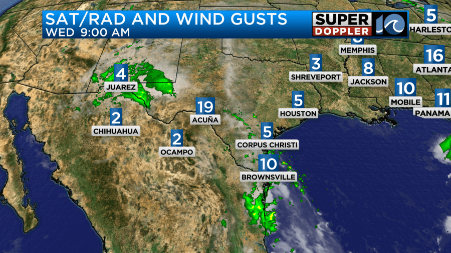
There may still be a few areas of flooding over that region.
Meanwhile tropical storm Franklin is moving north across the Dominican Republic this morning.
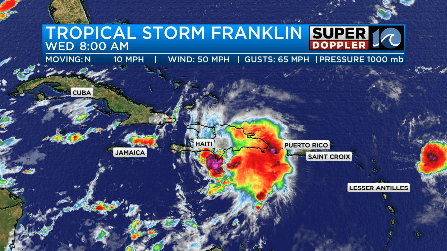
The system will move over the island today with heavy rain and strong gusty winds. There could easily be some flooding down there with some areas possibly getting 8-12inches. Franklin will weaken for a bit, but then it will likely move northeast and restrengthen tomorrow. In fact the system will moving over water temps in the low-mid 80s. Wind shear should also decrease a bit. Therefore the forecast calls for Franklin to become a hurricane this weekend.

The system could get pretty close to Bermuda in a few days. At least it looks likely that it will stay well east of the United States.
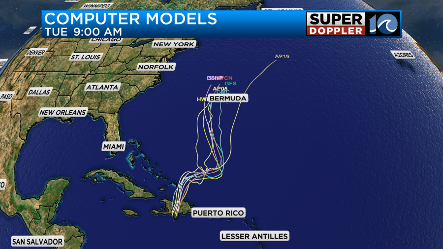
However, it could bring us some high waves for a few days. This could actually bring us some nice waves early into next week. Just AFTER the ECSC. Doesn’t that happen almost every year?
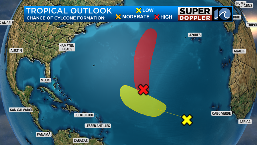
There are two other areas of disturbed weather in the Atlantic. One has a high chance of formation, but it will likely stay out to sea.
Stay tuned for updates.
Meteorologist: Jeremy Wheeler


