Yesterday was downright beautiful! I was outside for a while. In the morning I actually had brunch with Kerri Furey. We sat outside at a cafe in Virginia Beach to catch up on old times. The weather was perfect. I then went for a long walk with my dog around midday. It was heavenly. I won’t give you the full rundown of my day. (Laundry was at 1 p.m.).
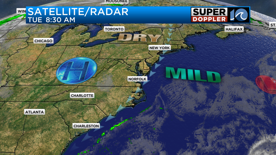
Today we’ll have similar weather in the region. A large area of high pressure is parked off to our west. It is bringing nice weather to the eastern half of the country.
We’ll be seasonably warm here today with high temps in the mid-upper 70s.
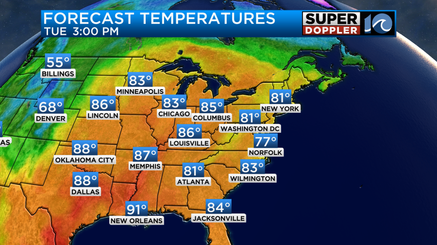
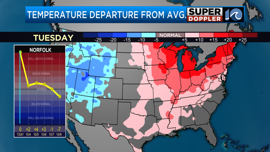
There will be a few 80s inland. Temps are below average in the west, but they are running well above average over parts of the Midwest, Great Lakes, and Northeast.
It’s even in the 80s up into Canada. That is pretty rare for late October.
We’ll have lots of sunshine through the afternoon with a light northeast breeze. Dew points are in the upper 50s to low 60s. So it should be comfortable once again.
Tomorrow we’ll have similar weather with lots of sunshine, mild temps, and a northeast breeze. However, the wind may be a bit more out of the east/southeast on Thursday. So I think we’ll have more 80s in the metro area.
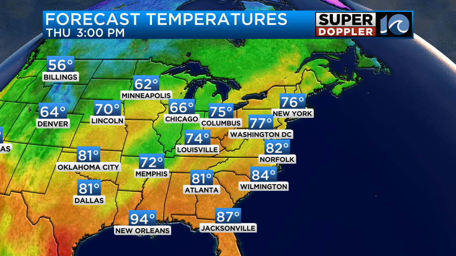
We’ll be partly cloudy. It should still be nice, but the humidity will rise a bit more.
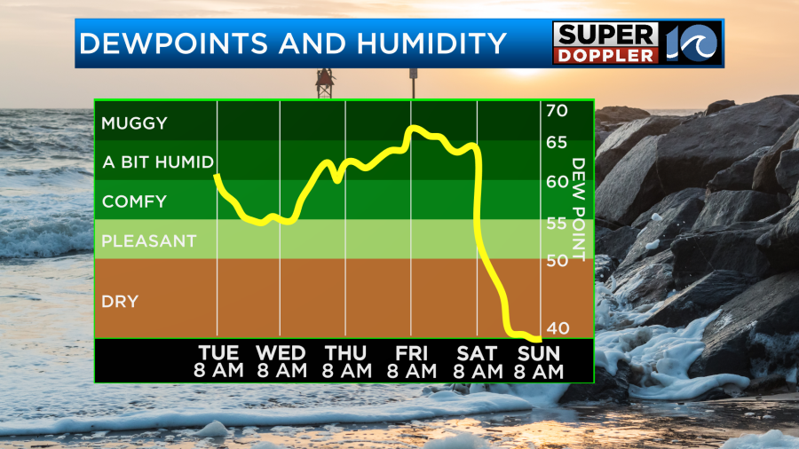
We’ll be fairly humid (for early October) Friday into Saturday. It will be warm on Friday with high temp near 80 again. However, we’ll have a mix of sun and clouds Friday with a few scattered PM rain showers. This will be ahead of a strong cold front. We’ll cool down a little on Saturday with highs in the mid 70s. There will be some scattered showers, but they will probably stick to the morning. Check back for updates on that. You can see that the humidity drops sharply on Saturday behind the front in the above graphic.
By Sunday we’ll be much cooler and drier. High temps will only be in the upper 60s. Low temps will be in the 50s and 40s. We’ll stay pretty cool early next week.
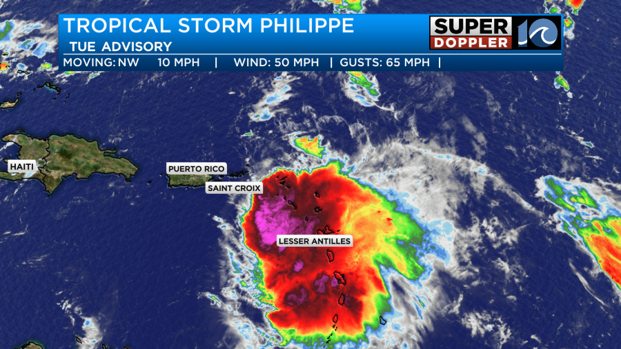
Tropical storm Philippe is affecting the northern end of the Lesser Antilles with some rain and gusty winds. However, the actual center of the storm is just a bit north of the islands.
Philippe is forecast to slowly move north over the next few days. Wind shear will decrease, but the storm now looks like it will stay below hurricane strength. It should stay east of Bermuda in a few days, but it may get fairly close.
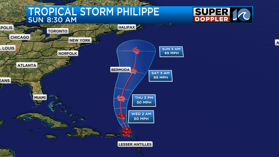
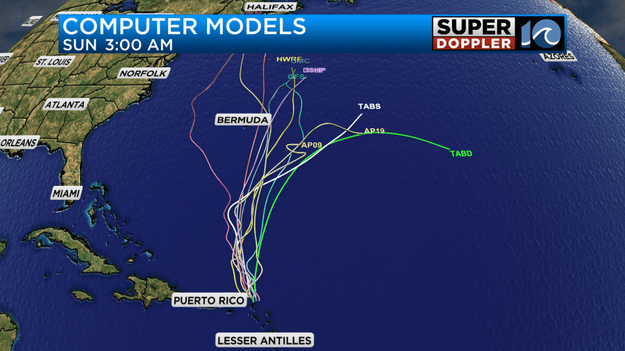
The models are a little split still, but the trend is mainly to the east of the island. It should stay far from the U.S.
Meteorologist: Jeremy Wheeler