Yesterday was hot. Surprise…surprise. High temps made it into the mid-upper 90s, but some locations were more in the low-mid 90s.
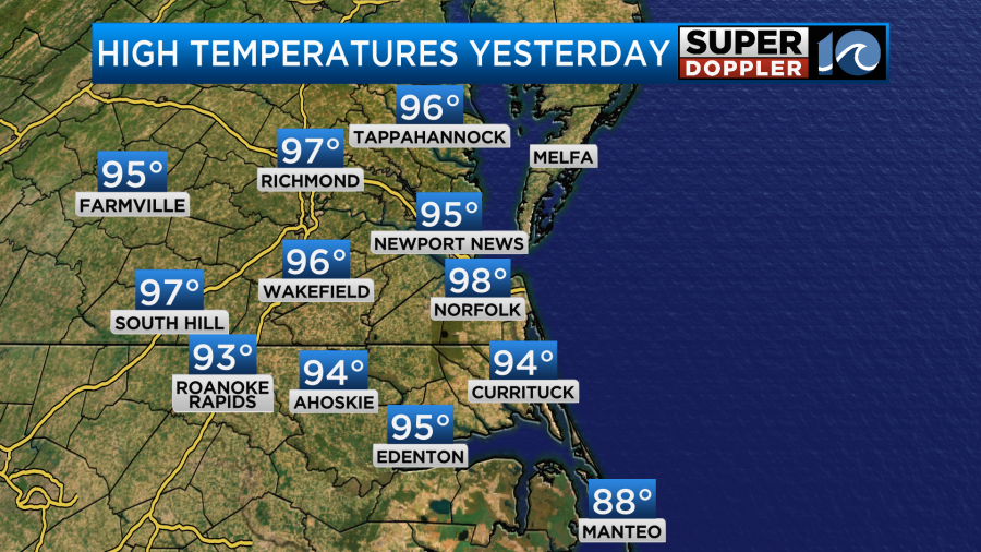
The heat index was over 105 in many places. We had a lot of sunshine through the day with only some isolated thunderstorms over North Carolina.
Today we’ll have similar weather. High pressure is offshore. There is a cool front over the Midwest.
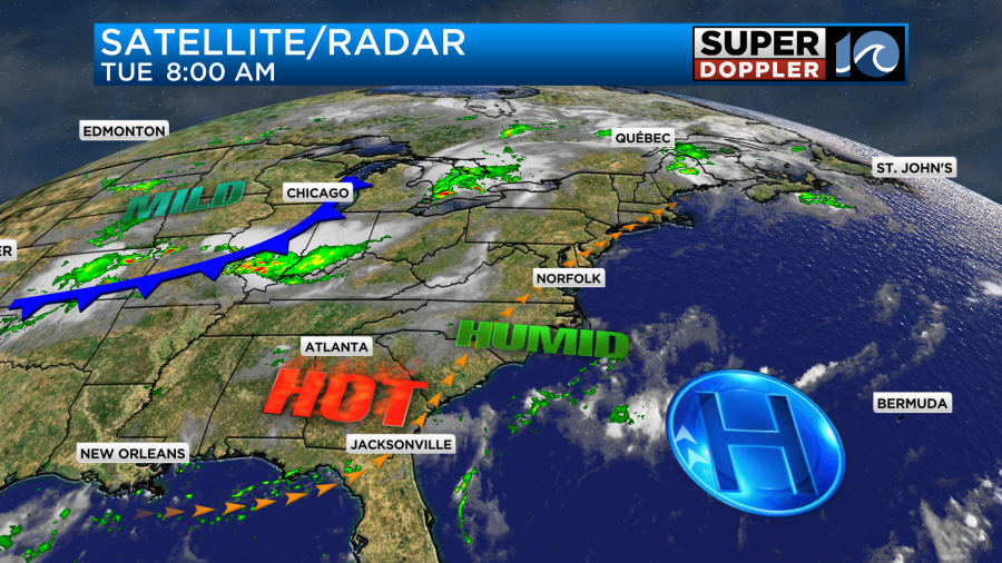
We’ll be mostly sunny through most of the day. There may be a few more clouds this afternoon but not too many. The Summer haze will be there from start to finish. There will only be some isolated showers or storms during the afternoon and early evening. High temps will aim for the upper 90s.
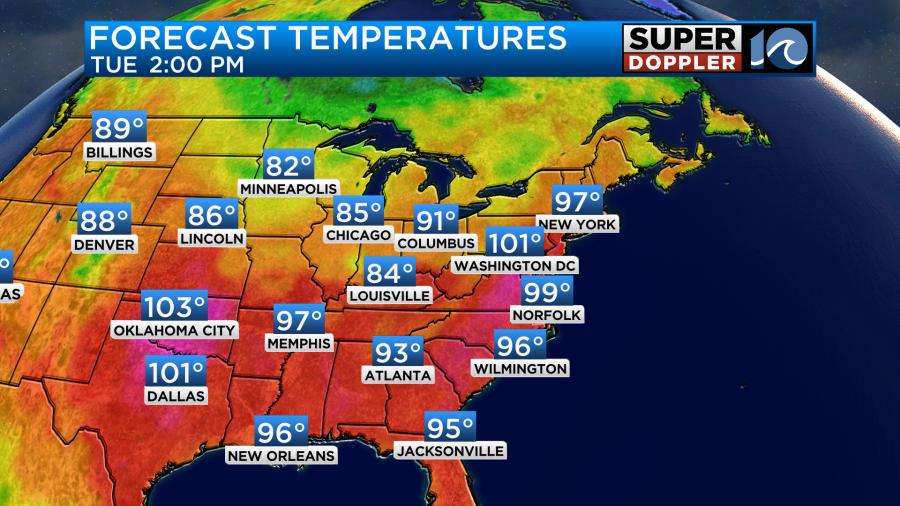
There will be a lot of upper 90s to near 100s in the region. The record in Norfolk is 102 (1879). We likely won’t hit that. However, the heat index today will be running between 105 and 112.
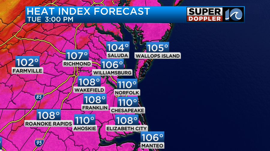
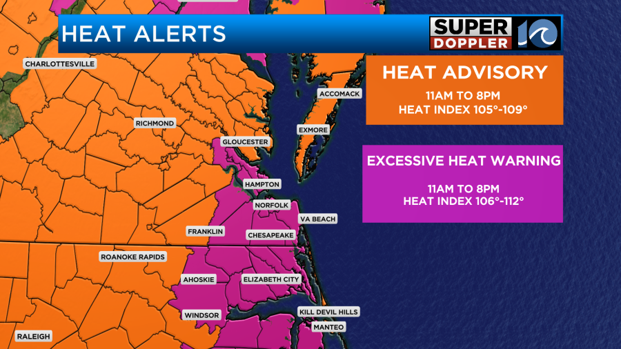
There are Excessive Heat Warnings up again today, but they cover more territory than yesterday.
The good news is that there will be a decent breeze out of the southwest. It should run at 10-15mph. So that will help a bit.
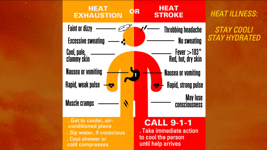
When you have Excessive Heat Warnings then it means that heat illnesses are more likely to occur. Especially in older folks like myself. Heat cramps, heat exhaustion, and heat stroke are possible if you don’t stay hydrated and are outside for a significant period of time. Here are some of the symptoms of heat exhaustion and heat stroke.
Tomorrow will be a little different. It will still be hot and humid. High temps will aim more for the mid-upper 90s. The heat index will probably still be over 105.
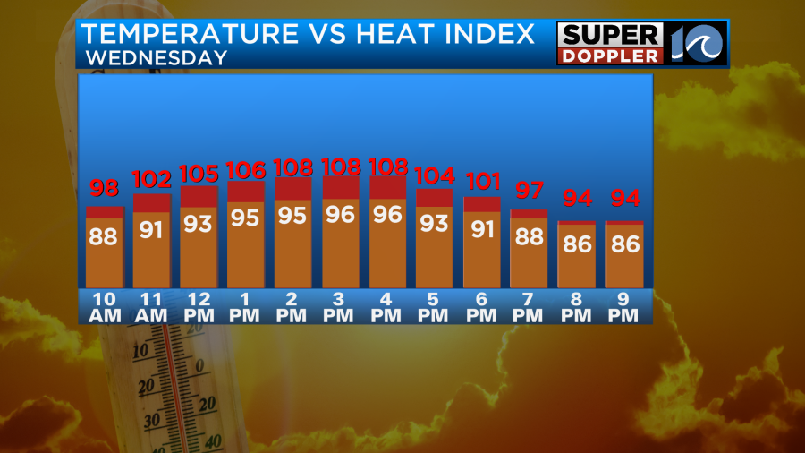
However, we’ll have more clouds tomorrow, and there will be a few scattered storms during the afternoon.
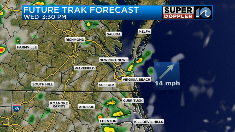
If the storms fire up a little earlier, then some of the temps may only make it to the low-mid 90s. We’ll see. This will still be ahead of the cool front. The actual front will arrive on Thursday. There may be a few showers in the morning, but several clusters of showers and storms will form during the afternoon. Some of them could be in the form of heavy downpours.
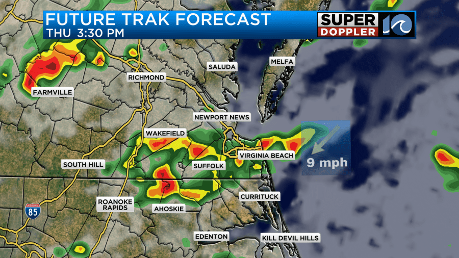
Temps will be knocked down to the upper 80s, but it will still be humid. So it will feel like the mid 90s.
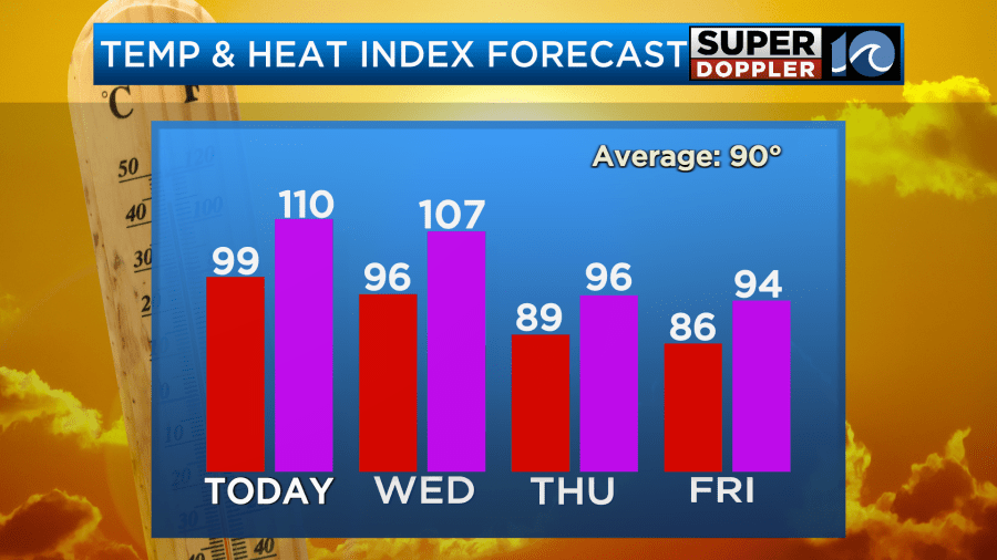
That’s the relief! He he he. The humidity will stay up for a while even though high temps will stay in the 80s through Saturday.
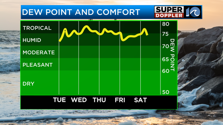
The problem is that we’ll have more scattered showers and storms Friday through the weekend. Some of them could contain heavy rain again.
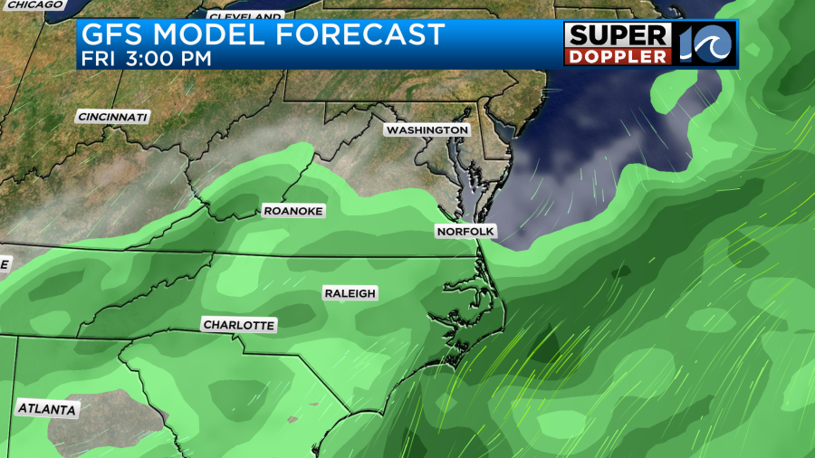
I’m hoping that it won’t be as much as last week, but we’ll see. It definitely won’t be a washout. I’ll be able to pinpoint the weekend rain chances a little better by tomorrow once it gets more in range of the NAM model. Stay tuned for updates.
Meteorologist: Jeremy Wheeler


