Remember about a week ago when a huge portion of the U.S. was in the deep freeze and everybody thought “here we go….It’s gonna be a cold Winter now!” Well….maybe not. The eastern 1/3rd of the country is currently in a January heat wave. Today many temperatures east of the Mississippi River will run about 20-25 degrees above average.
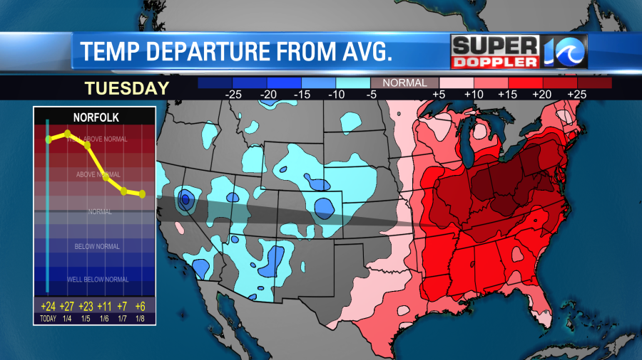
A lot of snow has been melting with the warmer temps, and more of that will happen today in the Northeast and Great Lakes.
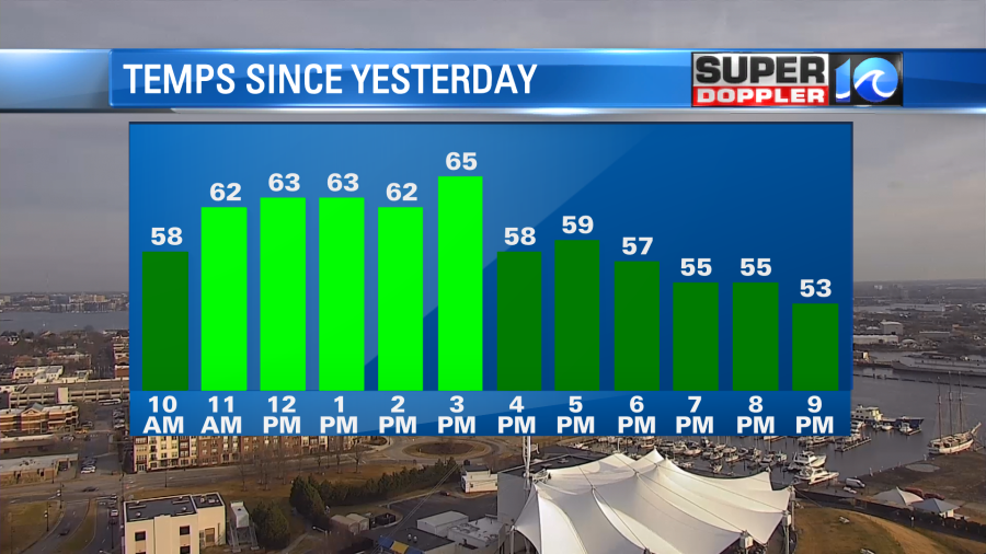
Locally, we hit the mid 60s yesterday in Hampton Roads. There were a few temps near 70 inland.
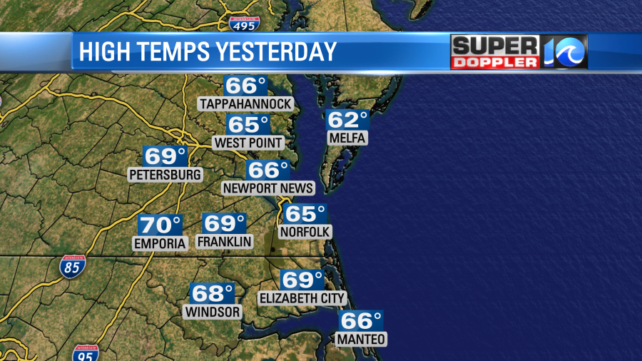
Norfolk would have been warmer than 65. However, a light breeze popped off of the Chesapeake Bay, and that actually dropped the temperature there.
Remember, the water temperatures are in the low-mid 40s over much of the region right now. They are in the 50s along the Outer Banks on the ocean side.
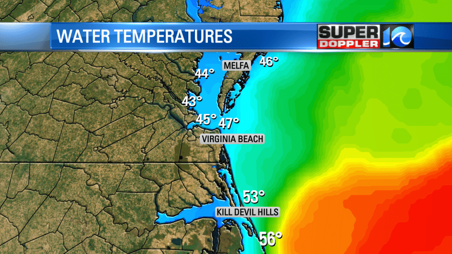
So the reason that I mention that is because today should be different in that regard. There will be a steadier/stronger southwest wind. It will run at 5-15mph. So that will push the warmer temperatures to the coast.
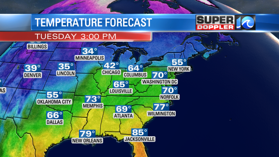
Again, on the map above you can see how warm it will be from the Gulf of Mexico to the Great Lakes. We’ll have a mix of sun and clouds in our area today. It should be very nice out. However, the humidity is increasing. It will become moderate.
High pressure is moving offshore with a warm front to our north and a cold front far to the west.
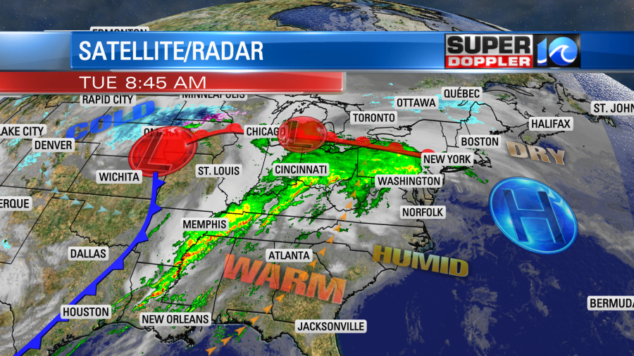
There will be some strong to severe storms over the Tennessee River Valley down to the Florida panhandle today.
Tomorrow the high pressure system will move farther offshore. We’ll have a stronger wind out of the south. It will gust up to 25mph. This will really boost the temperatures, but it will also drive up the humidity to high levels.
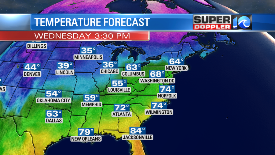
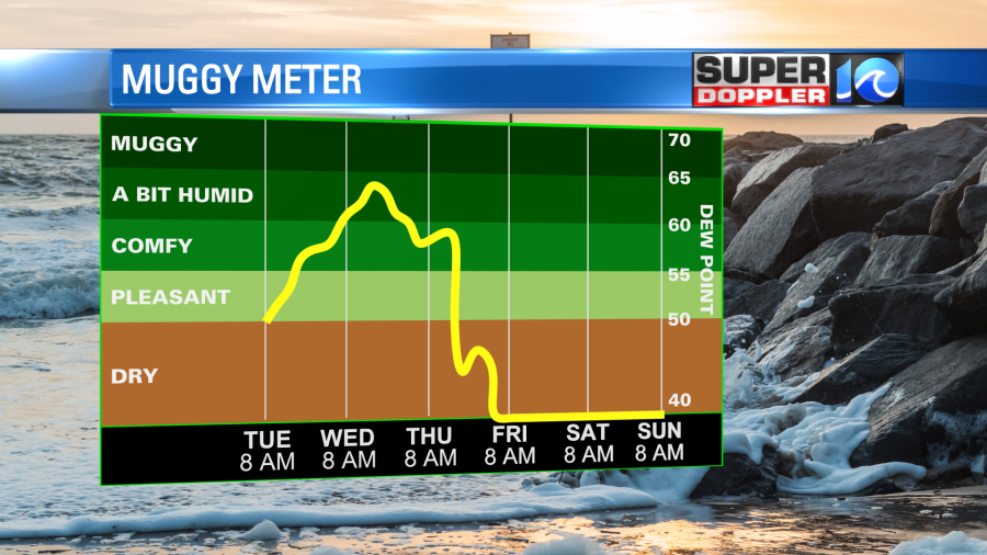
This will be some fuel for showers and a few thunderstorms. We’ll have a few showers in the morning through midday. However, scattered showers with a few storms will move in by the afternoon.
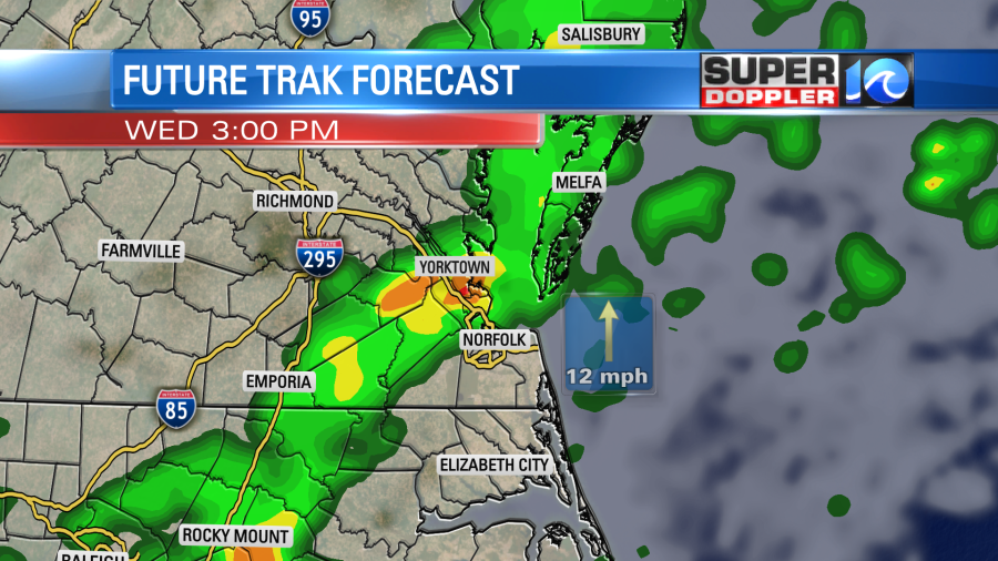
There could be a few heavy downpours along with some scattered gusty winds. However, I think the threat for hail and tornadoes will be limited.
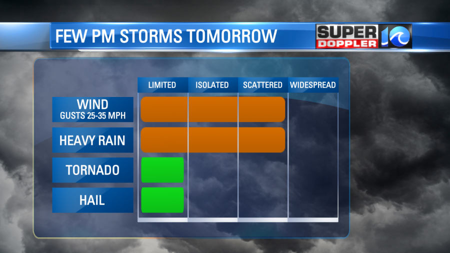
Scattered showers will continue into the evening and the overnight as the front slowly marches east. There will even be a few showers into Thursday morning. We’ll cool down a little on Thursday with high temps in the mid-upper 60s. We should dry out by the afternoon, and so it will become a pretty nice day. The even cooler air will arrive by next weekend. High temps will be in the low-mid 50s. It may be near 50 on one of the days. However, we are not going to return to the Arctic blast.
Meteorologist: Jeremy Wheeler


