Today we are going to heat up ahead of a cool front that is expected to slide through the region later this afternoon. This morning we had some isolated showers in the region. A couple were even heavy over the Outer Banks and Easter Shore. The front was to our northwest this morning, but it was sailing steadily to the southeast.
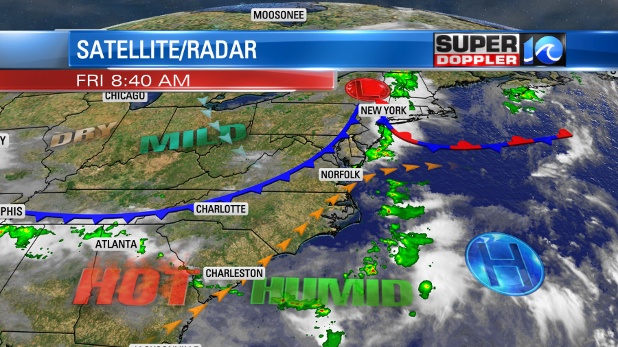
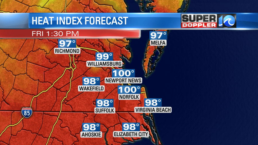
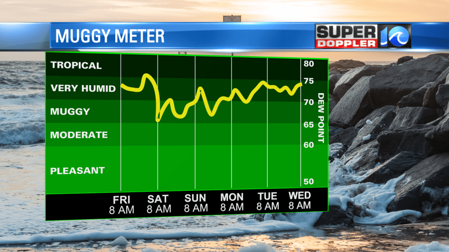
We’ll be partly cloudy with some isolated showers this morning. There will be enough sun to heat up the temps fast. We’ll rise up to the low-mid 90s during the afternoon. However, the heat index will rise to near 100.
Winds will be out of the southwest at 10mph. They will turn out of the northwest behind the front. As we get into the afternoon there will be some scattered showers and storms firing up.
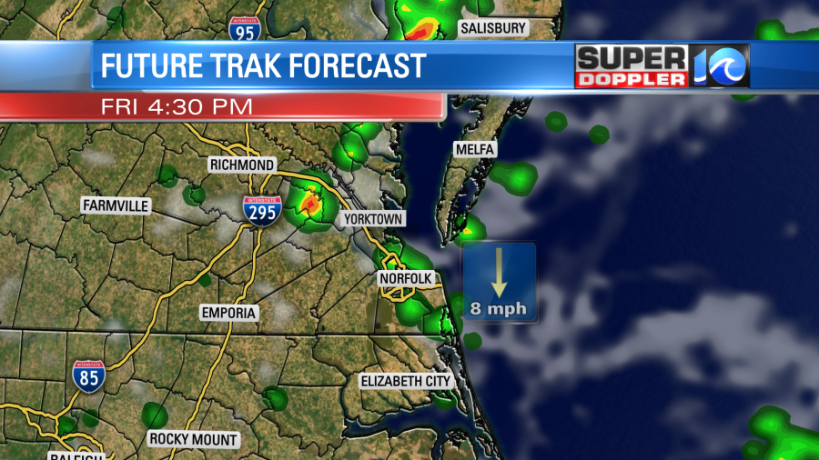
The coverage shouldn’t be huge, but there will be a potential for some isolated strong storms. Strong gusty winds will be possible in a few of the thunderstorms. There may be some isolated downpours as well. The scattered storms could continue through the evening commute, but things should settle down after about 7pm.
The weather will improve greatly for the weekend. We’ll cool down and dry out. High temps will drop to the mid-upper 80s. Humidity will also drop.
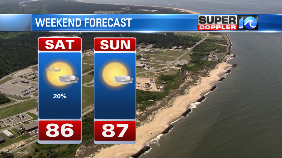
The front may briefly stall out to our south on Saturday. So there may be some isolated showers. However, the coverage should be low. Overall, the weekend looks great!
The rip current risk dropped to low today. However, it may go back up again Saturday and Sunday. Tropical storm Don is still out over the Mid-Atlantic. It has almost completed a full loop. It is now on on northwest track.
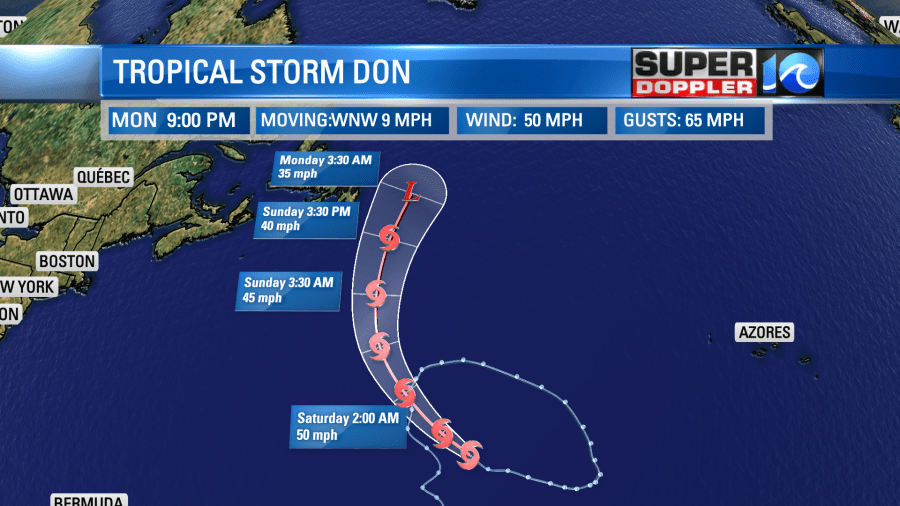
It should weaken over the cooler North Atlantic waters by early next. It may fall apart by that time. However, there is another tropical disturbance that is showing some signs of organization in the middle of the Atlantic. That one is moving west. It now has a medium chance of formation.
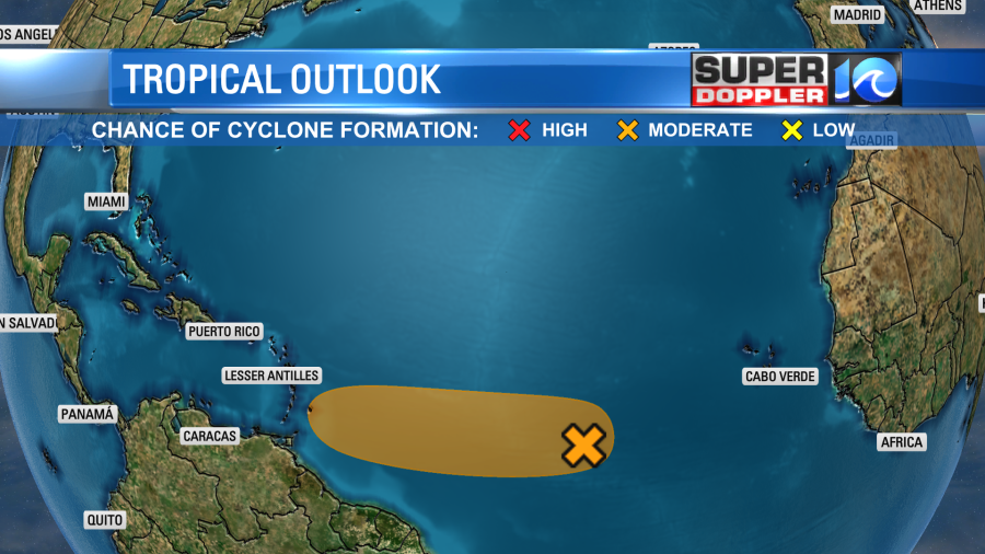
We’ll keep a close eye on it over the weekend as it will be rolling over some very warm water eventually.
Speaking of warm water… The El Nino weather pattern is still building in, but we are definitely past the threshold. The warming pattern in the Pacific Ocean is so large and powerful that is can help to increase the global temperature. However, this year’s El Nino is happening within the backdrop of one of the warmest years on record. This includes water temperatures that are running way above average. A recent article that got posted details this and even shows the difference between water temps during the powerful 1997 El Nino and this year’s. It is eye opening. Here is the article with more information: This year’s El Nino and past comparisons.
Meteorologist: Jeremy Wheeler