Over the weekend we had some nice weather. It was good for getting out to the parks, going to the beaches, or even doing some yard work. However, over the weekend the Super Doppler 10 Meteorologists were warning of heavy rain for this morning. So, as predicted, we started with heavy rain showers and thunderstorms.
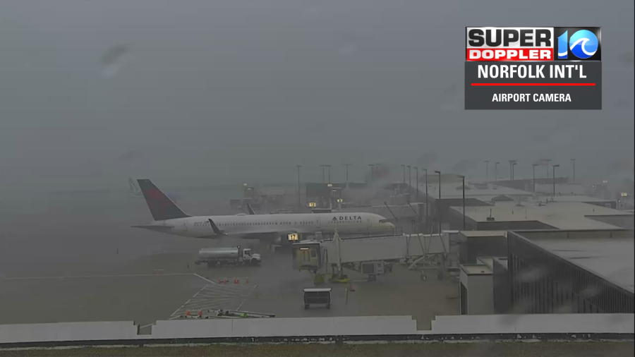
There were lots of downpours across the area with even some localized flooding.
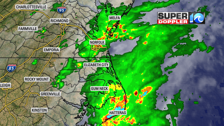
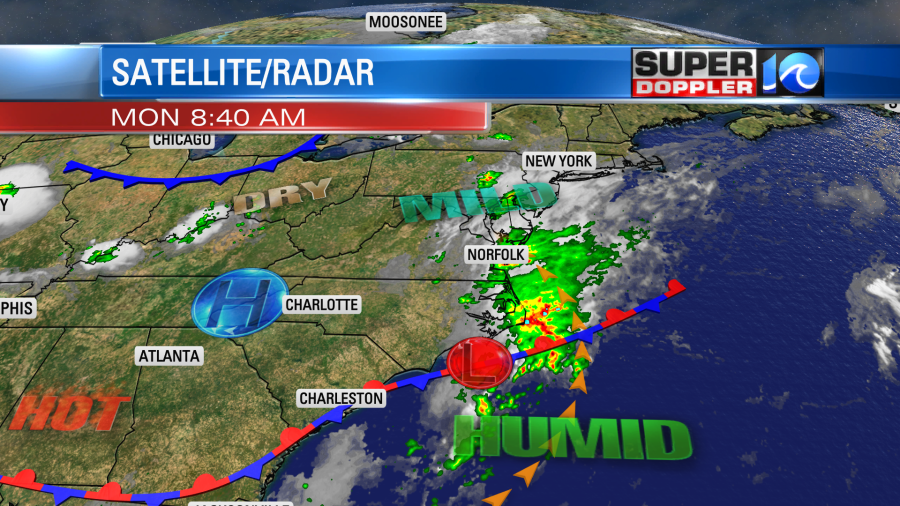
Since the weekend we’ve had a lot of moisture push up into the area from the southeast. Also, a weak area of low pressure is moving east along a stationary front. This is just to our south.
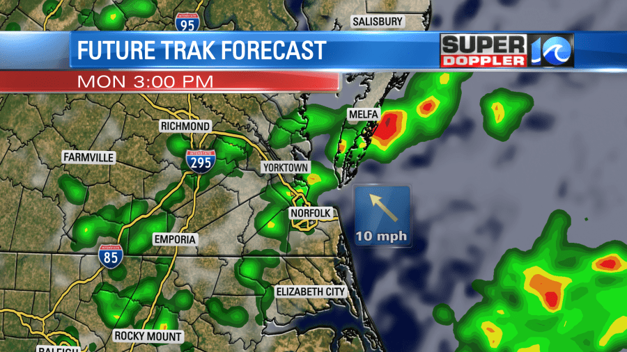
As we go into the afternoon the showers and storms should be more broken up. So they will become isolated to scattered. There could still be some spots of heavy rain, but it won’t be anything like this morning.
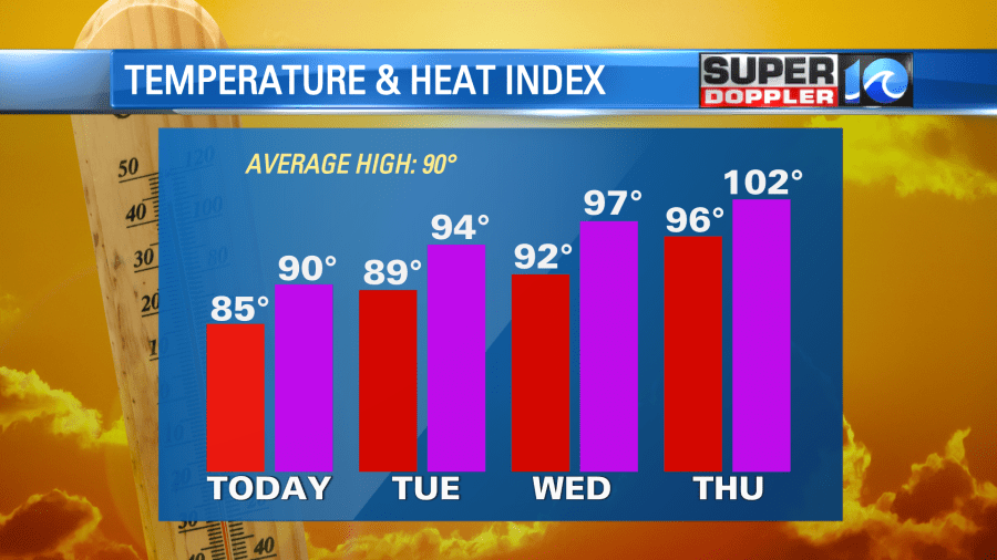
We’ll have a light southeast wind through the day. Plus, the sun will pop out some more during the afternoon. So high temps will aim for the mid 80s. However, the heat index will be near 90.
Tomorrow the low will swing out to sea, and high pressure will edge in from the west. So we’ll be partly cloudy with only some isolated showers or storms. High temps will climb to the upper 80s to near 90, but the heat index will be in the upper 90s. We’ll have quieter weather later this week, but the heat will increase even more. In fact…The heat index will probably be between 100 and 105 on Thursday and Friday.
I’ll talk more about that in tomorrow’s weather blog.
Meanwhile the tropics are quieting down. Don is pretty much no longer tropical. It is moving over the cooler waters of the north Atlantic, and it should fall apart soon.

The tropical disturbance that trailed across the Atlantic over the weekend now has a low chance of formation.
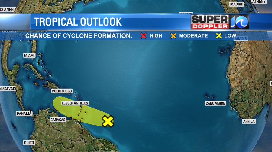
At one point it had a high threat of formation, but some dry air worked on it, and kept it from forming. I believe there was also a dry/Saharan dust layer that kept it from forming. There is some warm water near the Lesser Antilles. So we’ll see what happens in a couple of days.
Meteorologist: Jeremy Wheeler


