
Over the last 2 days we had warned people that there could be some heavy rain this morning during the AM commute. Sure enough…It happened. We not only had widespread rain with a few downpours. We also had a few thunderstorms.
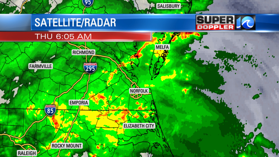
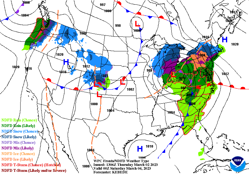
This came from a combo of a surface warm front, an upper level disturbance, and lots of moisture in the region.
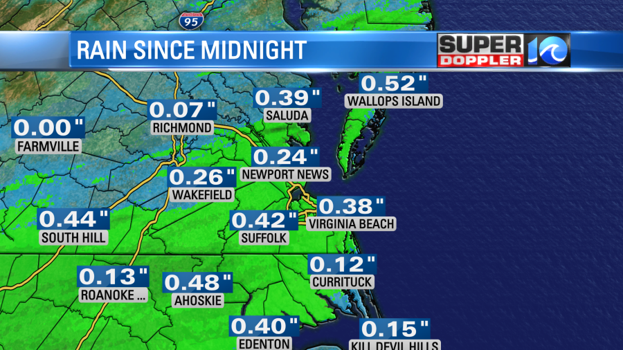
So far we’ve picked up about a quarter to a half an inch of rain. Some spots had a little more.
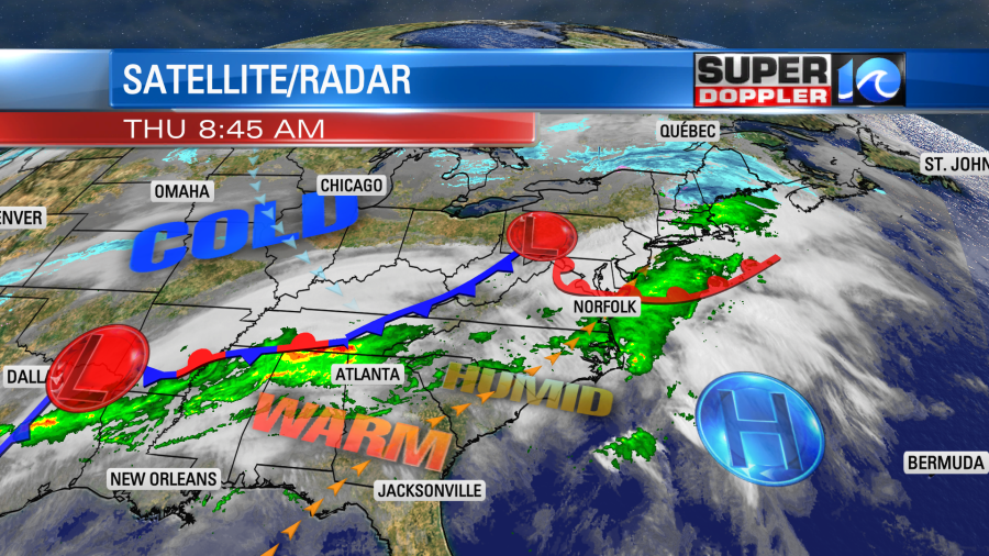
The warm front will lift to our north today, and the upper level disturbance will kick out by midday. So we’ll have some decent weather for the second half of the day. High temps will warm to near 70 degrees, and we’ll have a light southwest wind. The only bummer is that we’ll still have a high amount of clouds this afternoon and evening.
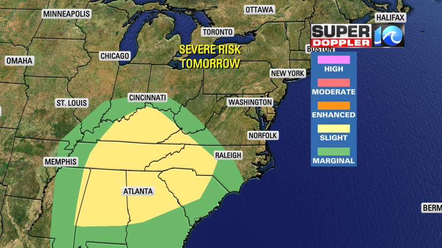
While we quiet down the weather here, things will become very active to our west. A quickly strengthening area of low pressure over the Plains will create a large unstable air mass with some broad spin. This will create an atmosphere that is conducive to tornado formation. Hence there is a moderate risk for severe weather between Texas, Louisiana, and Arkansas.
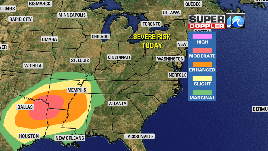
There could be some strong tornadoes out there between the afternoon and evening. Tomorrow the low will move northeast from the Tennessee River Valley to the Ohio River Valley. A cold front will roll over the Southeast, and that will create a few more strong to severe storms.
We will have a stalled out front to our south.
The front will work north as a warm front. However, it may not make it through Hampton Roads before the cold front sweeps east. For now I have high temps in the upper 50s to near 60 degrees. It could get a little warmer or stay a little cooler. Part of that will depend on the front, and part it will also depend on how long the rain falls. Rain is likely in the morning through midday.
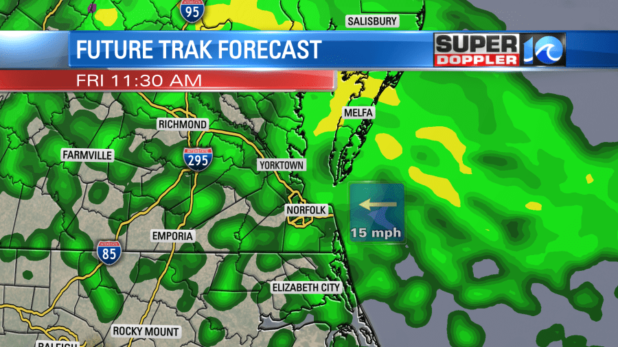
Showers will become more scattered during the afternoon. We will have a northeast breeze with gusts to 25mph. The last of the rain will arrive Friday evening. Then we’ll dry out. Then we are looking at a nice weekend for a change. BOTH days look good this time! We’ll be partly cloudy Saturday and Sunday. High temps will be in the upper 60s on Saturday. We’ll be in the upper 50s on Sunday. Nice!
Meteorologist: Jeremy Wheeler