We started this morning with quiet weather. However, it was warm, muggy, and hazy.
That haze was pretty far overhead, but it created some filtered sunshine over the region.

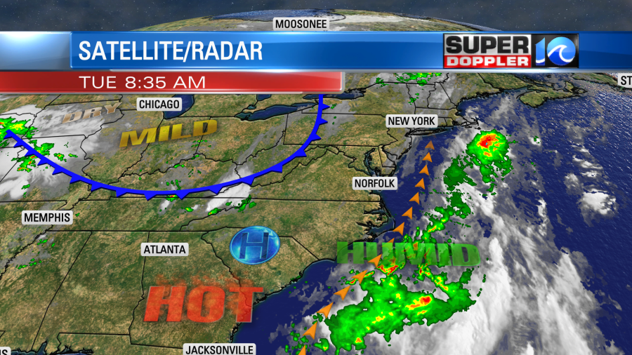
We’ll be partly cloudy today with that haze overhead. It is from the wildfires in eastern Canada. Yes…They are still burning. Our air quality at the surface is mostly moderate (which isn’t too bad).

It is worse towards D.C. and Raleigh/Durham. As far as weather features go, there is a stationary front near the area that is falling apart. There is a cool front over the Appalachians that is slowly pushing our way.
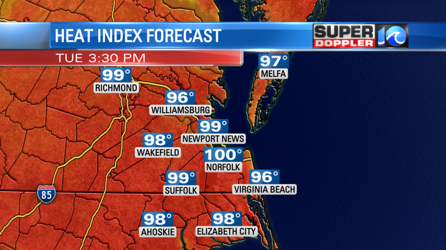
Today we’ll have pretty quiet weather, but will be hot. High temps will aim for the mid 90s.
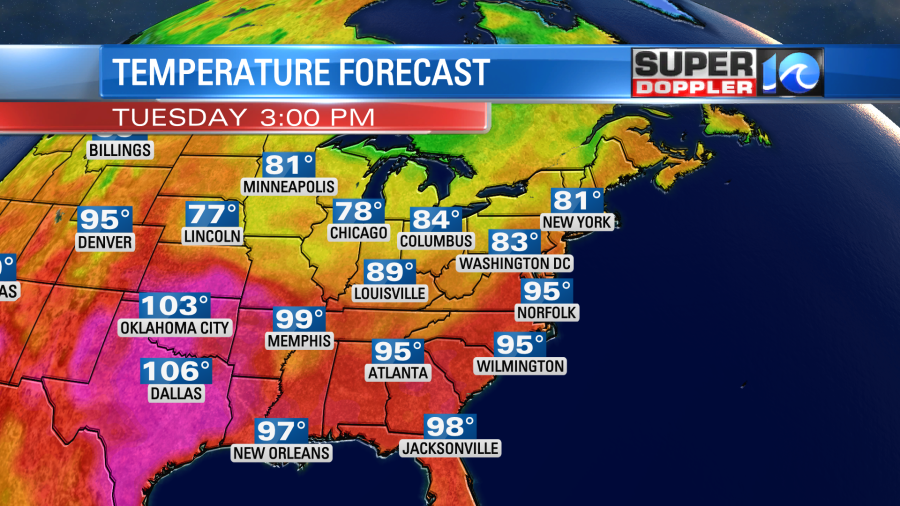
If the haze stays thick then we may wind up in the low-mid 90s. Regardless, it will feel like it’s in the upper 90s to near 100 this afternoon.
We’ll be partly cloudy with isolated afternoon showers and storms.
Tomorrow, the cool front will move-in and stall-out over the north edge of the viewing area. We’ll have a mix of sun and clouds. There may be some spotty showers in the morning, but we’ll have scattered showers and storms in the afternoon. There may be some pretty decent coverage for a time.

There could also be some heavy downpours. This will continue into the early evening. High temps should come down a few degrees. They will aim for the low 90s, but they may even be in the upper 80s if the rain starts up early. However, with the high humidity tomorrow it will feel like the upper 90s.
We’ll have a few showers and storms nearby on Thursday. Highs will be in the 90s. We’ll be partly cloudy on Friday with isolated PM showers or storms. High temps could rise to the mid 90s again. Then we should be able to cool down to the 80s over the weekend. That will be as a cool front slowly drifts through the area.
We have had some waves and a moderate threat for rip currents for the past 24 hours. That will continue today. This is likely to tropical storm Don. It is in the middle of the Atlantic.

This cyclone is forecast to continue on a clockwise loop. It should stay out to sea.

It will probably bring us some more nice surf. We’ll keep an eye it over the next few days.
Finally, there is a new model that the National Hurricane Center is using. It is called the HAFS model (Hurricane Analysis and Forecast Model). It uses the same construct as the GFS model (FV-3). It has a traveling hi-resolution grid that follows the storm within the larger grid. It is also a coupled-ocean model. It will run in parallel with the HMON and HWRF models this year. Eventually, it will take over as the main NHC model. From the sound of it, it looks very promising. Here is the article with more information: New NHC forecast model.
Meteorologist: Jeremy Wheeler