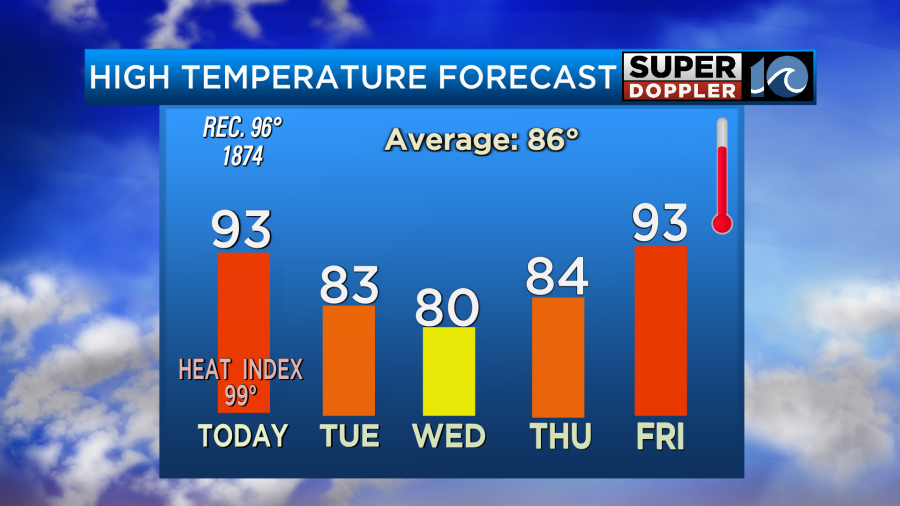
We are coming off of a very nice weekend. The air was mild and dry on Saturday with fair skies. Then yesterday, it heated up. But the humidity still wasn’t too bad. My family and I took advantage and went to the pool. It was nice! Today will be a bit hotter and more humid. Temps are going to aim for the low-mid 90s.
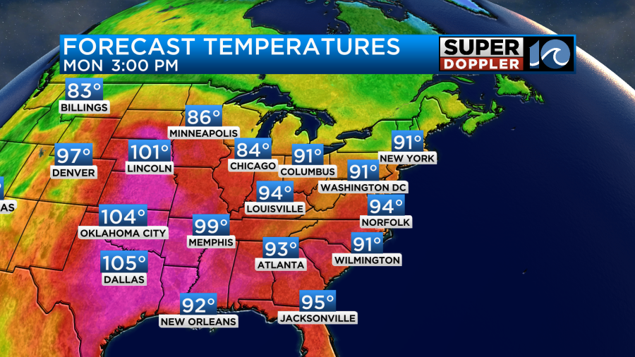
However, the heat index will be in the upper 90s to near 100.
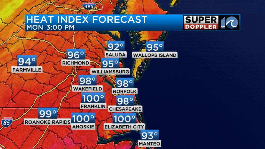
There are no Heat Advisories today. We have a stationary front falling apart nearby. There is a cold front over the Ohio River Valley.
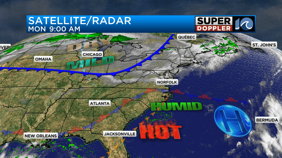
We’ll have partly cloudy skies through the day. Winds will be light out of the southwest and then north.
Tomorrow the front will slide through the region. However, we are not expecting rain with it. Some cooler/drier air will blow into the area. We’ll have a north/northeast breeze running at 10-15mph with gusts to 20mph. High temps will be knocked down to the low-mid 80s.
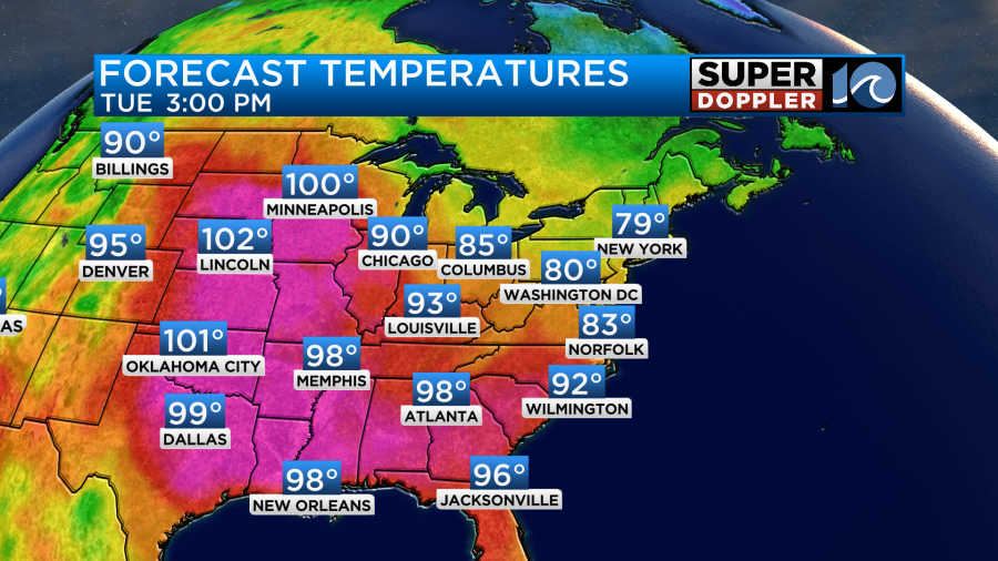
We’ll be cooler here while they heat up to near 100 in Minneapolis. It won’t just be cooler here. The humidity will also drop through the day.
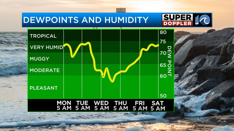
We’ll be dry and mild on Wednesday with high temps near 80 degrees. It will feel great! We’ll continue with the dry/mild weather on Thursday, but the heat and humidity will briefly spike again on Friday.
The tropics are heating up, but Hillary is finally falling apart over the southwestern U.S. Hillary has become post-tropical, and it is now pretty much just a rainmaker.
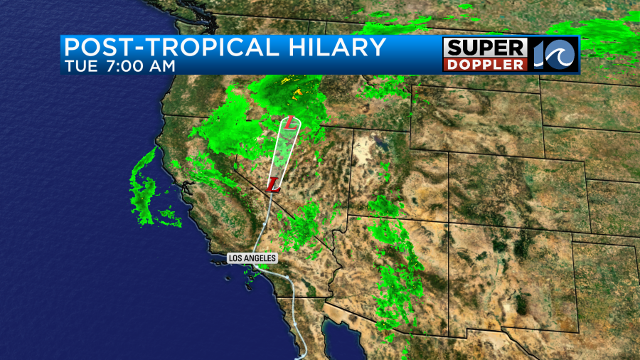
However, it has left a lot of flooding and some wind damage in its wake.
Meanwhile, things have heated up in the Atlantic. Over the weekend not 1, not 2, but 3 tropical storms had formed.
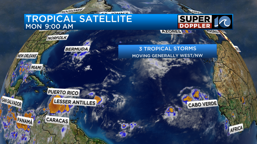
None of these will directly affect the United States, but one will affect some of the Caribbean islands. That is tropical storm Franklin.
The shortest-lived system will be Gert. It is in the central/western Atlantic, and it is forecast to fall apart very soon as it encounters some dry air and increasing wind shear.
At the same time tropical storm Emily will work its way northwest then north. It will likely remain a tropical storm. It will stay out to sea.
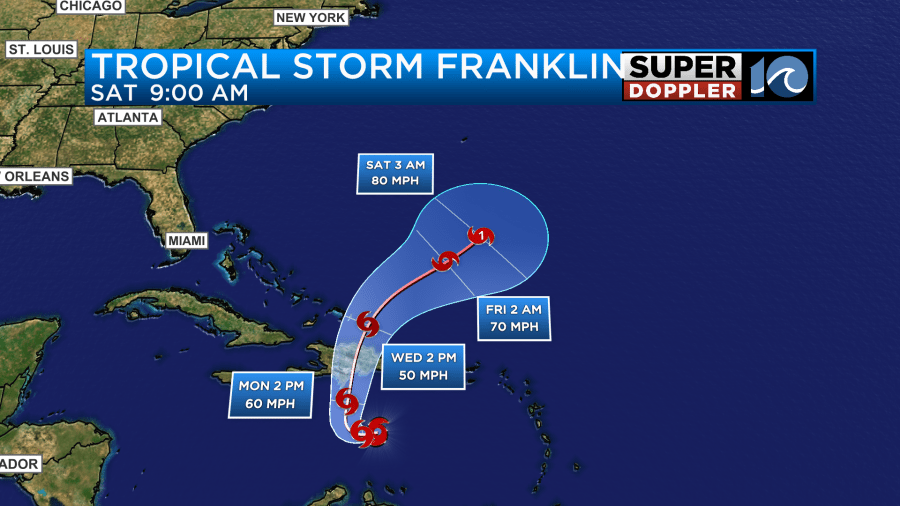
Franklin has gained some strength recently, and it will likely maintain that strength as it moves west then north over the next couple of days.
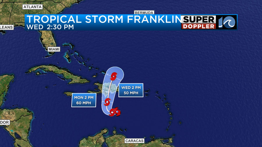
The system is forecast to cross the Dominican Republic Wednesday morning. It will bring some heavy rain and gusty winds to the island of Hispaniola. Then it is expected to turn to the northeast. At that point it will be moving over some warm water. So it may even strengthen to hurricane strength in a few days.
All of these systems will likely bring us some higher waves. That is great news for the ECSC surf competition this week. However, it would also mean that our rip current threat would increase.
There are also 2 more zones that have a high chance of formation.
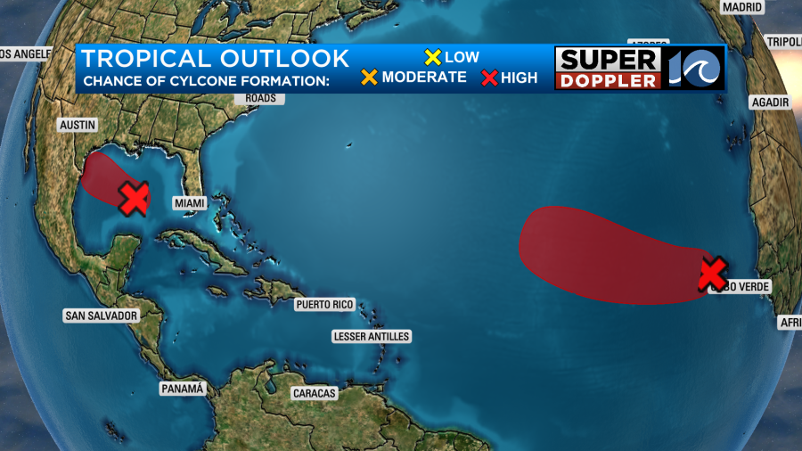
The one in the Gulf of Mexico could develop and hit south Texas. We’ll have updates on all of this throughout the day.
Meteorologist: Jeremy Wheeler