Lots of folks are ready for a break from the heat and humidity. Even if they like the heat, I think many are ready for a break from the Summer steam. So today will be the apex for the mugginess. Then tomorrow we’ll start a general slide into the weekend.
Today we have a warm front and and area of low pressure offshore. Both of them are lifting north. There is a cool front over the Midwest that is steadily heading in our direction. High pressure is to the southwest.

We’ll be partly cloudy today with a light southwest wind. There won’t be much rain during the day. There will only be some isolated showers and storms. So high temps will heat up to near 90 this afternoon with some low-mid 90s inland. The heat index will rise to the mid-upper 90s.
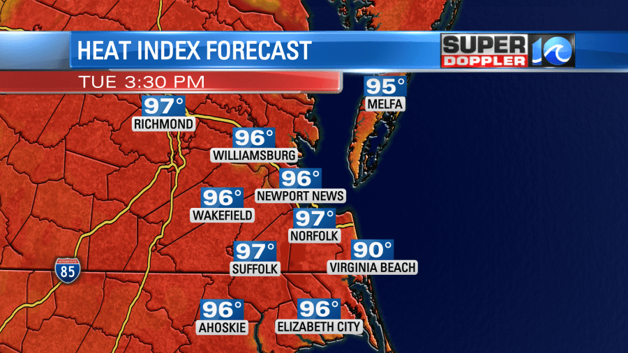
We won’t be breaking any records, but it will be a few degrees above average. Still…the A.C.s will be humming. By later this evening a line of showers and storms will work there way into our region ahead of the front. Earlier our Future Trak model had scattered showers and storms overnight with some heavy rain. The mid-morning update came out, and dissolved a lot of the rain.
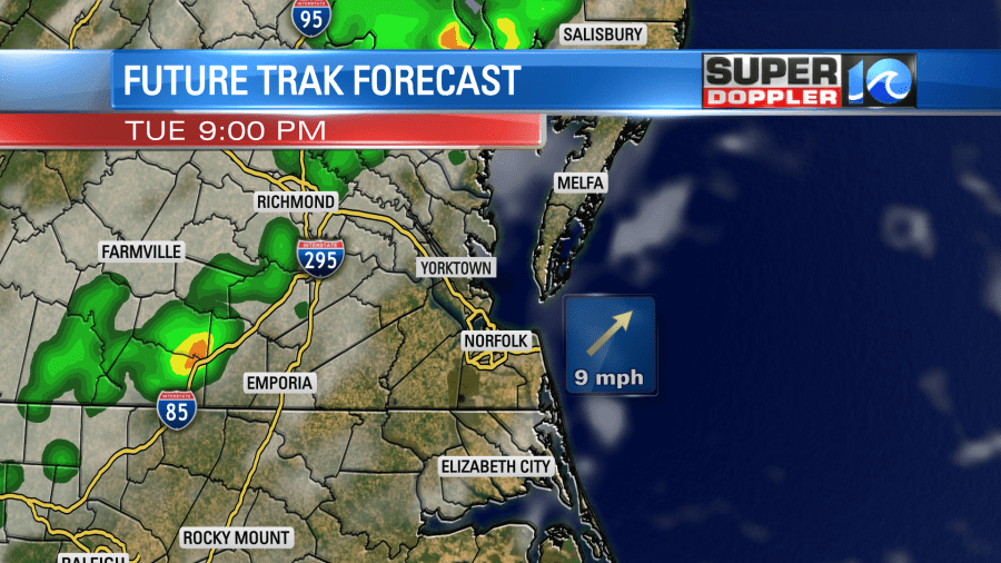
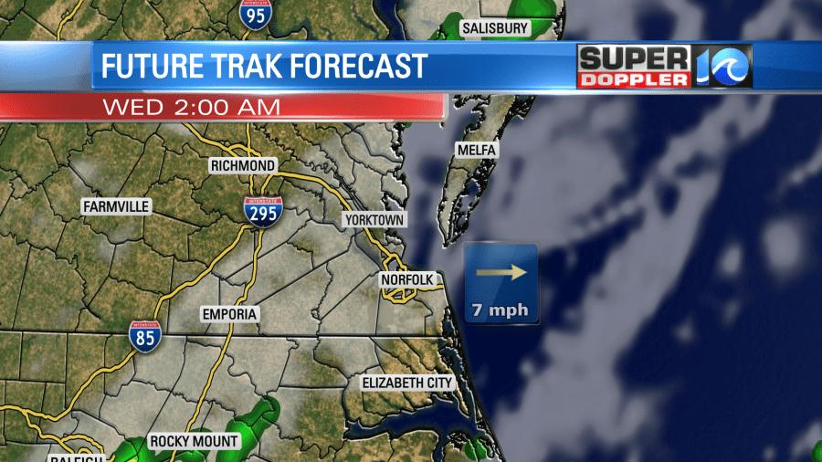
I am going to split the difference. I think we’ll have at least a few showers and storms overnight, and I think a few heavier downpours will be possible. The hi-resolution NAM model still has some scattered storms overnight. A handful of these will continue into early tomorrow morning.
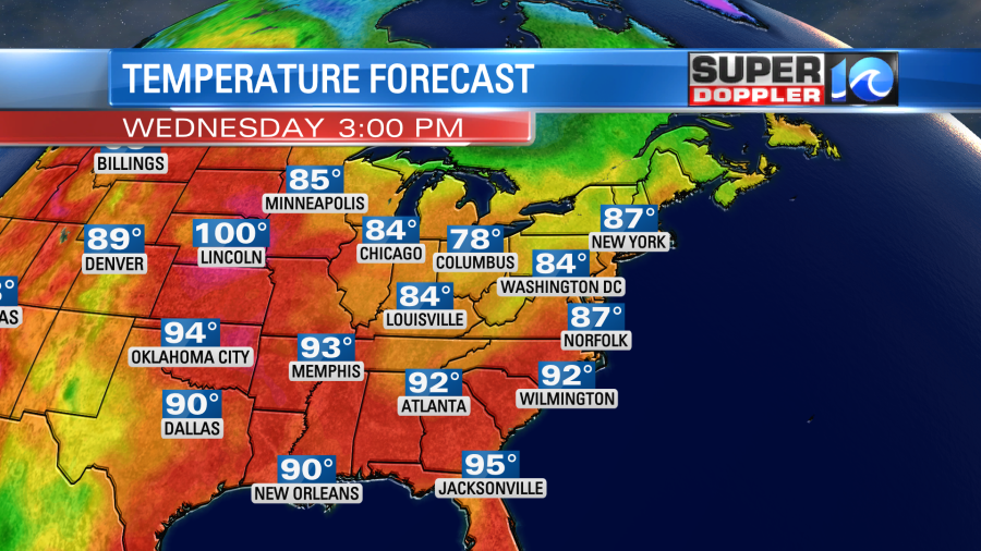
Then we’ll slowly dry out through the day. We’ll have some gradual clearing. High temps will only drop a little as we should have a good amount of sunshine in the region. Plus, the north/northwest wind won’t be too strong. High temps will be in the upper 80s.
We’ll dry out and cool down a little more Thursday into Friday. High temps will be in the low-mid 80s. Dew points will be in the 60s and even 50s for a time.
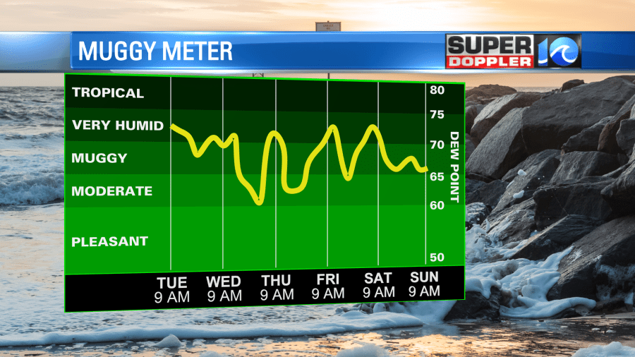
We’ll have more quiet weather Saturday and Sunday. High temps will stay in the low-mid 80s.
The tropics are picking up slowly. There is one tropical disturbance in the eastern Atlantic that has a medium chance of formation over the next few days.

If this does form, then it would likely stay out to sea. However, the disturbance in the middle of the Atlantic is moving to the west/northwest. That one has a high chance of formation over the next 3-5 days.

The models generally have it moving to the northwest, forming into a weak system, then moving more to the north.
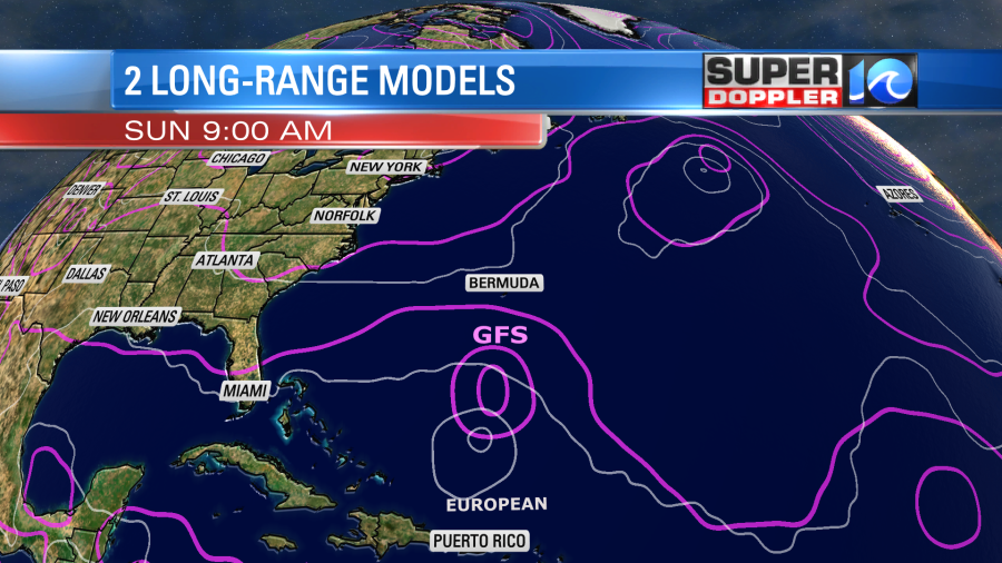

Some of the models still do have it moving a little closer to the east coast. So we’ll have to watch it closely. Even if it moves offshore, then it could create a high threat for rip currents at the local beaches.
Stay tuned for updates.
Finally, I saw a scary headline about some recent weather on the other side of the world. Apparently, over 1,000 people have died from some terrible flooding in Pakistan. At least 30 million people have been impacted. These floods were caused by monsoon rains that have been creating historic flooding since June. Here is the article with more information: Deadly flooding in Pakistan.
Meteorologist: Jeremy Wheeler