The rain is moving in to Hampton Roads, and this is part of the outer reach of Category 2 Hurricane Dorian. The National Hurricane Center said in its 2 a.m. update Friday morning that Dorian was a Category 1 hurricane with sustained winds around 90 mph, and was expected to weaken further. Dorian was located about 30 miles south, southwest of Cape Lookout, North Carolina.
Here are a few things you can do tonight ahead of the storm:
- Charge your smartphone, we may lose power tomorrow
- Gas up the generator
- Move your car! Tidal Flooding is expected to be a major issue Friday afternoon. (Here is where you can park for free)
- Secure your stuff! Anything outside that is loose may blow around or away.
The wind will increase tonight and during the morning tomorrow.
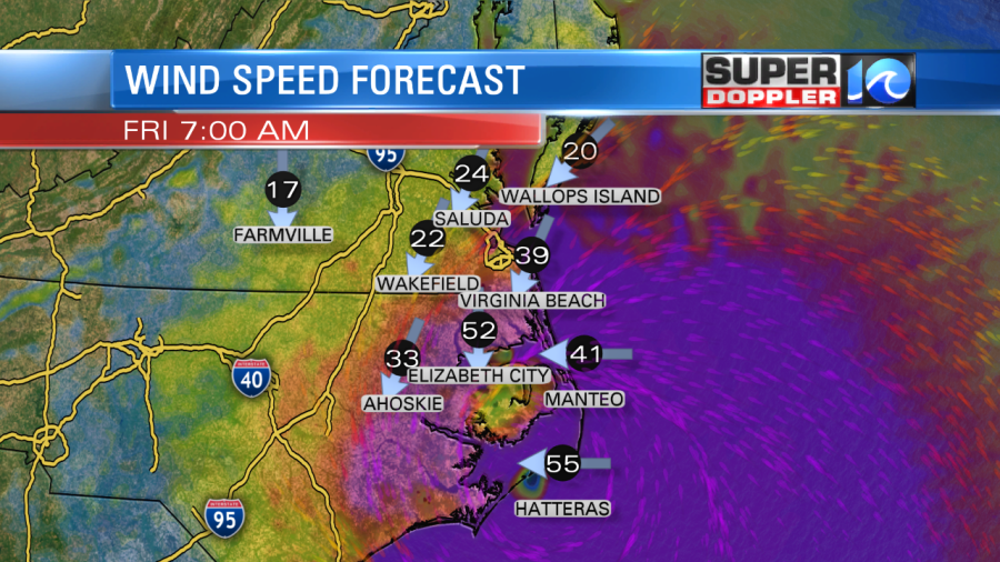
Morning Winds 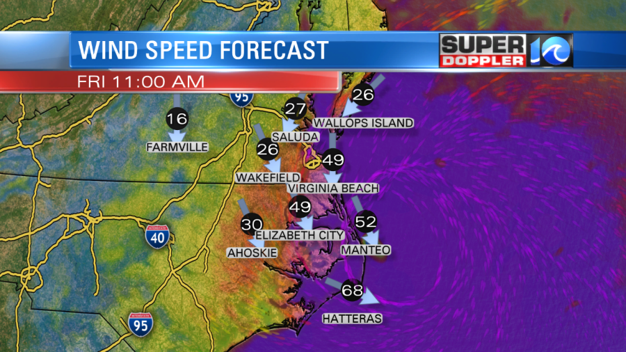
Midday Wind Speeds 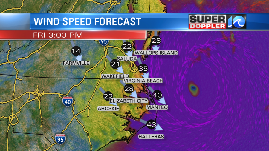
Afternoon Wind Speeds
Here are some of the impacts that we will see during Dorian:
- Southside Cities Friday 6 AM – 5 PM
- 6″-8″ of rainfall SE VA Beach, 4″-6″ North
- Wind: Ocean, 65-75 mph | Bay, 55-65 mph | Inland, 45-55 mph
- Peninsula, E. Shore and Inland Friday 7 AM – 5 PM
- Rain, 2″ north – 6″ south
- Wind: Bay 45-55 mph | 35-45 Inland & North
- Outer Banks Tonight – Friday 5 PM
- Rain: 6″-10″ North/West, 4″-7″ OBX
- Wind: 65 mph North | 85-100 mph South
- Mainland N.C. Friday 3 AM – Fri 6 PM
- Rain: 6-10″ East, 2-6″ West
- Wind: 65 East, 45 West
Major Tidal flooding is also expected to arrive with the storm.
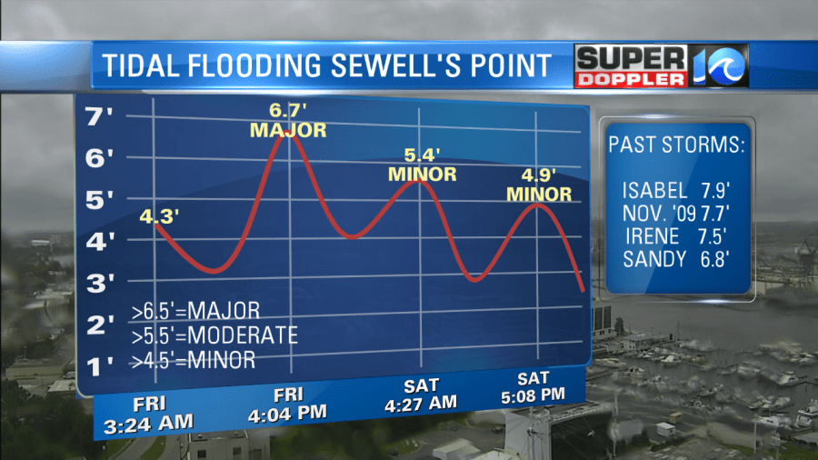
By 4-5 pm Friday, the rain will begin to taper off, the wind will move offshore and decrease in speed, and the high tide will be the only problem we will have to deal with. This is why I recommend you to move your car if you are in an area that sees tidal flooding.
We are going to be on air starting at 4 a.m. Friday morning and will likely be on air all day and ending tomorrow evening. We will keep you updated with the latest. Follow me on Twitter and Facebook so you can send in your weather reports. Stay safe!
Meteorologist Jeff Edmondson