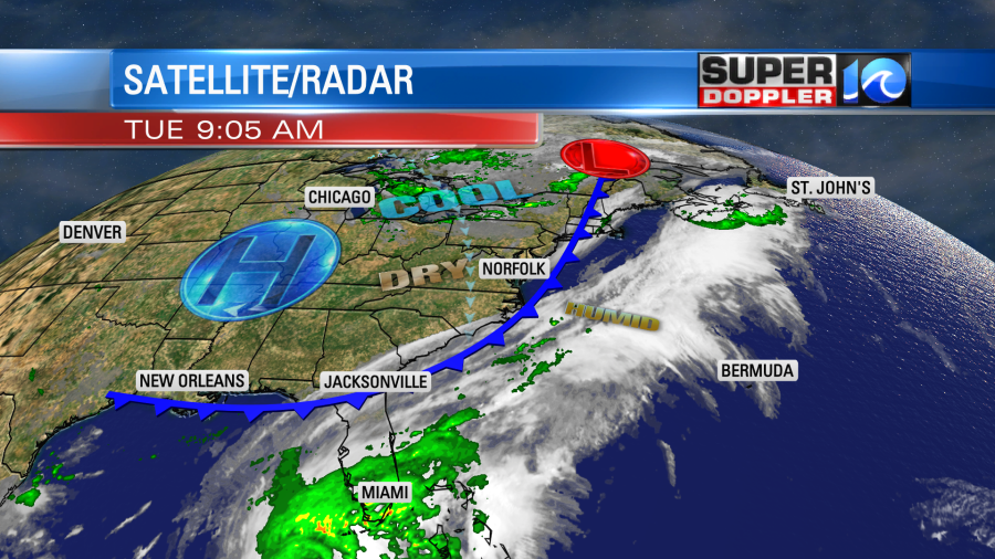
The local weather over the next couple of days will be very nice! A strong cold front is now sinking farther to the south, and high pressure is building into the region.
We’ll have lots of sunshine today with a light north wind. High temps will be in the upper 70s.
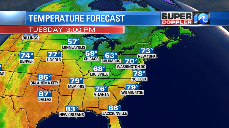
It will feel great as the dew points are dropping from the 50s to the 40s. We’ll be even cooler tomorrow. High temps will be near 70 with partly cloudy skies. We’ll have similar weather on Thursday.
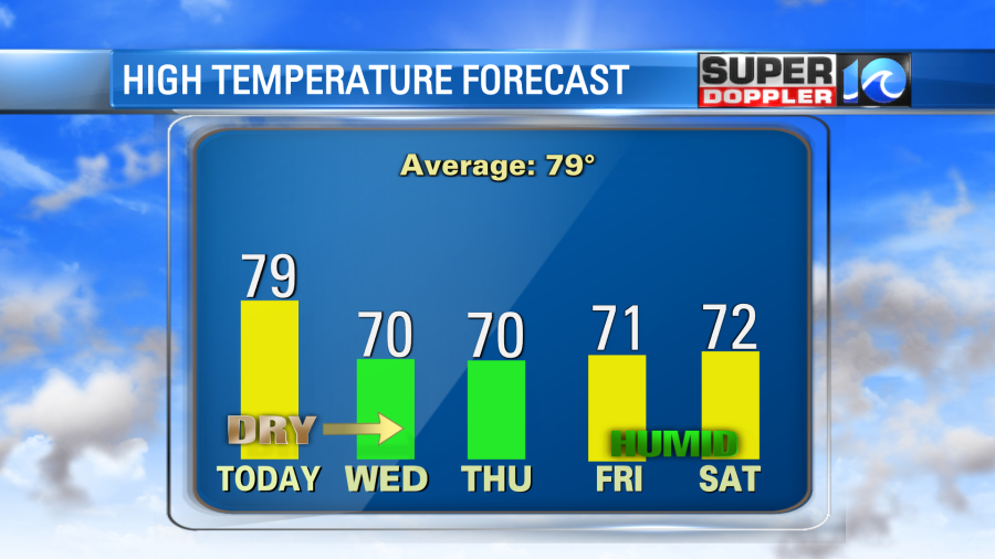
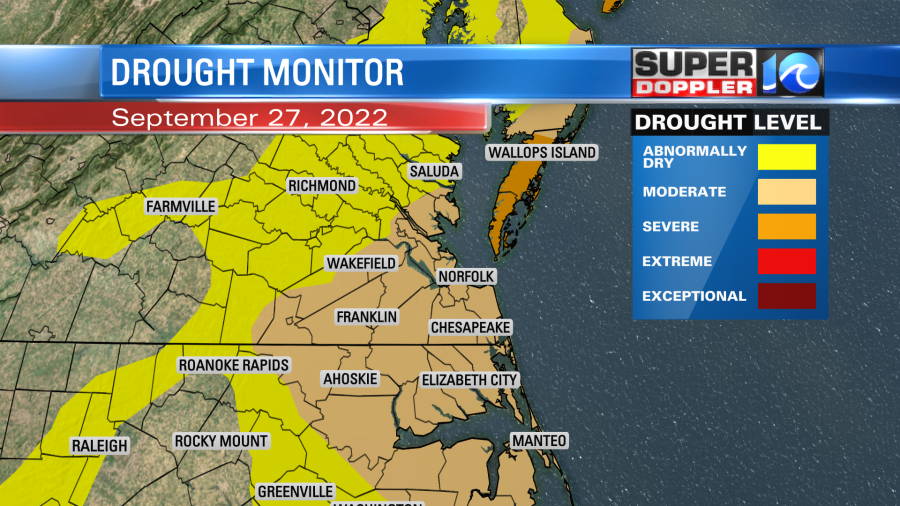
By Friday we’ll have increasing clouds with a few pm showers. Then the rain will be moving in. As of this time the Friday night, Saturday, and Sunday forecasts look very wet. The moisture and rain from Ian will travel north and run into a cool/dry airmass at the surface. That overunning of the warmer/more humid air will cause a lot of the rainfall. This could be a really good thing for us in terms of the ongoing drought.
So that transitions us to hurricane Ian. Ian made landfall over western Cuba this morning around 4:30am. It is beginning to move north of the island this morning.

The hurricane moved over Cuba with category 3 winds. We’ll likely get the damage reports from there once things clear up there and people can get out to assess the damage.
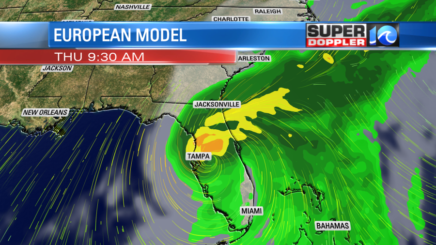
So today everyone in western Florida is preparing for the storm. The latest track has Ian moving north/northeast over the next 24-48 hours. Through that time Ian is forecast to strengthen to a category 4 storm. It may weaken slightly by Wednesday night down to a 3.
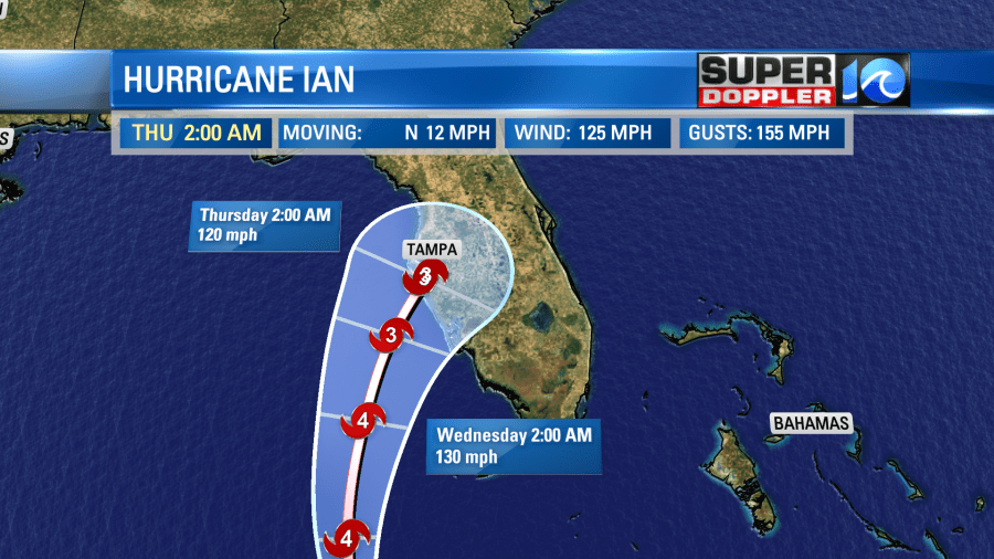
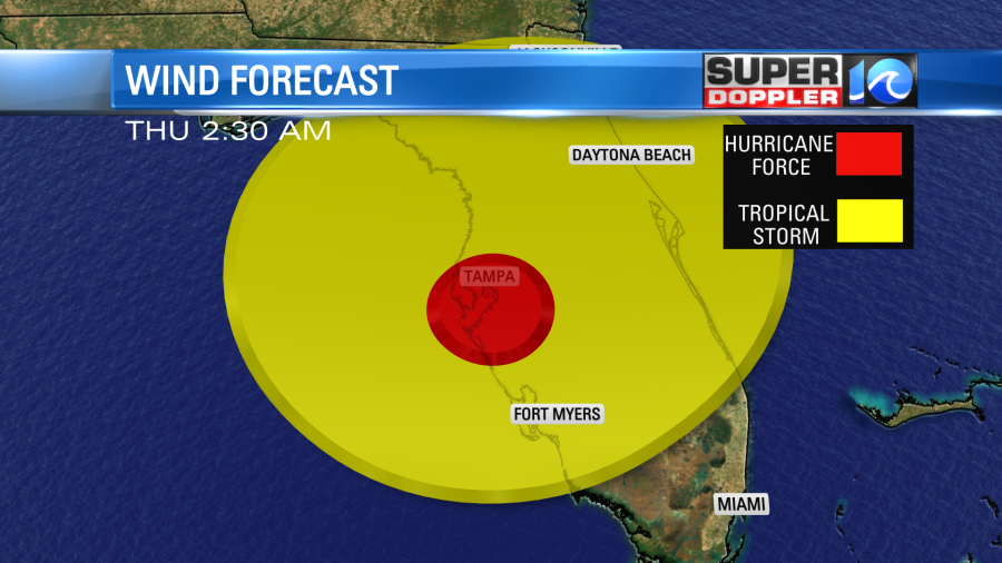
Regardless, the hurricane will be aiming for an area between Ft. Myers and Tampa. This will be late Wednesday night into early Thursday morning. Hurricane force winds will cover a sizable area.
It is forecast to be a category 3 upon landfall. If you read the weather blog from yesterday you can see that if the hurricane were to hook east, then it would be stronger. The more north and northwest it traveled, then the weaker it would be at landfall. (of course in a different location). This would be due to a longer time of interaction between Ian and the cold front. Plus, there would be more time for the wind shear to work on the system. So it’s bad news that the models and the forecast have trended east.
The latest official track looks like it will pass just north of hurricane Charley’s path.
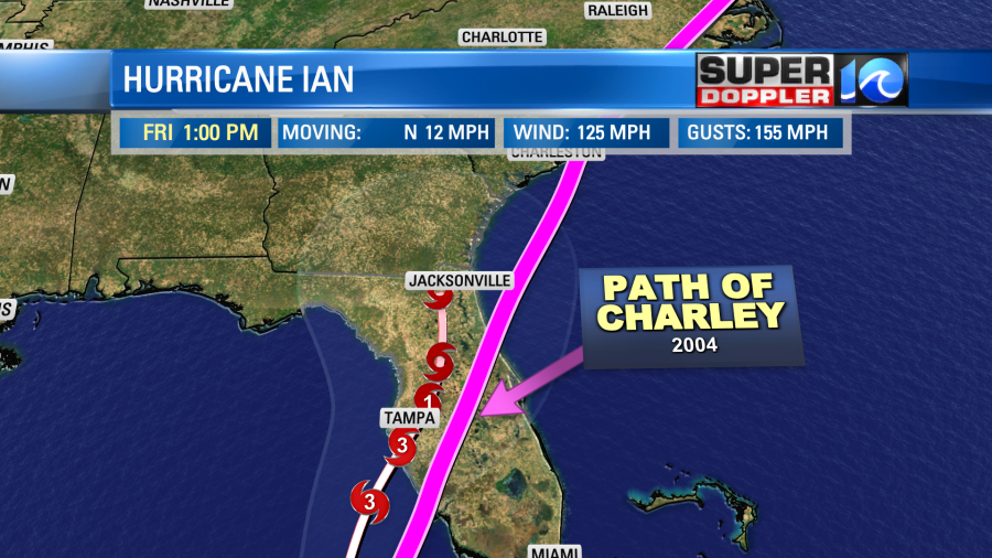
The damage along Charley’s path was extreme. They did have a lot of damage from Charley down in Tampa, but it could have been much worse. This could be that worse-case scenario. At least in terms of damage. Charley did have a smaller center compared to the forecast for Ian.
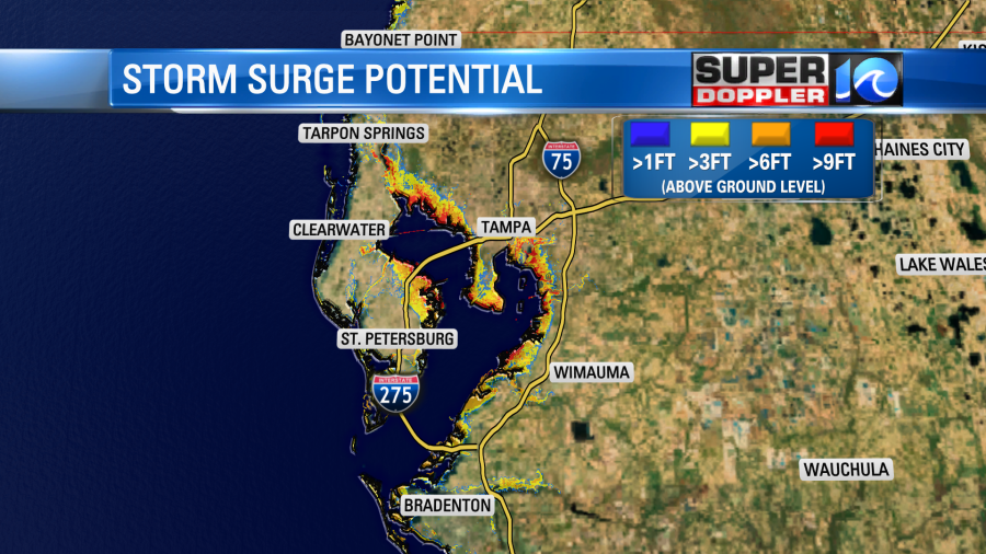
The wind will be very destructive down that way, but the storm surge will also cause many problems. Some of the surge down there will be between 6-9 ft. Some locations could be 10 ft or higher.
The forecast calls for Ian to weaken as it moves north. The cooler/drier air will work into the system. Also it will be cut off from the water.
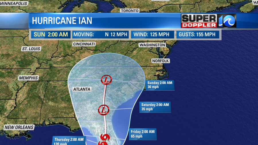
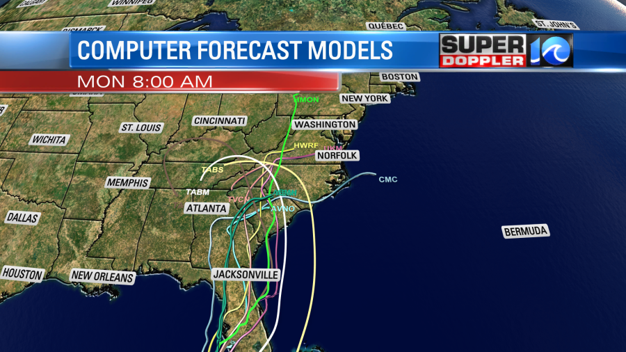
There is a low chance that it could move more to the east over the Atlantic. The system could become post-tropical by the late weekend. The GFS and European models are in good agreement as to the track over the next couple of days.
Then they split as it get into the 3-5 day period.
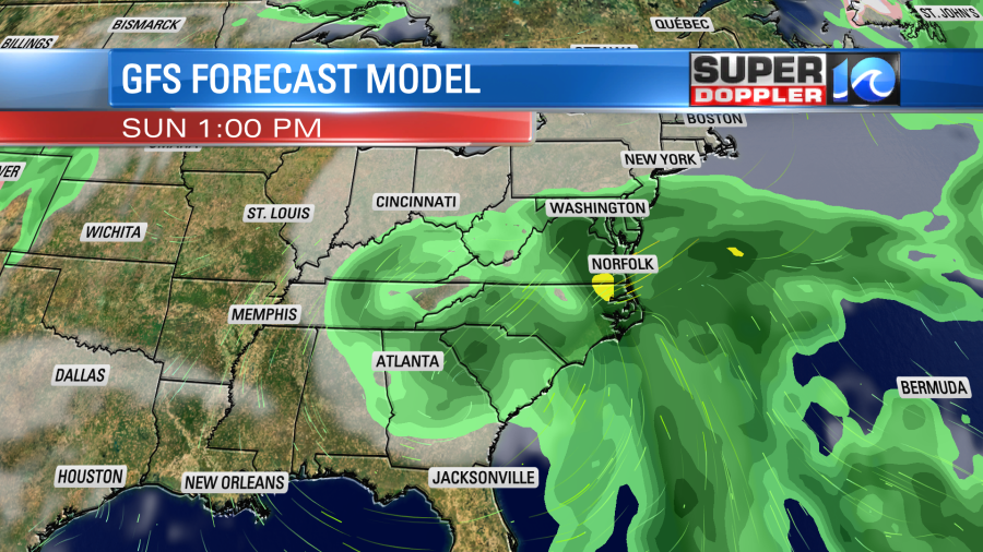
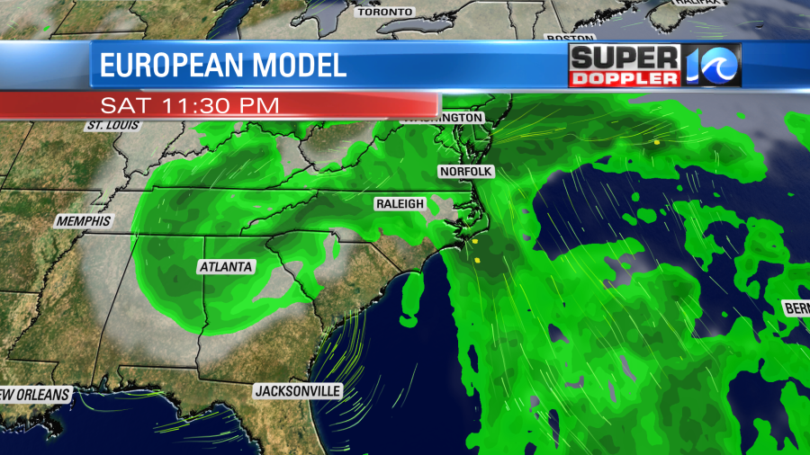
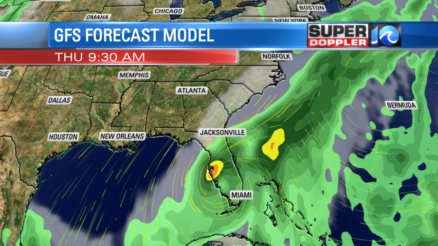
The European model basically has the system falling apart while the GFS has a very weak/broad low. However, the trend is the same. They have Ian moving northward and weakening, and they both have the rain spreading northeast away from the storm.
So the rainfall will be huge down towards Tampa. This is due partly to the slower motion. It could add up to 15-20 inches there. The good news for us is that we could see a few inches up here.

This rain would be spread out over a couple of days. Remember, we are in a moderate to severe drought, and it is only getting worse. A lot of the initial rain will soak right in or runoff.
The European model also has a decent amount of rain over the region.

There may be some isolated flooding, but it will take a lot of rain to raise our streams to flooding levels. Also, keep in mind that lately the models have advertised several rainy forecasts, but they have come up dry. This won’t be that case (most likely), but the amounts may come down as we get closer to the weekend. Stay tuned for updates.
Meteorologist: Jeremy Wheeler