This month has been filled with plenty of rain, more than we need. And now another form of rain will cause plenty of problems across the state. As temperatures hover around 32 degrees, freezing rain has been coming down this morning. The changeover between freezing rain and rain is across our area.
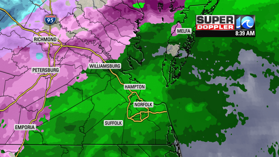
Reports so far this morning have shown northern James City County is seeing some ice accumulation on branches and surfaces but roads so far have been okay in JCC. Northwest of Williamsburg could see dangerous travel conditions.
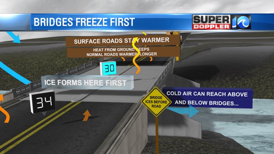
Remember bridges and overpasses freeze before roads, so drive slower if you have to drive today. I would advise against it especially the more NW you are.
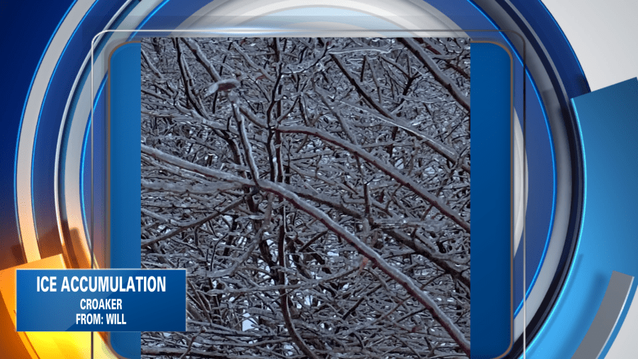
Here’s a photo sent in from Will in Croaker, JCC. Ice has accumulated on branches, and this becomes rather heavy.
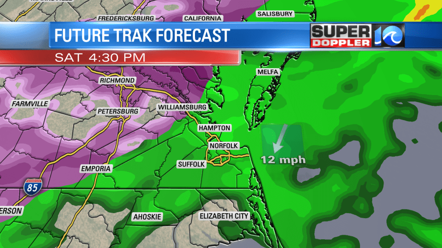
Rain/ freezing rain will continue through this afternoon, tapering in the evening. But it will be very tricky to say exactly where that changeover will be. Be cautious!
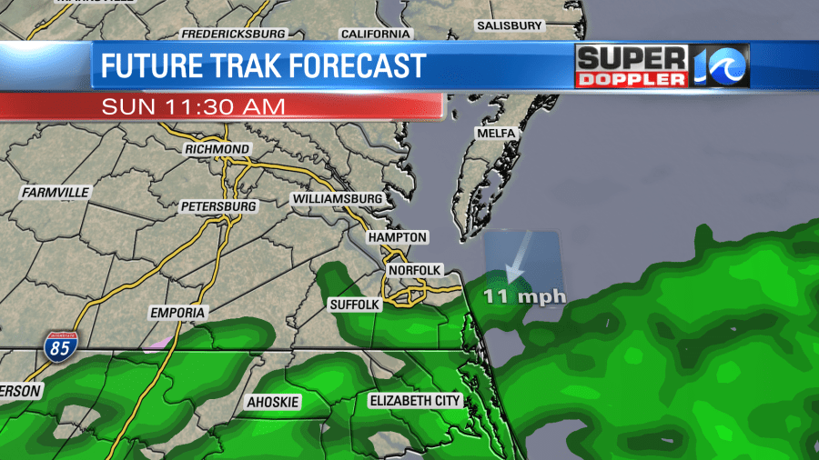
Sick of the rain yet? Yeah, me too. Unfortunately, still more to come by Sunday. The morning will be dry with an overcast sky but the rain moves back in through the afternoon. Ugh!
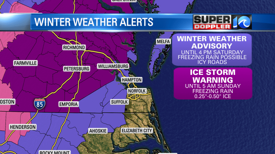
Here’s a look at the alerts in place from the NWS in Wakefield. This is the first time they have used the Ice Storm Warning! It’ll be a nightmare for much of central Virginia.
It’s better to stay inside this weekend! Enjoy Valentine’s Day with the rain falling down outside.
-Meteorologist Casey Lehecka


