This morning Idalia was running as forecast. It was located just south of Wilmington, NC around 5 a.m..
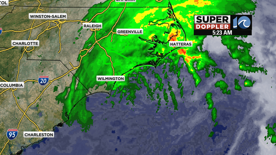
It is on a northeast track, and that keeps the center south of Hatteras by about 50-100 miles.

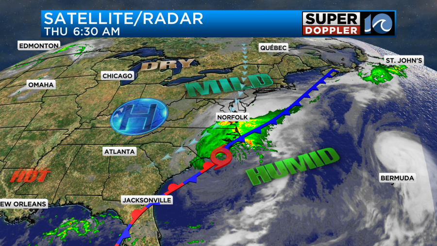
However, the rain and wind have been able to reach far to the north of the storm. It has made it as far north as the Middle Peninsula and Eastern Shore. This is due to the interaction with a front and an area of high pressure to the northwest.
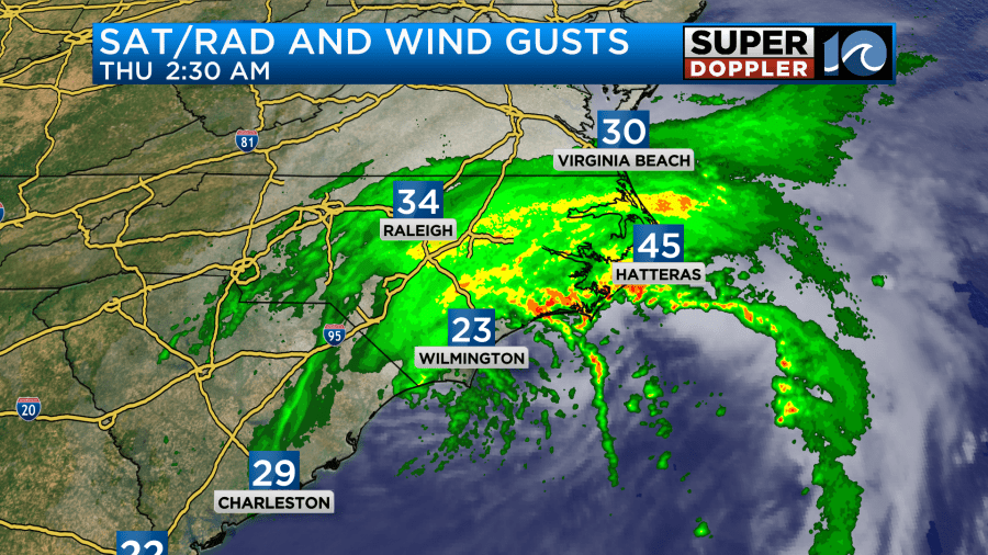
Winds were gusting to 30-35mph near the shore, but there were some brief gusts to over 40mph when a rain band hit the Outer Banks.
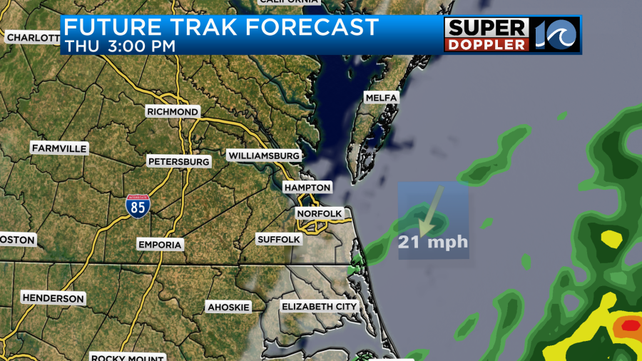
The center of Idalia will be to our southeast by the afternoon, and then it will quickly push out to sea.
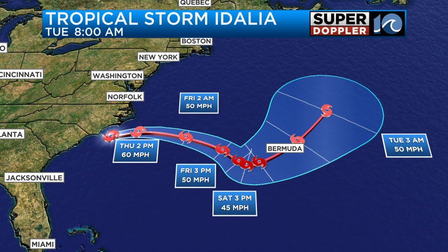
There are some models that bring Idalia back to the west, but there is a lot of uncertainty in this as you can see by the large spread:
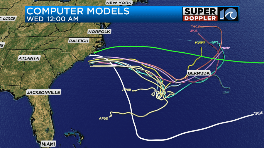
So we’ll see where it goes.
Through the day rain will decrease. Even by midday there might be some clearing inland.
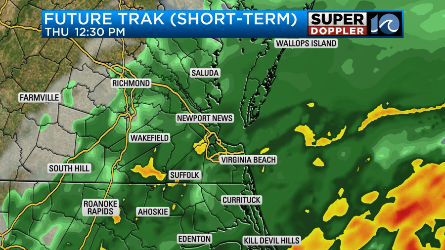
Rain will push east into the afternoon, and we may totally dry out by 5-6 p.m.
So far we have picked up about a half inch to an inch of rain in Hampton Roads. There was a cluster of heavy rain around 7:30 a.m. around the Peninsula, Middle Peninsula, and lower Eastern Shore. So the totals will come up after I post this blog. This was near the cool front.
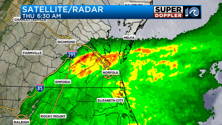
There has been about 3-5″ over the southern Outer Banks.
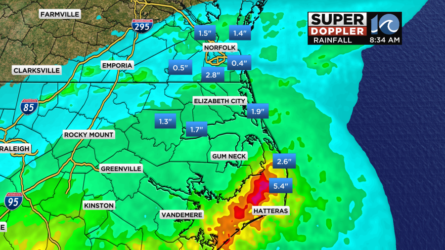
Going forward we’ll have another couple tenths of an inch in southeast Virginia (after the brief downpour). We could see another 0.5′ to 1.0″ in eastern North Carolina before it tapers off.
Wind is different. Wind gusts will increase a bit more, and then they will stay up for a while. Gusts will be up to 35mph near the shore. It will gust up to about 50mph along the Outer Banks.
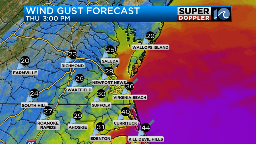
Winds will decrease tonight into tomorrow, but they will stay up out of the northeast for a while. This will lead to some minor tidal flooding with some low-end moderate tidal flooding in a few places.
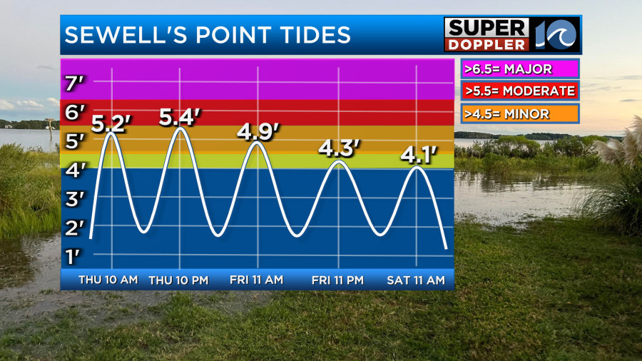
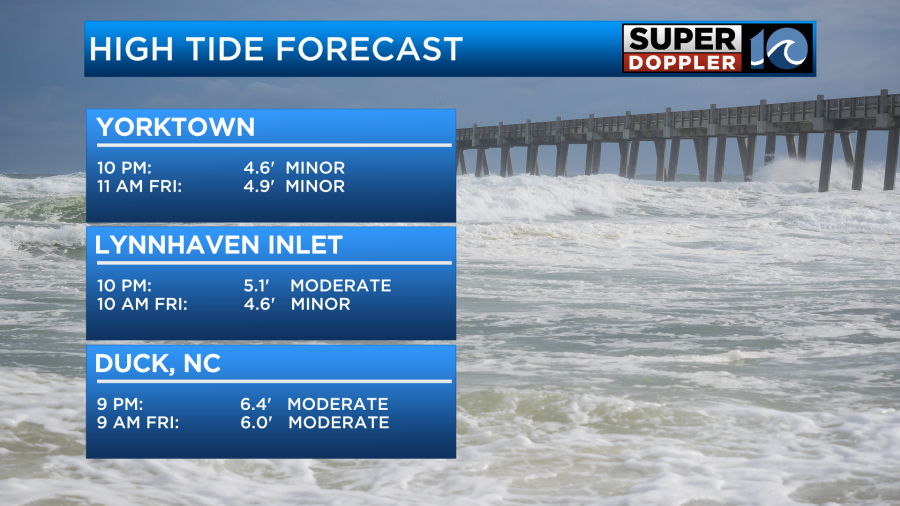
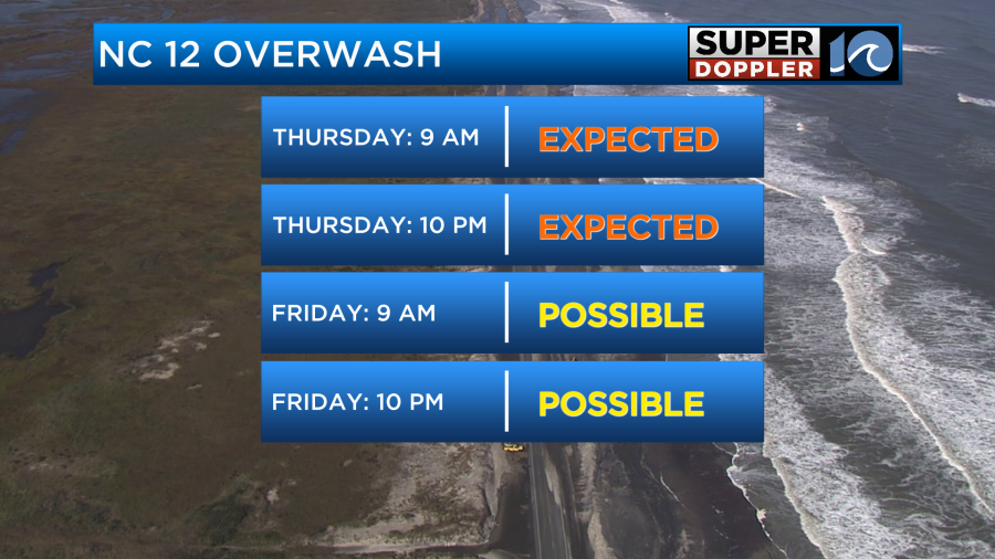
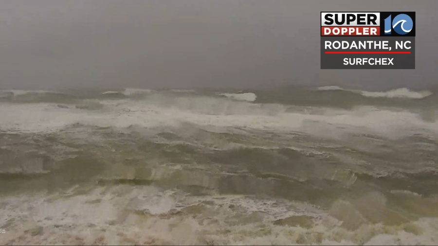
Over the Outer Banks we have some high waves over 7ft. This, on top of the tide, will lead to some ocean overwash today.
The risk for rip currents will be high all day. The surf is too rough for even surfers though. So no one should get in the water.
The bummer is that the rip current threat will probably stay high tomorrow and Saturday. After that we’ll see.
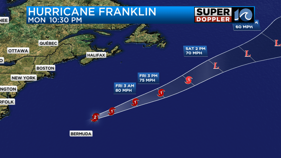
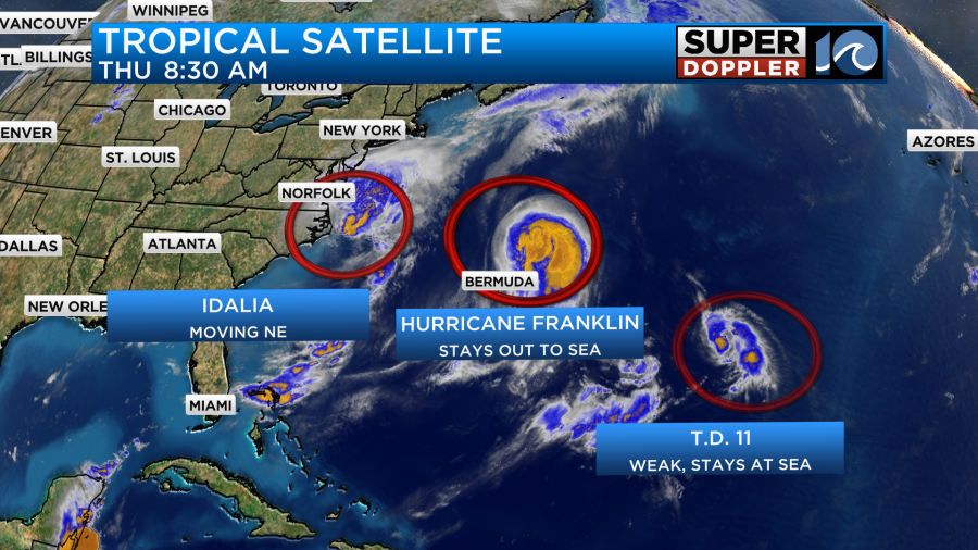
A lot of the rough surf is from hurricane Franklin. That system is now northeast of Bermuda. It is moving to the northeast. There is some cooler water along its track, but the temps are running above average. So it will take a while to weaken.
Tropical depression 11 should fall apart soon.
After today we will have some nice weather this weekend as high pressure builds in. We’ll be mostly sunny Saturday through Monday. Highs will be in the 70s on Friday, upper 70s on Saturday, and mid 80s on Sunday. We may hit 90 on Monday.
Check back for updates on all of this information.
Meteorologist: Jeremy Wheeler
`


