Yesterday was dry and cool. It was a really nice day! Today is going to be nice overall, but some scattered showers will arrive by the evening. Let’s talk about it…
Today we have high pressure just offshore with a weak area of low pressure forming to our south/southwest.
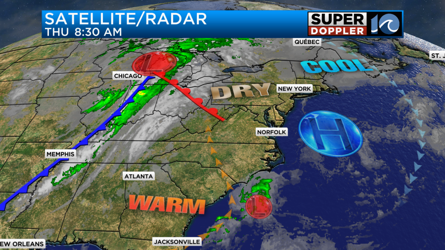
With the high offshore now we will develop a light southeast wind through the day. Between that and the morning sunshine we’ll warm up fast. Temps are in the 40s and 50s this morning. We’ll rise to the 60s by mid-morning. We’ll top off in the low 70s this afternoon.


Clouds will increase today as the moisture increases and the weak low comes up from the south. We’ll stay dry at the surface, but dew points will rise steadily through the day. Winds will be light and out of the southeast. By the evening we’ll have mostly cloudy skies along with scattered rain showers.
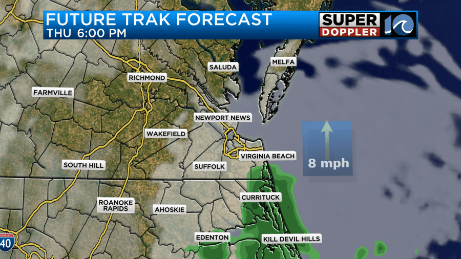
Scattered rain showers will continue tonight into tomorrow morning. The models differ on how much rain will fall in the morning, but I am thinking that we’ll have at least some scattered showers along the coast. Our Future Trak model is one of the driest for that time.
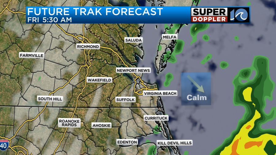

Either way the models do tend to agree that we’ll dry out through the morning on Friday. They have some pretty nice weather in the afternoon as the low scoots away from our area. We should have a mix of sun and clouds for a good stretch of time.
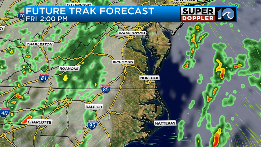
High temps will be in the 70s. By the early evening a cold front will be marching in from the west. We’ll go back to mostly cloudy skies. There will be some more scattered rain showers moving in from the west.

These showers will continue into Saturday morning. The good news is that the models have all trended earlier with the rain. So they basically have nice weather for the day aside from a few scattered showers in the morning.
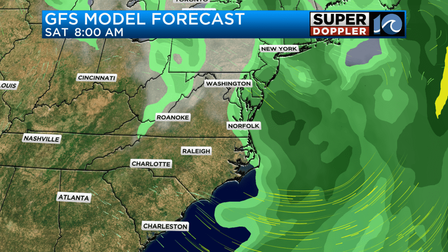
We’ll probably tweak the timing as we get closer to the weekend. So check back tomorrow if you have weekend plans. High temps will be near 70 Saturday as long as we get the sun to pop out as early as forecast. However, temps will fall on Sunday. High temps will be in the mid-upper 60s. This is cool and below average. However, it will probably feel even colder with the wind. There will be strong breeze out of the northwest. We’ll then start Monday with lows in the 40s (maybe a few 30s inland). Then we’ll only top off in the low 60s in the afternoon. At least we’ll be dry.
In the tropics…Yesterday, tropical storm Tammy formed east of the Lesser Antilles. It had sustained winds of 40mph early, but then the Hurricane Hunters flew into the storm. They found strong winds of 60mph, and so that was the strength in the 8am update.
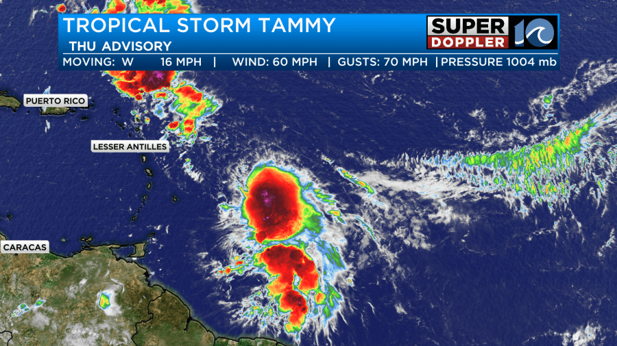
The storm will move to the west/northwest. It will likely move over the northern Lesser Antilles. So they will have strong winds and heavy rain there for a brief time. After that point it will move to the north then northeast.
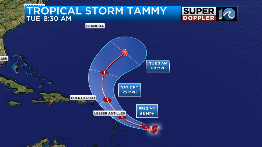
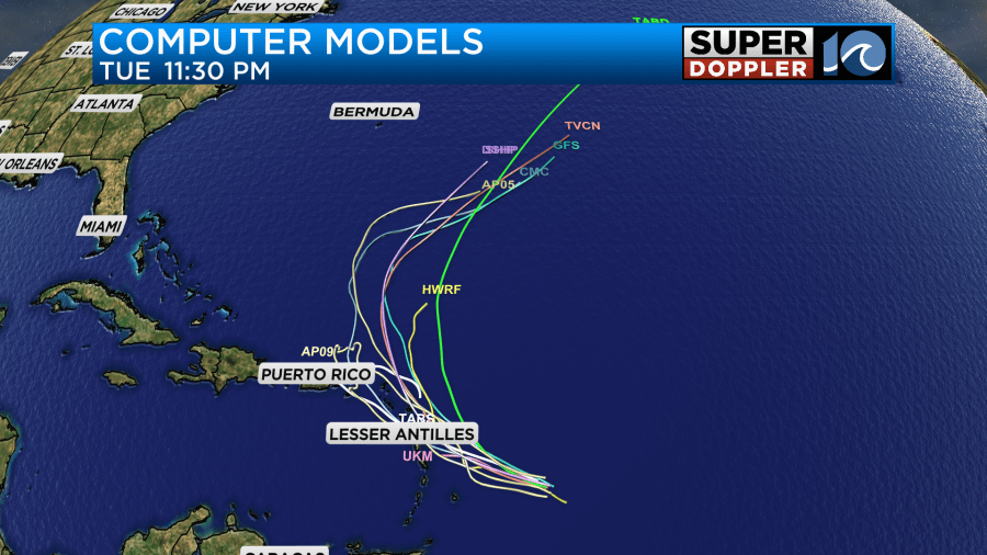
This should keep it southeast of Bermuda and well away from the U.S. However, now that it looks like it will be stronger, it might send us some more big waves along the coast early next week. We’ll have updates. The storm is over some unseasonably warm water, but there has been some decent wind shear. The forecast for the shear is disagreed upon by the models for the next 2-5 days. So the strength forecast could change. However, there is pretty good agreement in the track models.
Stay tuned for the latest updates.
Meteorologist: Jeremy Wheeler


