Over the next couple of days there will be some decent weather for travel over large parts of the region and the country. However, it could get a little messy over the eastern U.S. on Thanksgiving. Let’s take a look.
Today we have a cold front sliding into the region from the west.
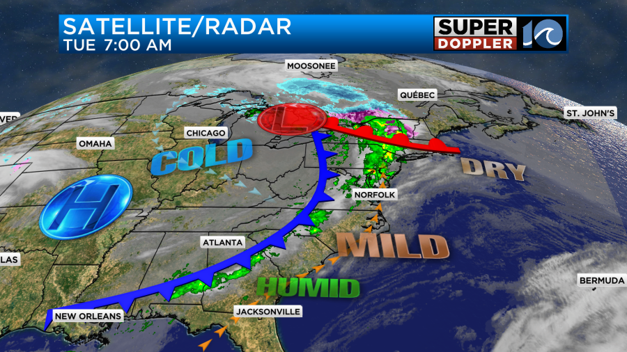
Moisture has increased over the area. So we have had increasing clouds since last night. There have been scattered showers along the front, but luckily they have stayed west of the metro for most of the commute. We will have some scattered showers moving through the region this morning up until the early afternoon.
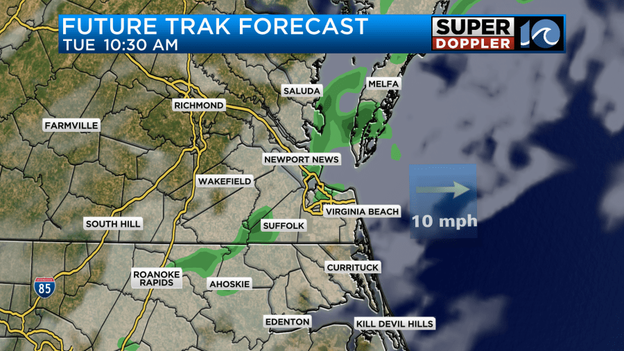
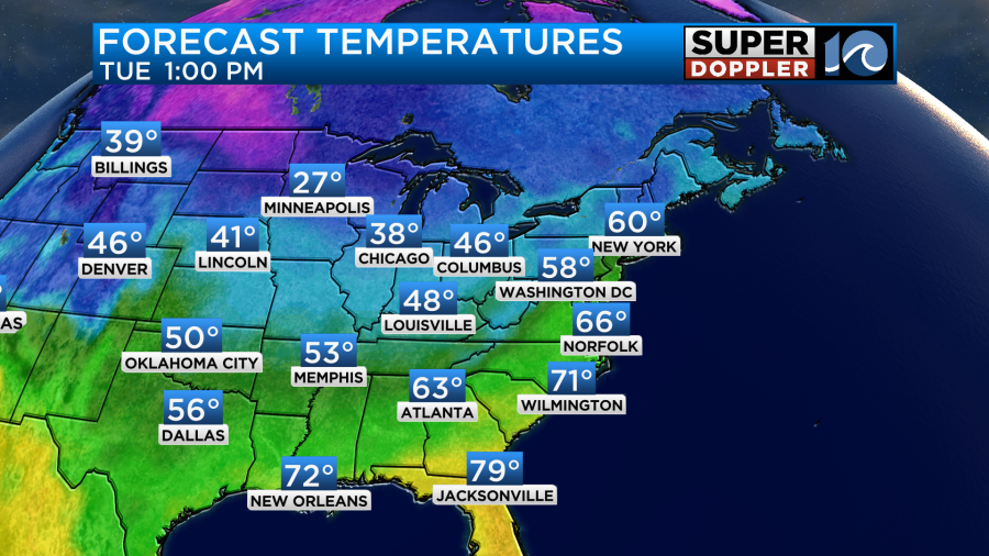
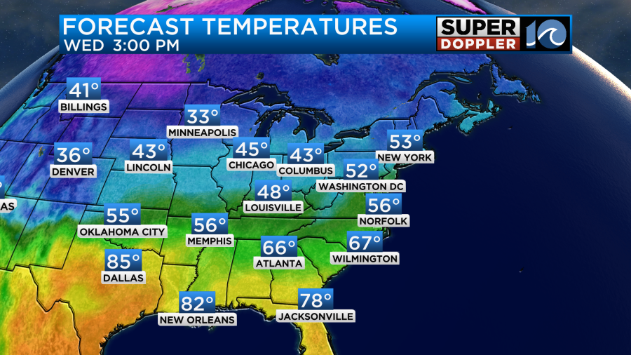
Then we’ll have some drying and a little clearing as the front sinks to our south this afternoon. Winds will turn from southwest to northwest. They will run at 10-15mph with a few higher gusts. We are in the warmer zone for most of the day. So high temps will be able to rise to the mid-upper 60s before we start to cool down late.
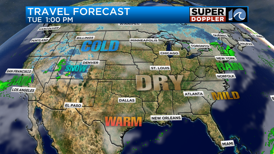
The weather will be pretty good for travel across the country. One problem area will be over parts of the Rockies where heavy snow could impact flying and driving. Especially around Denver which is a big hub. There will also be some precip in New England and the Northeast.
Tomorrow there will be a system pushing east of the Rockies into the Plains states.
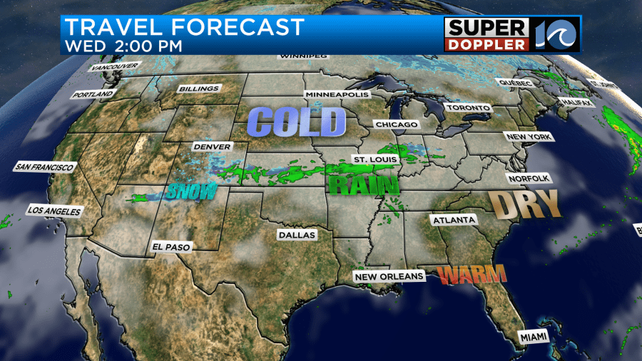
This will create a ribbon of mixed precip between Kansas and Indiana. Luckily it will be dry over the eastern third of the country. Locally, we’ll be partly cloudy with a few more clouds by the late afternoon. High temps will be in the upper 50s.
By Thursday the system over the middle part of the country will slide east. It will have a lot of moisture with it. This will create a lot of rain for the eastern U.S., and it will impact travel. The models are in agreement that rain chances will increase through the day Thursday. Both the GFS and Euro models only have a few showers Thursday morning. However, they both have the coverage increasing though the day.
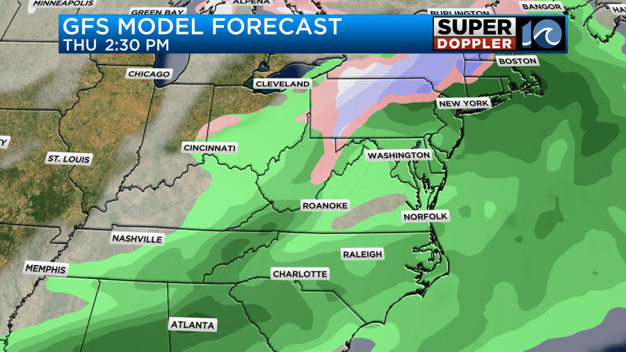
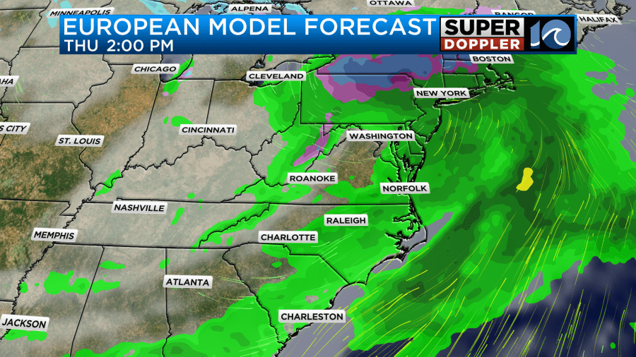
The NAM model (not shown) also has an increasing chance for rain, but it really doesn’t have a lot of coverage for our region until late in the day. The GFS And NAM models have scattered showers continuing Thursday night into Friday morning.
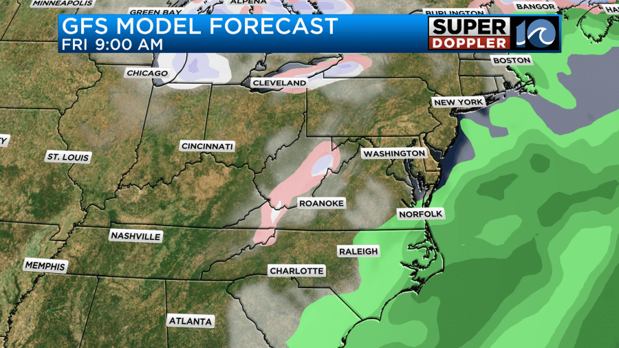
However, the Euro models dries things out during that time. For now I’m siding with the GFS and NAM which have at least some rain into Friday morning. I’m going with the drier forecast Friday afternoon into Saturday. High temps will be much cooler by Friday. We’ll be in the low 50s.
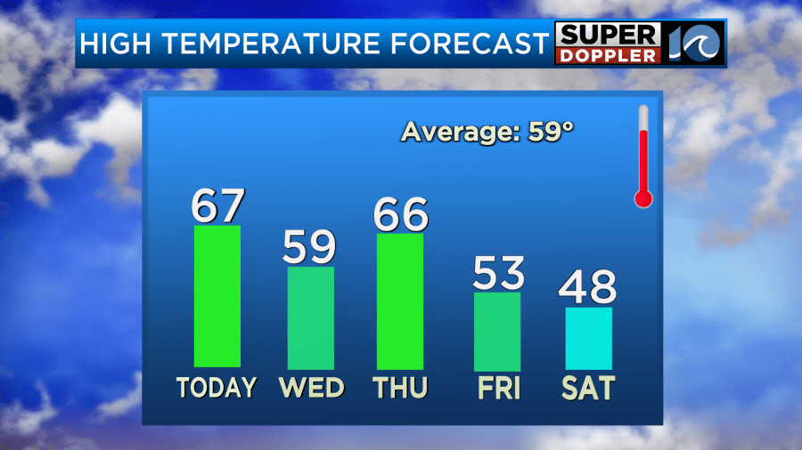
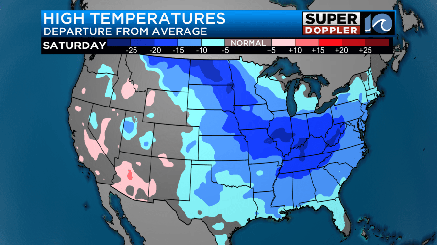
High temps will only be in the 40s this weekend. Lows will be in the 20s and 30s. It will be COLD! Things look mostly dry, but the GFS hints at an upper-level disturbance swinging through on Sunday. That feature might bring us some isolated showers if they happen during the day. However, if they happen more towards the evening, then it could turn into a couple of flurries. We’ll see. It will be dry at the surface. So I don’t see anything more than that.
Either way there will be a blast of colder air that will affect the eastern parts of the country from this weekend into the middle of next week.
Stay tuned for updates on the long-term forecast.
Meteorologist: Jeremy Wheeler


