Locally we are going into a wet pattern for the next few days. It will impact Election Day, it will make for a soggy first day of Summer, and it could create some localized flooding. Let’s talk about it.
Today we have a ton of tropical moisture coming in off of the ocean. There is also an area of low pressure creeping towards us from the southwest. There is a stationary front to our south.
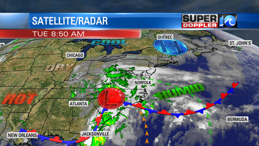
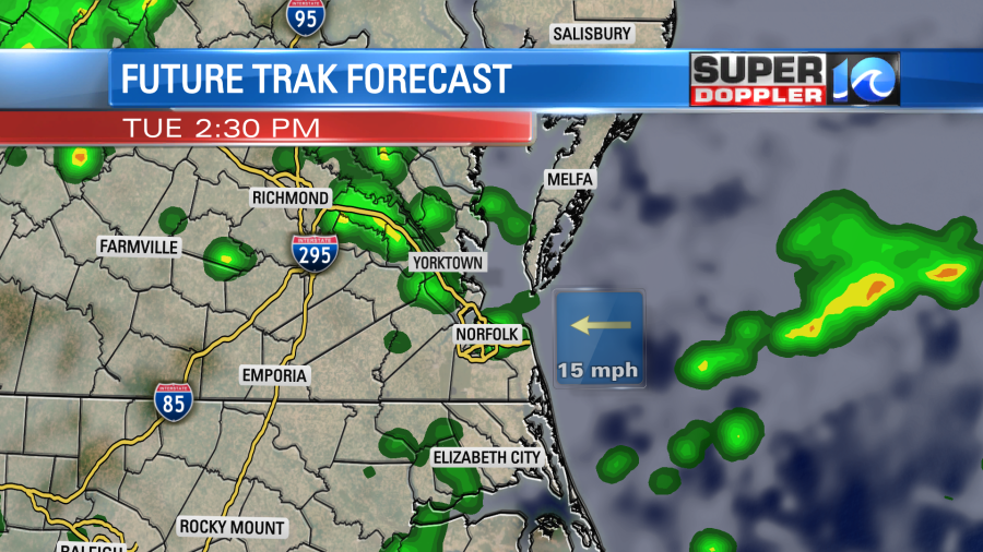
The low will keep edging closer to us through the day. With the increasing deep moisture over the area we will have lots of clouds and scattered rain showers at times. We already had a few showers impact parts of the region during the morning commute.
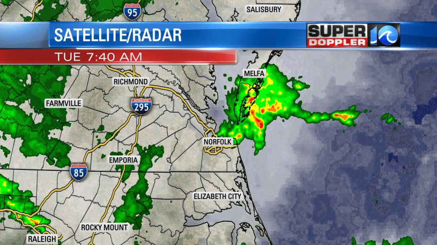
So we’ll have a few more rain showers this morning, but the chance will increase a little more during the afternoon.
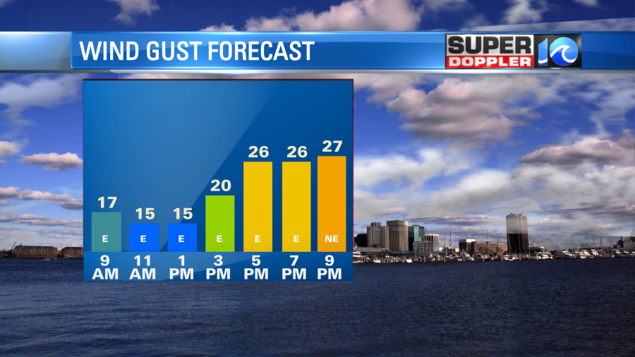
The wind will increase out of the east/southeast by the midday hours. It will run at 10-15mph with gusts up to 25mph.
The combination of the strong onshore breeze, the clouds, and the scattered rain showers will all work to keep the temps down. We’ll only top off in the upper 70s this afternoon.
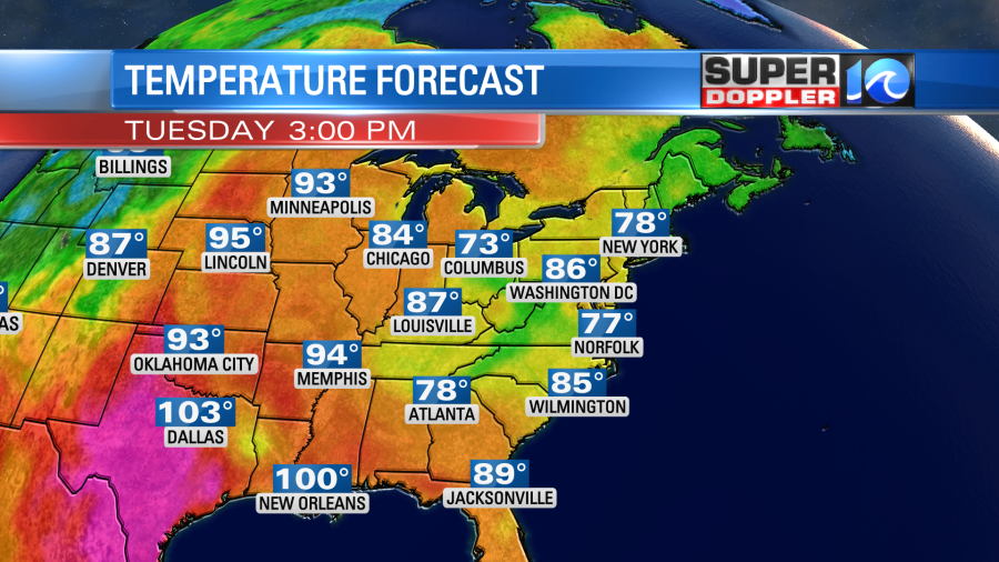
The extreme heat has returned in Louisiana, and it continues over parts of Texas.
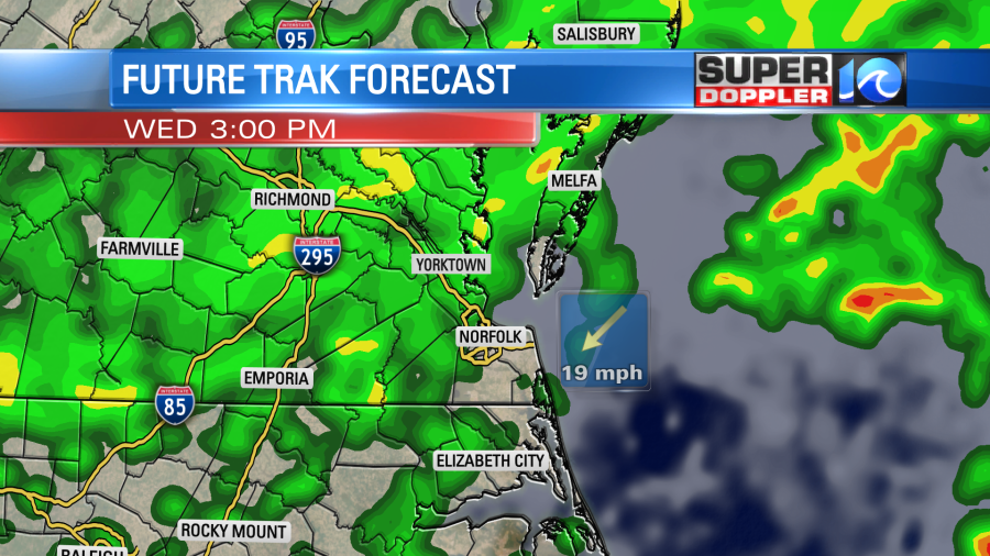
Tomorrow we’ll have even more rain as the low slowly drifts over the region. The front will also sit on top of us. This will create a lot of rain at times. It may be briefly heavy as well.
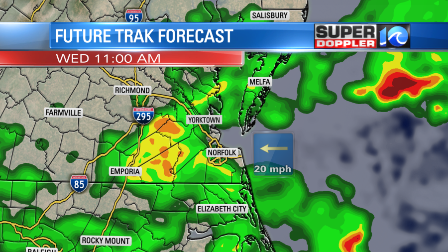
More rain is expected during the afternoon. There could be some heavy downpours at times.
The wind will be even stronger out of the east and southeast. Gusts could be up to 30mph with gusts to 35mph near the shore. It will not be a pretty day.
We’ll have several clusters of showers on Thursday as the low sits nearby.
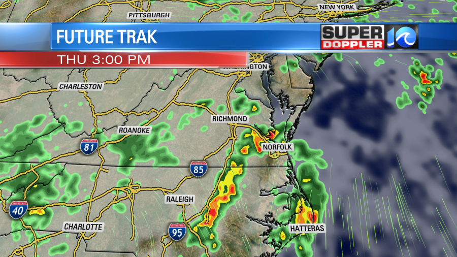
It should be a little more to the north. So that will allow for more of a southerly or southeasterly wind, and that should in-turn warm things up a bit. High temps will aim for the low 80s. I’m hopeful that the rain chances will decrease as we head towards the weekend, but it will likely not be dry. The area of low pressure is forecast to move to our north, but the front may hang out. Either way high temps should warm to the mid-upper 80s. If we get a little clearing then we may hit 90 on one of the days.
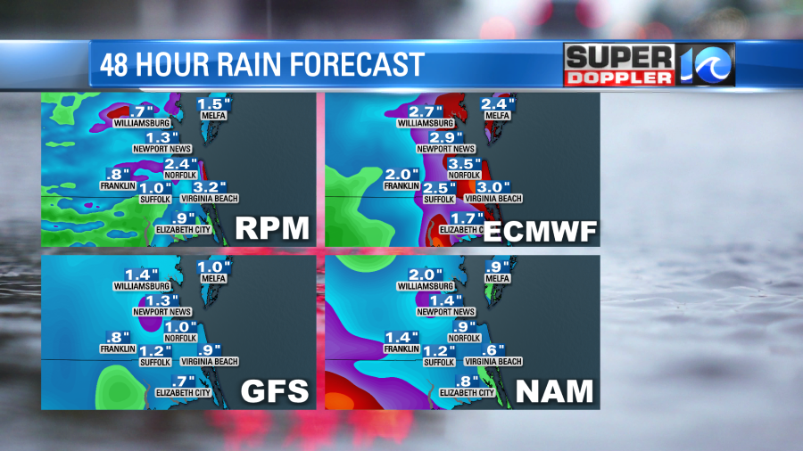
As far as rainfall goes, we are going to see a real soaker. We could see 1-2 inches of rainfall in the next 24-48hours.

It’s possible that some areas could see 3 inches or more. However, I wouldn’t be surprised to see some areas get 3-5 inches between now and the weekend. Some folks still need rain like the lower Eastern Shore, but a lot of us had 1-2 inches recently from the storm system last Friday. So most of us are doing pretty good in the short-term.
Meanwhile things are heating up in the tropics. Tropical storm Bret (with one T) is over the central Atlantic now. It is tracking west. There is a weak tropical disturbance east of Bret that is also moving west.
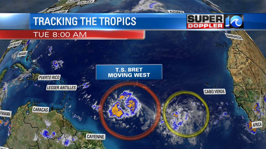
Bret is on the southern edge of a big area of high pressure. So it should stay on a westerly track for a while. It is forecast to move west and strengthen over the next couple of days.
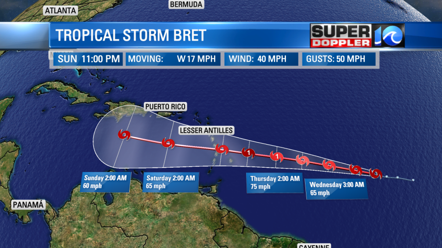
Keep in mind that a lot of the models have trended down the strength over the last 24 hours. The GFS and the European models both keep it weak through the next few days. They even kill off the storm in about 3-4 days.
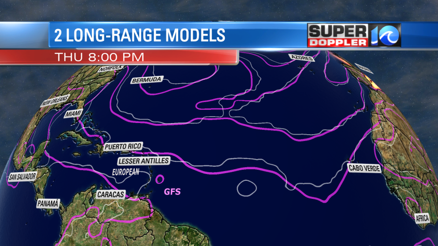
The bulk of the models do keep it on that western track, but there are a couple that still have it taking the bend to the north.
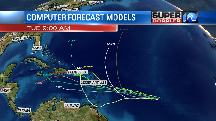
Brett is definitely over some very warm water. The wind shear (increasing wind with height) will be light in the next 24 hours, but it should increase after that point. Remember…wind shear works to strengthen storms over land, but it weakens tropical systems. We’ll have updates on the tropics and on the local rain threat over the next couple of days.
Meteorologist: Jeremy Wheeler