Well….This weekend is going about as planned. We had some rain move in late Saturday. Yesterday was pretty much a nasty washout. We had rain on and off through the day. It was pretty windy again too. This morning was looking gloomy for a little while with scattered rain showers and some fog.
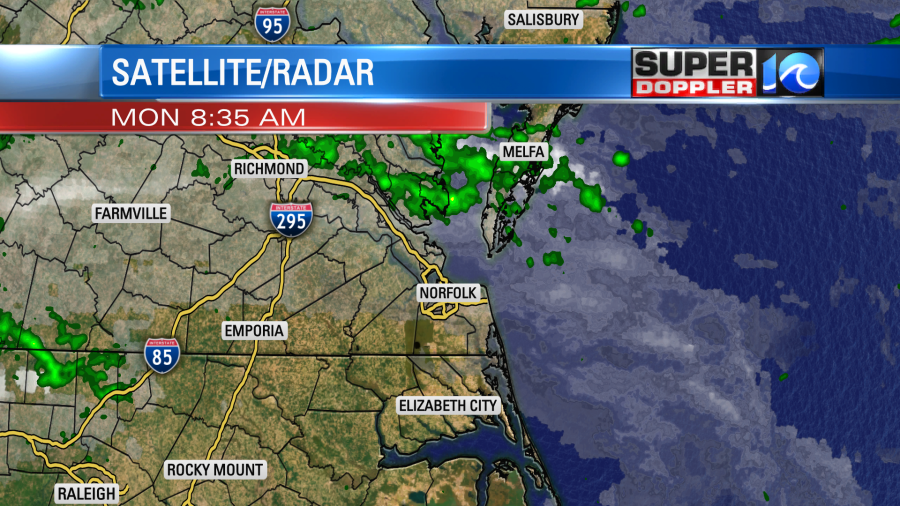
However, by about 8am there was some sunshine over parts of North Carolina and the Southside. Today will be better overall. There is still an area of low pressure near the region, but it has moved a bit more to the west.
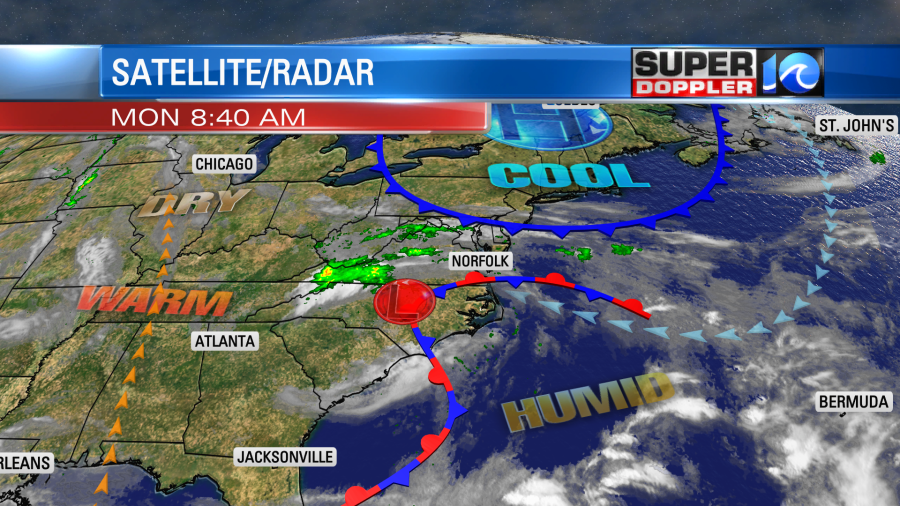
There is also a stationary front over the area. Notice that there is a cold front to the north. This will impact our weather tomorrow.
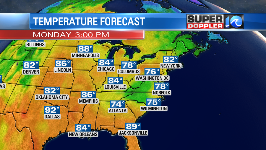
Today we’ll have a mix of sun and clouds. We’ll also have much less wind. It will only run at 5-10mph out of the southeast. With this combo temps will be able to rise to the upper 70s this afternoon.
Plus, dew points are in the 60s. So as we heat up this afternoon a few showers and storms will pop up.
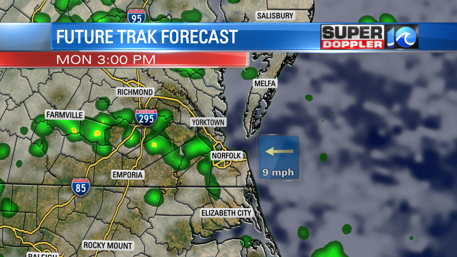
Rain will pick up even more later this evening. A few heavy downpours will be possible tonight.
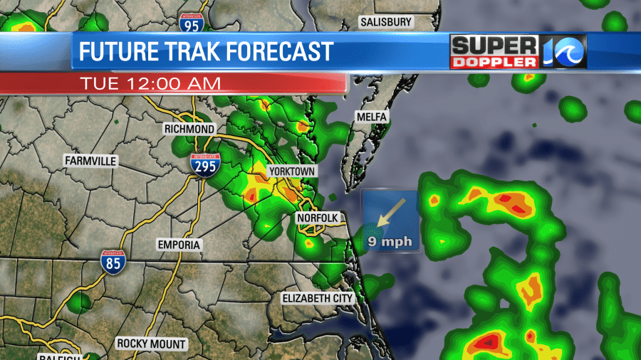
Tomorrow the cold front will wrap in around the low, and it will drop to the south. The low will move east a bit. This will A. bring us a higher chance for rain showers, B. increase the clouds, and C. drop our temperatures.
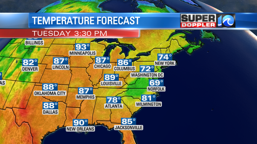
We’ll be mostly cloudy on Tuesday. There will be a few showers in the morning with some spotty showers in the afternoon. Winds will run at 10-15mph with gusts to 20mph out of the northeast. Some gusts may reach 25mph near the shore. This will drop the temps to the upper 60s to low 70s.
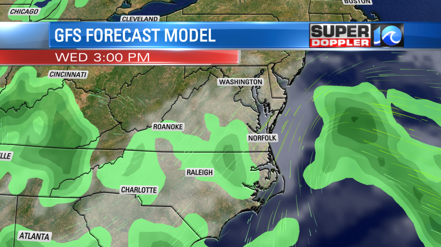
The low should move out to sea a bit on Wednesday. We’ll have the remnants of an upper level low still overhead. So a few more showers will be possible, but the chance should drop.
High temps will be in the 70s.
Here’s a bit of potentially bad news… The long-range models are now showing an area of low pressure over the western Atlantic later this week. It could even lie just offshore from our area. If this forms, then it could continue the chance for some scattered showers into at least Friday and possibly Saturday.
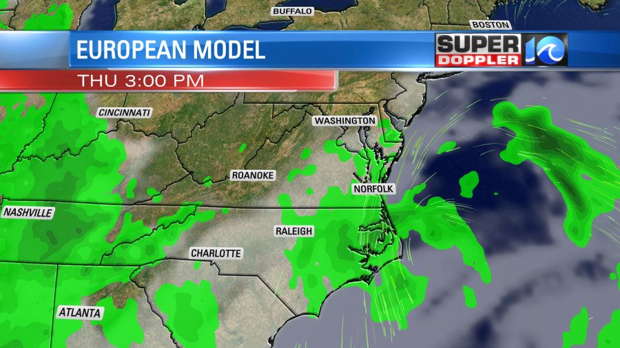
It’s possible that this system could become tropical or subtropical. This also means that the cool breeze would kick in again out of the northeast. This is not set yet, and it could change. So check back for updates. Either way I’m hopeful. that we’ll have at least some sunshine by next weekend.
Meteorologist: Jeremy Wheeler


