Yesterday, the heavy rain came in with some gusty winds during the afternoon and evening.
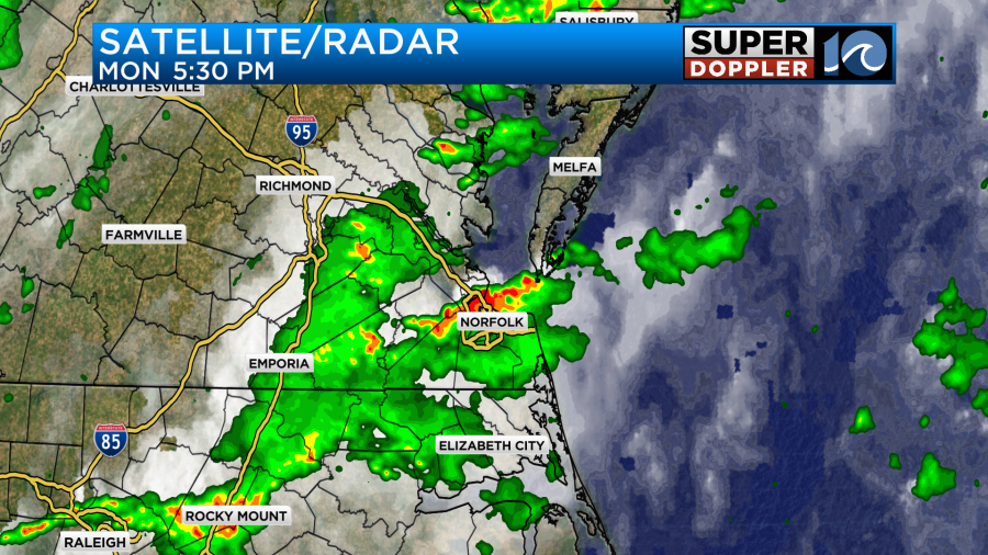
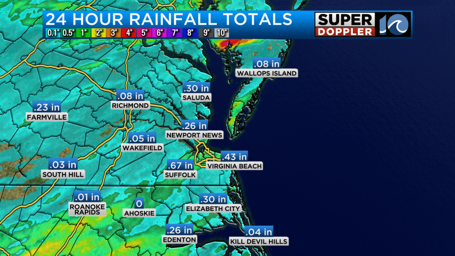
My trees were swaying in the wind for a little while. Rainfall added up in the rain gauges. They varied quite a bit.
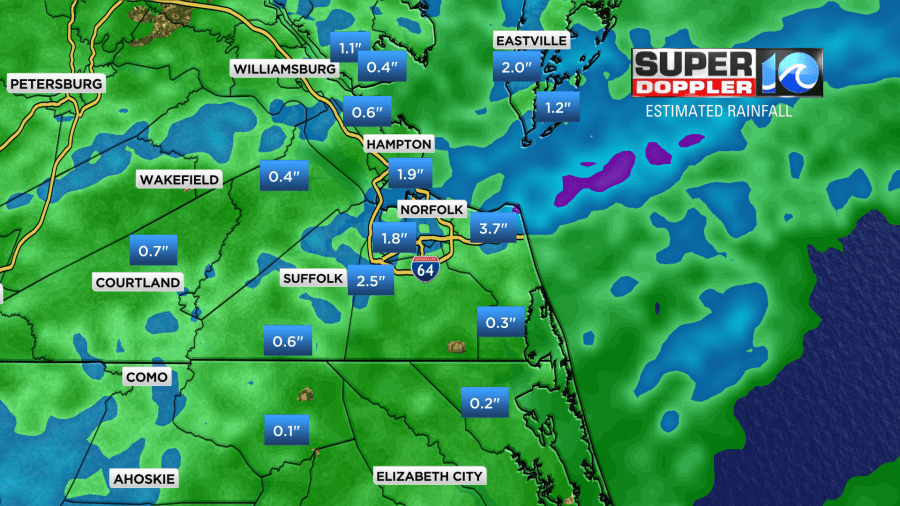
The radar estimates were even higher over parts of the Southside.
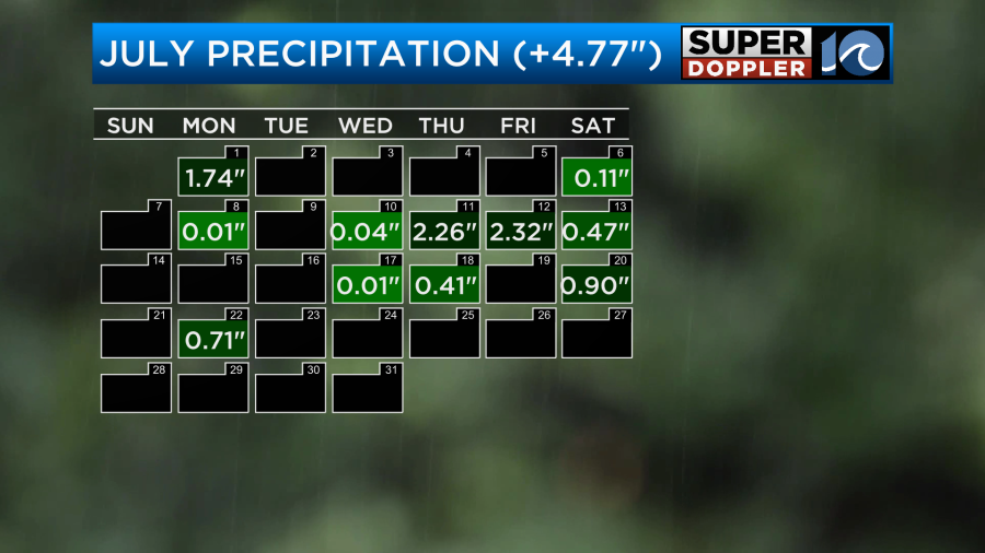
We are definitely soaked. Many ditches are becoming full, and we still have a lot of Summer to go. So far for the month we are up about 4.77″ above average.
We are expecting more rain today, but it won’t be a washout. Scattered storms are forecast for the afternoon. Isolated downpours will be possible.
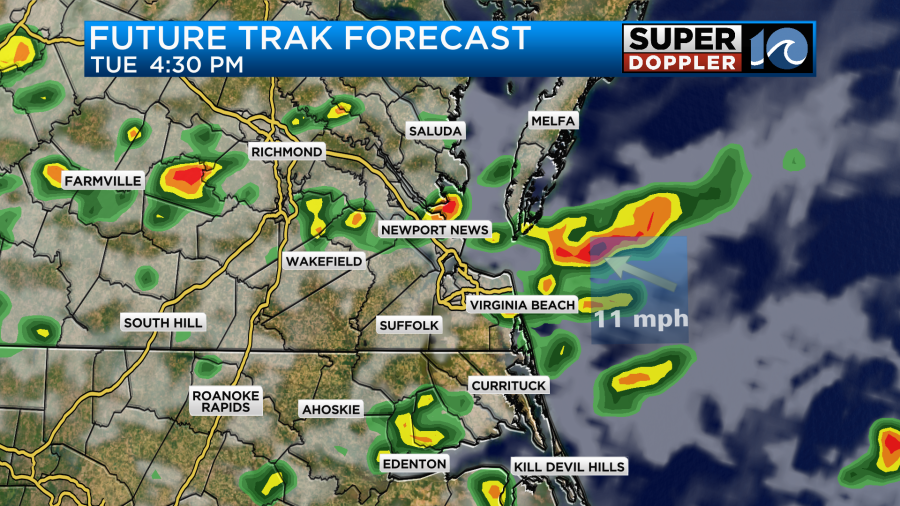
There may be another round of heavy rain tonight in some areas and an upper level impulse swings through.

We’ll see if that area will be as large as forecast.
We have a stationary front just to our north. We are in the hot/humid zone.
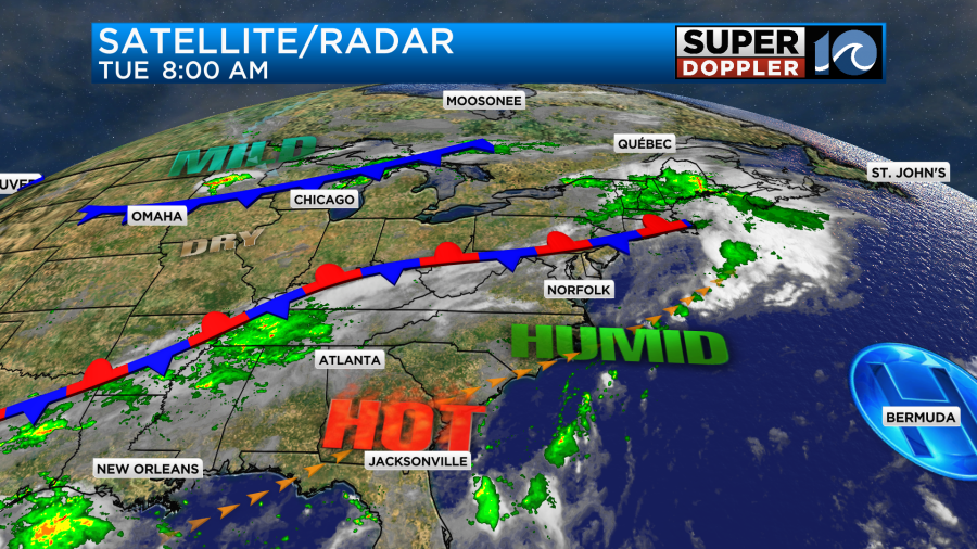
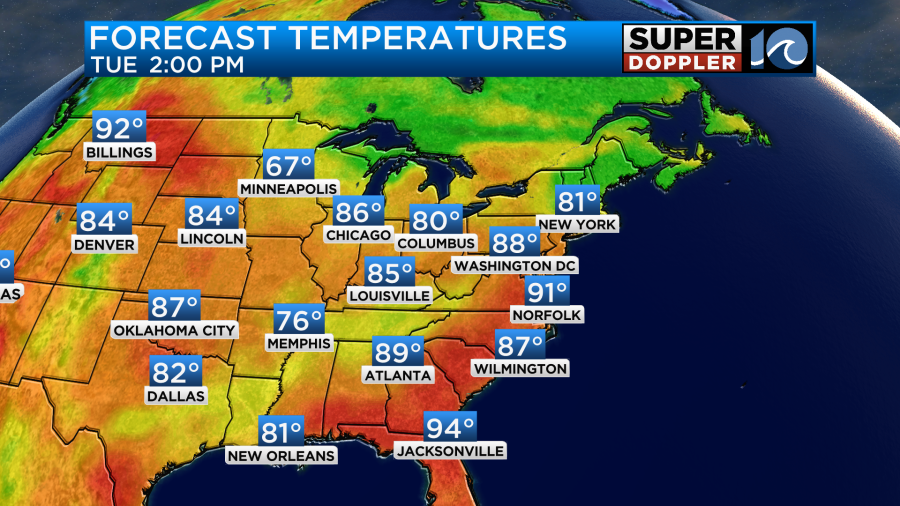
The front lifted just a little more to the north compared to yesterday. So we actually had a good amount of sunshine this morning. We’ll have a mix of sun and clouds today. Careful what you wish for though… We are going to heat up to today into the low 90s.
The heat index is going to rise up to near 100 degrees.
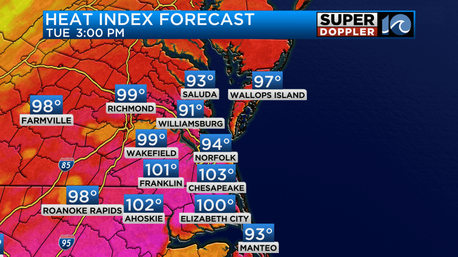
This will be until the scattered storms cool down about half of the region or more later in the day. Tomorrow the front will stay to our north. We’ll have partly cloudy skies with some more scattered storms in the afternoon. Our latest model runs have had less rain on Wednesday overall, but still have a few storms.

The GFS still has quite a bit of rain. We could get a half inch up to two and a half inches of rain over the next 48 hours.
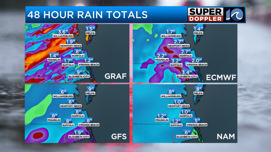
Isolated flooding will be possible. High temps and heat indices will be about the same as today.
On Thursday and Friday the moisture increases again. The clouds will also increase ahead of a cool front. Temps will be more in the 80s. So that will help. It will still be very humid through early Friday.
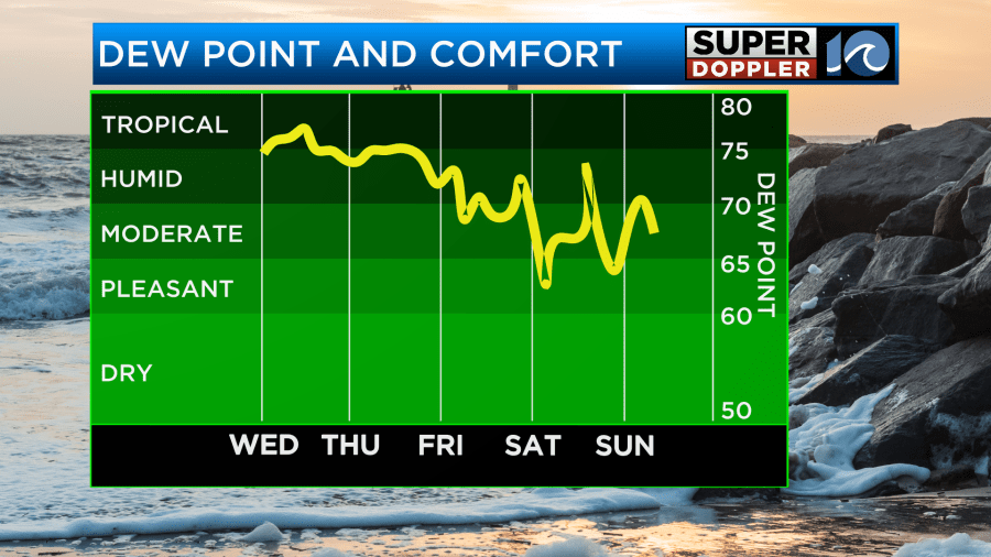
This cool front that is forecast to swipe through the region has the potential to bring us a GORGEOUS weekend!
I don’t want to jinx it, but as of right now both the GFS and Euro models have the front sinking to our south. This would produce fair skies both days with high temps in the low-mid 80s. It would mean lower humidity for a time, and lower overnight temps.
I don’t want to get my hopes up too high, but if the forecast doesn’t change, then I will be jumping up-and-down on Friday. And over the weekend!
It’s still quiet in the tropics.
Meteorologist: Jeremy Wheeler


