This weekend was definitely warm and muggy. It even felt downright soupy at times. There were also some scattered showers and storms with a couple of downpours in the region.
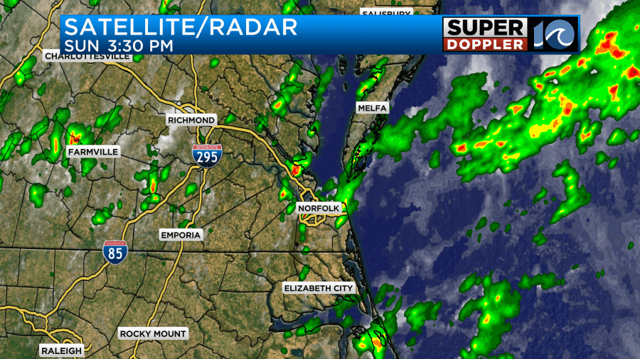
We had a cool front gradually move into the region, but it stalled out. Today that same front is overhead.
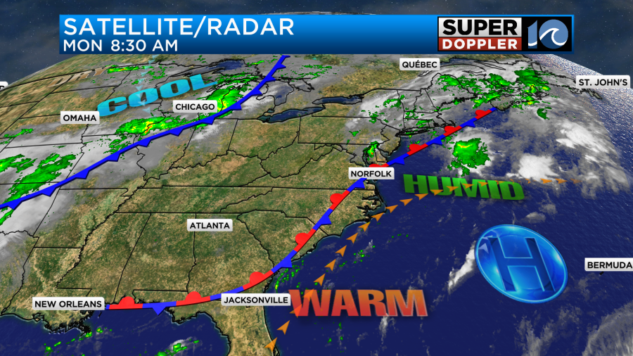
It may kick off a few showers and storms this afternoon. I can’t rule out some isolated downpours. High temps will be in the mid-upper 80s.
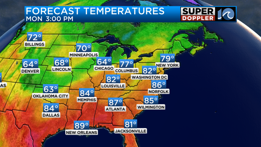
Remember though, the heat index will be in the low 90s. Tomorrow we’ll be even hotter with high temps in the upper 80s to near 90.
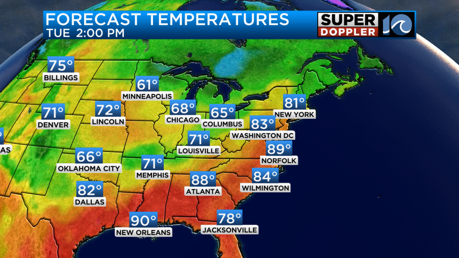
The heat indices will be in the mid-upper 90s. It will feel like the Dog Days of Summer instead of mid-September. We’ll be partly cloudy with only some isolated showers or storms. Then on Wednesday that game-changing cold front will move into the region. We’ll be mostly cloudy with some scattered showers and storms. High temps will be in the lower 80s. By the time we hit Thursday we’ll be behind the front. It will cool us down to the 70s for highs with a lot of drier air sinking into the area.
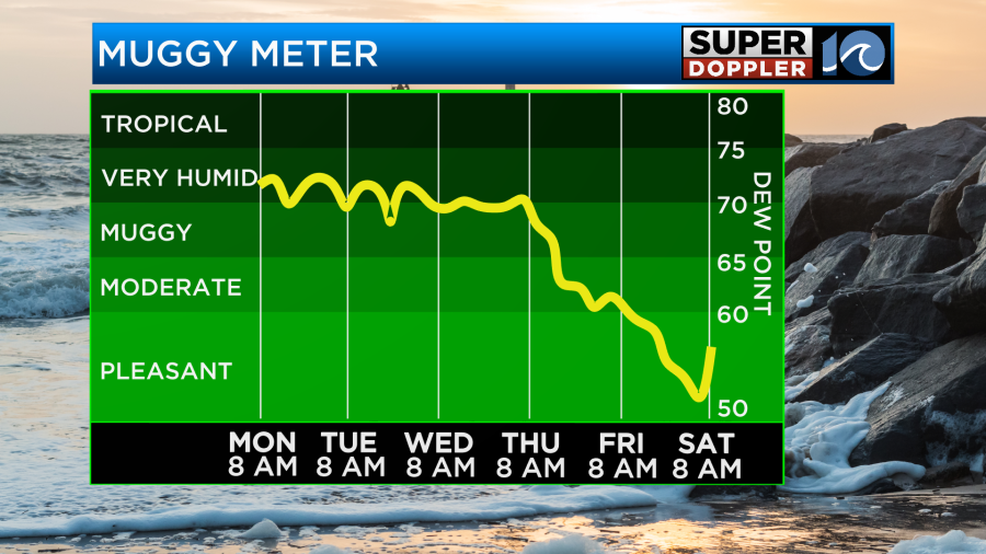
It will feel awesome later this week into the weekend. Hang in there until then.
We are tracking 2 systems in the Atlantic. Tropical storm Margot continues to strengthen. It is forecast to become a hurricane in the next 24-36 hours as it moves north.
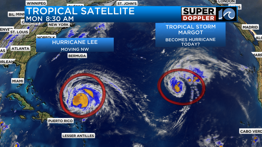
It is forecast to stay out to sea. Meanwhile, hurricane Lee is a major hurricane. It is forecast to go up and down in strength over the next couple of days, but it will likely maintain major hurricane status through that time.
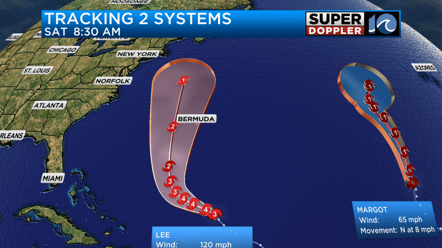
The storm is forecast to move to the northwest for the next 48 hours or so. Then it is expected to take a northerly turn. It is likely to pass to the west of Bermuda, but it could get fairly close to the island. They could get some tropical storm forced winds there for a time. This would be along with some big waves and tidal flooding. Lee would then keep moving north. This could eventually threaten Nova Scotia and/or some of the northeast states.
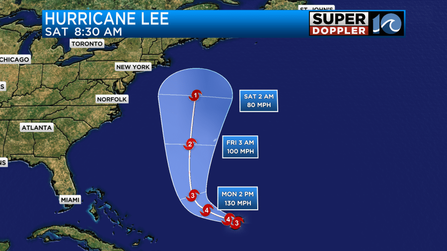
The latest models are in fair agreement in the long-term forecast. However, they have trended a bit west lately.
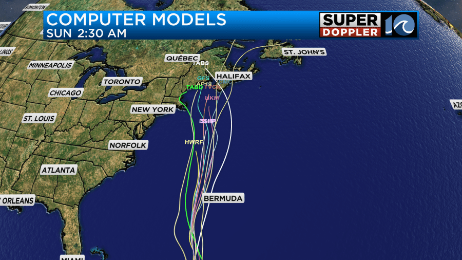
This means that it could potentially make landfall along the coast of Maine or even skirt or hit the coast of Massachusetts. The GFS and European models are also favoring the coast of Maine now for landfall in about a week.
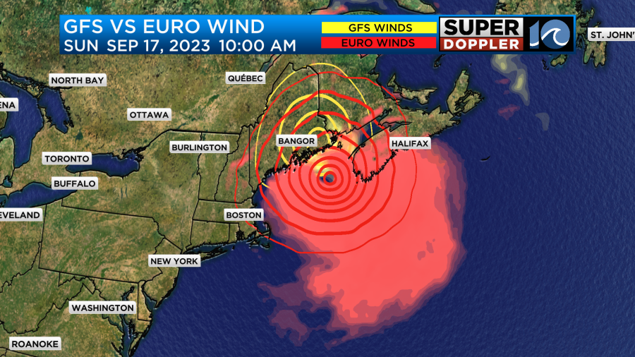
The system and the strong winds should stay offshore as far as we’re concerned. However, we are still going to be dealing with a high threat for rip currents and some high waves later this week into the weekend.
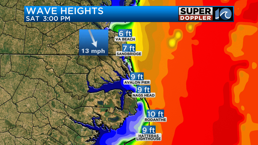
There may be some beach erosion and overwash as well. We have some time to work out the finer details about that. Tropical storm Margot may add a little to that surf as well. It was a tropical storm this morning, but it could become a hurricane in the next day or so. However, it will stay out to sea.
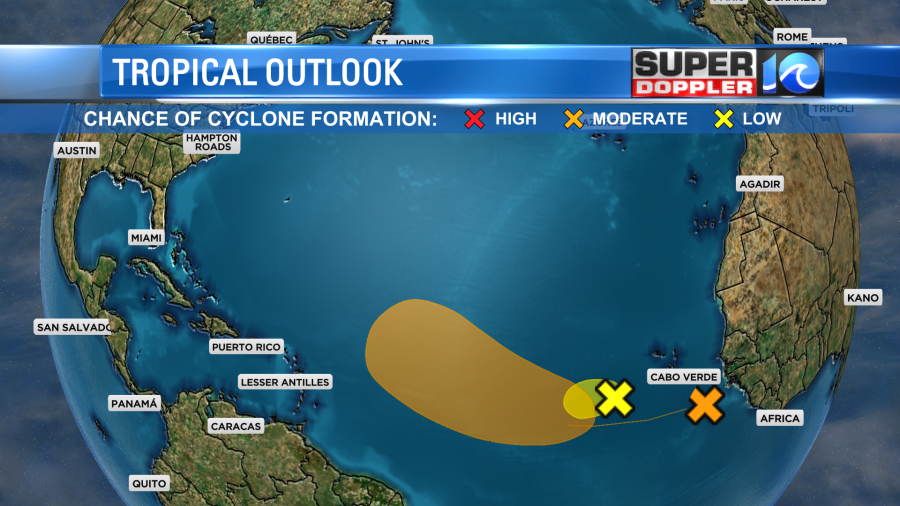
There is another tropical disturbance in the eastern Atlantic that has a medium to high chance for formation over the next few days.
Stay tuned for updates to all of this dynamic weather.
Meteorologist: Jeremy Wheeler


