Well…It happened again… This time we were ready though. Heavy rain and a few storms fired up during the morning commute. However, it was heavier and earlier than yesterday.
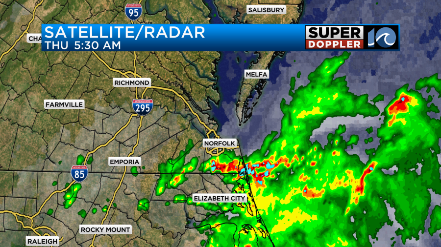
The heavy rain started tapering off by around 8am. Plus, the showers became more scattered. We have a stationary front sitting over the region with a lot of deep/rich moisture streaming up from the south.
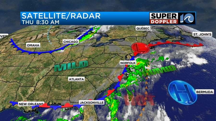
This will create a lot of clouds through the day with a few peeks of sunshine from time to time. The showers will become more scattered this morning, but we’ll really have scattered rain showers on and off through the day. There will be a couple of thunderstorms this afternoon as well.
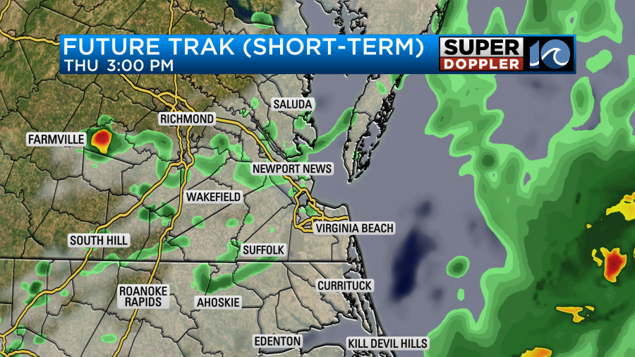
These will continue into the early evening, but the rain should shut down overnight. Due to the clouds and the scattered showers the temperature will held down again today. Highs will aim for the upper 80s this afternoon.
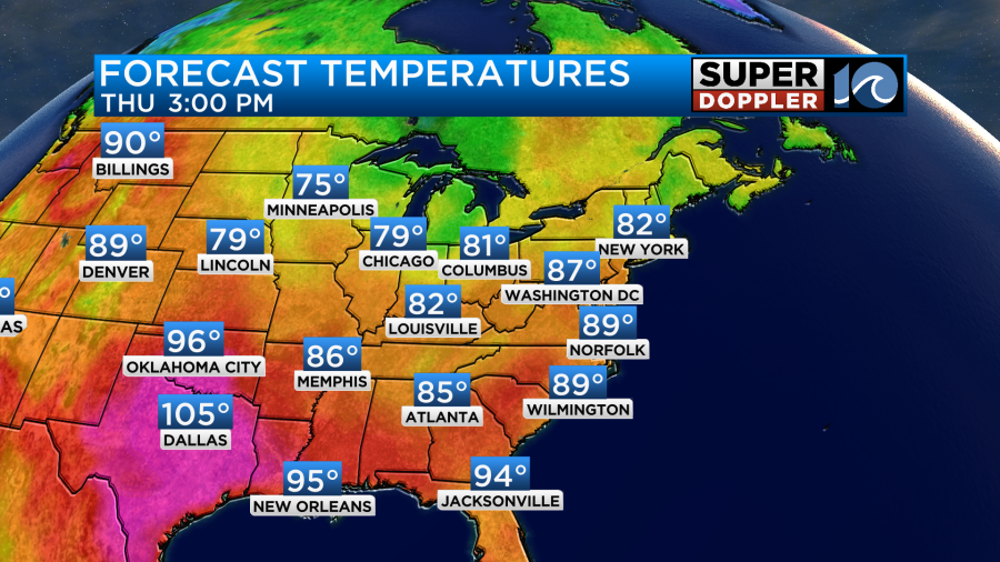
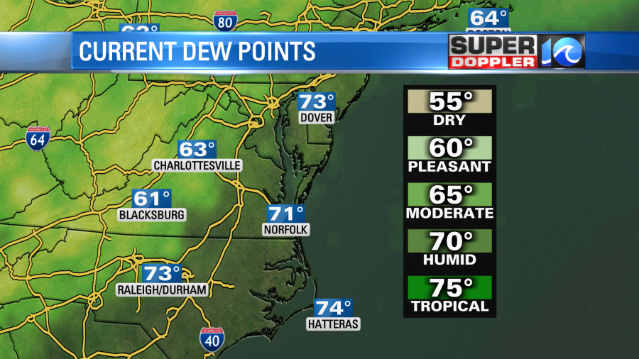
Keep in mind that it will be muggy. Dew points are rising into the 70s.
Winds will be light and out of the south.
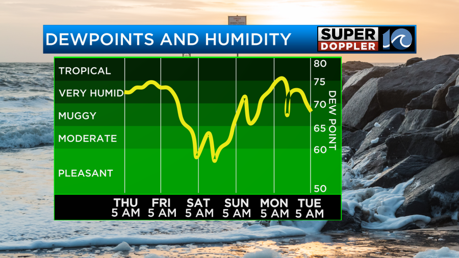
Tomorrow the stationary front will fall apart just to our west. Meanwhile a stronger cool front will be closing in from the northwest. We will have more sunshine tomorrow. We’ll be partly cloudy with only some stray showers possible. Drier air will blow in through the day. In fact the humidity will drop sharply Friday afternoon.
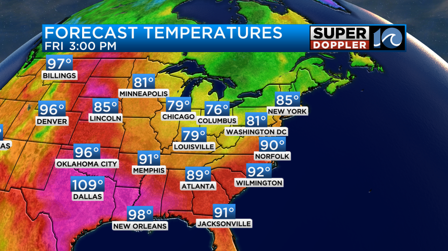
High temps will be able to reach the low 90s before cooler air arrives.
Then the weekend….Ahh the weekend. The humidity will be much lower. So it will feel great Saturday and Sunday. High temps will be in the low-mid 80s on Saturday. We’ll be in the upper 80s on Sunday. Keep in mind that the heat (and humidity) will bounce back on Monday. Highs will be in the 90s, but the heat index will be over 100.
We are still watching some possible areas of development in the tropics. There are two tropical disturbances in the central/eastern Atlantic that have a medium chance of formation over the next few days.
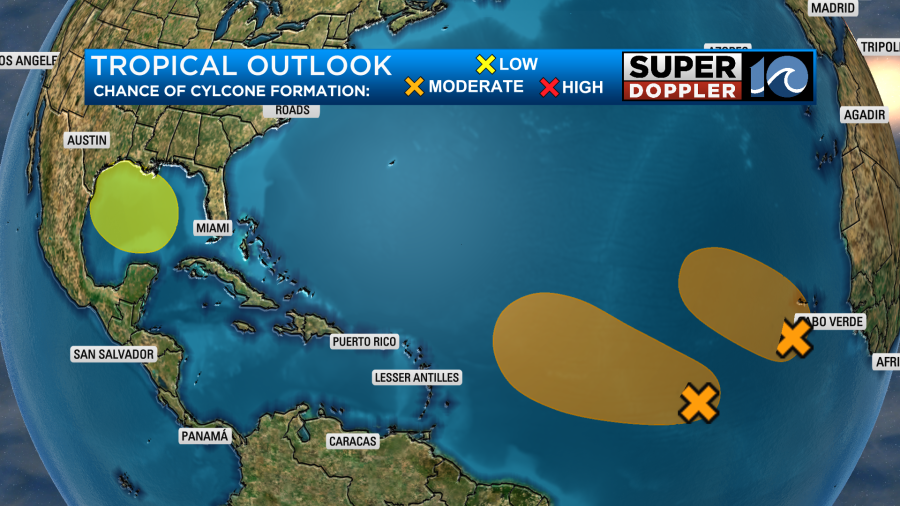
They are both moving towards an area of warmer water and more heat potential. The wind shear doesn’t look too strong along their path. However, the models do pretty much keep both of them out to sea. We’ll keep monitoring them just to be sure. Stay tuned for updates.
There is an area of possible development in the Gulf of Mexico as well. This one has a lower chance of formation, but it is closer to the United States. The water is super warm down there. So this one bears close watching. At least for the Gulf Coast.
There is a hurricane in the Pacific (Hillary) that will weaken and move into northern Mexico. It will probably run through southern California as a tropical storm. I’ll have more updates on that in tomorrow’s weather blog.
Stay tuned for updates.
Meteorologist: Jeremy Wheeler


